Photo: Gaggi Luca 76 · CC BY 3.0

A lovely day trip from Tirano · by car to the nearest point, then on foot
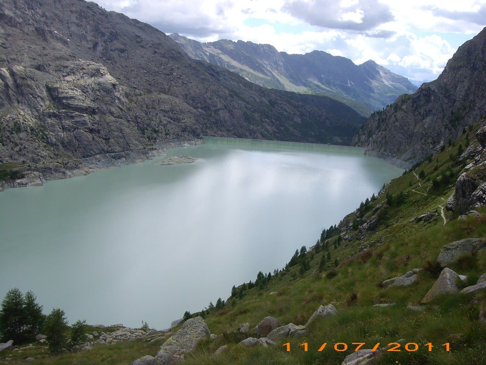
One of the largest artificial lakes in Italy: a gigantic reservoir above 2,000 metres, below the Fellaria glacier and dominated by a dam 174 metres high.
- Type
- Lake
- Municipality
- Lanzada
- From Tirano
- Visit time
- Opening
- June 15 - September 30An outdoor place, always reachable. At altitude snow can make roads and paths impassable: they generally clear from June-July to September. An estimate based on the altitude.Indicative dates, not official: check before you go.
- Activities
- Hiking
The water giant below the glacier
Above the Campo Moro Reservoir, above 2,000 metres, the valley closes on an even larger basin: the Alpe Gera Reservoir, which with about 1.15 square kilometres of surface is one of the largest artificial lakes in Italy. Looking at it, from the road or the path, what strikes you is the dam: a concrete wall 174 metres high and 530 long, built between 1961 and 1964, which holds about 68 million cubic metres of water.
The glacier that feeds it
The water comes from the tongues of the Fellaria glacier, on the Piz Bernina plateau, and from the Scerscen glacier, which descend towards the basin. The Campo Moro and Lanzada power stations turn this high-altitude water into energy. Above the lake stands the Bignami hut, a stage towards the peaks and glaciers.
A place to walk
From Campo Moro you walk towards the basin in a high-altitude landscape: smooth rocks, scree, the green and turquoise reflections of the water. It is a route to be tackled with care and a good map.
The dam: history, capacity and the hydroelectric system
Raising your eyes to the Alpe Gera dam is one of those moments that put the world back into proportion. A concrete wall built between 1961 and 1964, at about 2,050 metres, 530 metres long and 174 high according to the most authoritative sources (others give from 110 to 175 metres: the measurements should be taken with caution), closing the head of the valley like a great hand laid to bar the way to the ice. It took about one million eight hundred thousand cubic metres of concrete, and the reservoir holds about 68 million cubic metres of water, more than six times that of Campo Moro. The spillways are of the Howell-Bunger hollow-jet type, and inside the wall runs a vertical lift of about 140 metres, among the highest in Europe, local tradition says.
The work is the first step of the Valmalenco hydroelectric axis, run by Enel Green Power: two reservoirs, Alpe Gera and Campo Moro, and three power stations, for over 400 megawatts in total according to local sources. The water is born in the glaciers of the Fellaria, Pizzo Scalino and Scerscen, and drops about 135 metres to the Campo Moro cavern power station, completed in 1965; from there a tunnel of about eight kilometres, with a drop of 900-1,000 metres, carries it to the large Lanzada power station (built between the fifties and 1962, with about 190 megawatts), and the returned water feeds the Sondrio power station, in operation since 1960. A drop of glacier that works three times before returning to the Mallero: is it not a lovely picture of how the mountain, here, has put itself at the service of those who live below?
From Tirano: distance, driving time and day trip
Alpe Gera Reservoir from Tirano: about 1 hour 45 minutes by car (60 km), to the nearest starting point; then you continue on foot. You drive down the SS38 towards Sondrio and up the Valmalenco to Chiesa and, for the higher destinations, to Lanzada and Chiareggio. To these times add the walk described on this page: plan your day accordingly. Tirano is the ideal base to visit the Valtellina: hotels and B&Bs, restaurants, shops, supermarkets, the Bernina Red Train station and buses to get around.
How to get there
From the Campo Moro Reservoir you continue on foot towards Alpe Gera and the Bignami hut. The lake's altitude is about 2,050 metres according to some sources and 2,125 according to others.
Before you go
Always check path and weather conditions.
Warning: road closed by a landslide
The municipal road from Lanzada to Franscia and Campo Moro is closed because of the landslide of November 2025 and, according to the Zoia hut, will stay closed for the whole winter 2026/27. A free shuttle bus ran in summer. Before setting out, check the state of the road and the alternative routes with the Municipality of Lanzada.
Photo: LIUCAnastasia4 · CC BY-SA 4.0, Marsel Minga · CC0, Michele Mondora · CC BY-SA 4.0, Gaggi Luca 76 · CC BY 3.0