Valtellina and Alta Valtellina
Trekking
From Tirano you set off on foot: historic paths, panoramic balconies and valleys climbing towards the peaks, with a stop at a hut or a table along the way.
The starting point
Why start from Tirano
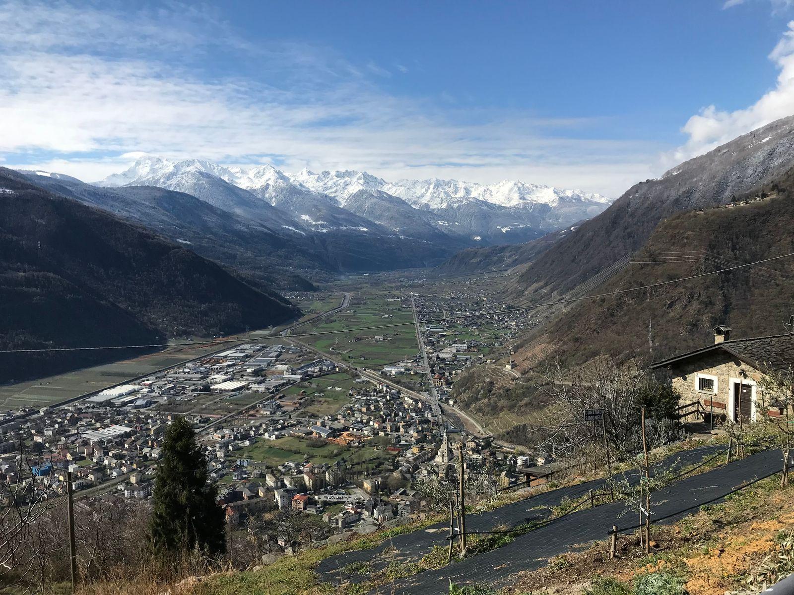
Tirano is the Valtellina's gateway to Switzerland and a rare starting point for anyone who loves walking: the first paths begin a few steps from the town, and in a few minutes by car you reach panoramic balconies, peat bogs, glacial valleys and the huts of the Alta Valle.
From here you can build very different days on foot: a soft loop among the stone villages above the town, a stroll on the Balcone della Valtellina, a whole valley in the Stelvio National Park. Either way the day is made of walking and stops: a coffee in a hut, a hot dish in a refuge, a trattoria with a view over the valley.
Many paths are also pages of history. Above Tirano run the routes the inhabitants have always used to climb to the hamlets and that the smugglers followed at night towards Switzerland; higher up, the border and the abandoned barracks at Sasso del Gallo tell of another age.
And in the evening you come back: Tirano has the railway station, where the train arrives and the Bernina Red Train departs, an old town to wander at leisure, restaurants and shops. A good base for anyone who wants to walk for a few days without changing hotel.
- 7
- places of interest reachable on foot from Tirano in under an hour (estimated time from Via Valorsa)
- 12
- suggested routes on foot, starting from Tirano
- 10
- huts less than an hour by car from Tirano
- 39
- huts collected on this site, from the Alta Valle to the Valmalenco
The areas
Where to walk, and how easy it is to get there
From the path that starts at your doorstep to the valleys that need a transfer: here are the main areas to walk. Driving times are calculated from Tirano to the nearest point reachable by car: always check route, distances and conditions before setting out.
Above Tirano: Roncaiola and Baruffini
About 11 minutes by car, or on foot from the town: stone villages among the vineyards, ancient smugglers' paths, a giant bench at Baruffini and a trattoria with a view over the valley. Higher up, about 26 minutes by car, Sasso del Gallo, where Italy gives way to Switzerland.
The Balcone della Valtellina: Teglio
About 21 minutes by car: a sunny terrace above the valley, with a medieval tower and a Renaissance palace. A place to walk slowly looking at the valley from above, and to sit down to a plate of pizzoccheri.
Aprica, Pian di Gembro and Val Belviso
About 33 minutes by car: the Pian di Gembro peat bog, at 1,350 metres, with its wooden walkways, and the Val Belviso, the longest of the Orobie valleys, with a large alpine lake. The Rifugio Valtellina, in the Orobie Valtellinesi Park, is about 43 minutes away.
Val Grosina and around Grosio
About 35 minutes by car: a valley that starts from castles and rock carvings five thousand years old and climbs among lakes, pastures and peaks over three thousand metres. At Eita, about 45 minutes away, a volunteer-run hut opens the door to the Val Grosina Orientale.
Bormio and the Stelvio National Park
About 37 minutes by car: one of Italy's largest and oldest parks, with glaciers and peaks over 3,900 metres. From the Bormio side open the Val di Rezzalo, about 51 minutes away, and the Val Zebrù, about 55.
Valposchiavo
About 11 minutes by car, across the border: Lake Poschiavo, at 962 metres, a turquoise mirror among larches and Bernina peaks, with an easy, panoramic loop for the whole family. Bring a valid identity document.
When to go? The valley floor and the low-altitude paths can be walked from spring to late autumn, with the best days in May, June and September. At altitude the paths clear of snow late in the season, generally from June-July to September. Farther away, about an hour by car, the Valmalenco and the Val Viola deserve a whole day.
The routes
Suggested routes
Each page shows the route map on Komoot, with the essential information in the header, the places of interest you meet along the way and the link to the route page, where you find photos and comments.
 Komoot · © OpenStreetMap
Tirano-Lake of Lovero loop
9.8 km2 h 36 min↗ 98 mEasy
A flat route suitable for families: 10 kilometres from Tirano to the Lake of Lovero along the Sentiero Valtellina, returning also on the dirt path on the other side of the Adda.
Discover the route →
 Komoot · © OpenStreetMap
Tirano-Lughina-Wine Path loop
12.6 km5 h 47 min↗ 1089 mDemanding
A technical route from Tirano to Lughina via Switzerland, returning via Novaglia and the Wine Path: the Val Poschiavo on one side, the Valtellina on the other.
Discover the route →
 Komoot · © OpenStreetMap
Tirano-Novaglia-Lughina loop
12 km5 h 38 min↗ 1050 mDemanding
From Tirano to Lughina, on the border between Italy and Switzerland, via Santa Perpetua and Novaglia: woodland paths, mountain roads and the old border fortifications.
Discover the route →
 Komoot · © OpenStreetMap
Tirano-Roncaiola-Baruffini loop
12.3 km3 h 53 min↗ 477 mModerate
A soft 12-kilometre loop on the historic paths above Tirano, through the villages of Roncaiola and Baruffini and the giant bench: suitable for families, with a pinch of fitness.
Discover the route →
 Komoot · © OpenStreetMap
Tirano-Roncaiola-Baruffini-Baitelli loop
11.2 km3 h 49 min↗ 517 mDemanding
An 11-kilometre loop for fit hikers: the historic mule track among the terraces, the Bread Path from Roncaiola to Baruffini, the Valtellina baitelli and a return along the hillside.
Discover the route →
 Komoot · © OpenStreetMap
Tirano-Roncaiola-Nasen loop
8.1 km3 h 03 min↗ 470 mModerate
A medium-difficulty 8-kilometre path: the climb to the terraces north-east of Tirano, an old mule track to Roncaiola and the return via Nasen and the road to Ciocca.
Discover the route →
 Komoot · © OpenStreetMap
Tirano-Santa Perpetua-Novaglia loop
6.9 km2 h 55 min↗ 508 mModerate
A 7-kilometre loop of medium difficulty, with good preparation needed for the first climb: from Santa Perpetua to Novaglia through the woods, returning via Villa di Tirano. Not suitable for families.
Discover the route →
 Komoot · © OpenStreetMap
Tirano-Sasso del Gallo-San Romerio
23.2 km9 h 10 min↗ 1629 mDemanding
An all-day route for those with good athletic preparation: from Tirano to the old Sasso del Gallo barracks, across the Swiss border, to the San Romerio viewpoint over the Val Poschiavo.
Discover the route →
 Komoot · © OpenStreetMap
Tirano-Sasso del Gallo-Smugglers' Path loop
14.3 km5 h 32 min↗ 939 mDemanding
A path for those with athletic preparation: from Tirano to the old Sasso del Gallo barracks, then the Smugglers' Path, Baruffini, Roncaiola and the return along an old mule track.
Discover the route →
 Komoot · © OpenStreetMap
Tirano-Villa di Tirano loop
10.4 km2 h 41 min↗ 59 mEasy
A flat route suitable for families: 10 kilometres from Tirano to Villa di Tirano along the Sentiero Valtellina and among the apple orchards.
Discover the route →
 Komoot · © OpenStreetMap
Tirano-Villa di Tirano loop: the wine path
9.5 km2 h 40 min↗ 167 mEasy
An easy path, suitable for families: 9 kilometres from Santa Perpetua along the wine path among the terraces, returning through the apple orchards of the Villa di Tirano plain.
Discover the route →
 Komoot · © OpenStreetMap
Baruffini-Rifugio Schiazzera loop
17.9 km7 h 13 min↗ 1357 mDemanding
A technical, panoramic route for those with good athletic preparation: from Baruffini to the Rifugio Schiazzera on Monte Masuccio, as a day trip or with an overnight stay at the hut.
From Tirano: 4.6 km · 10 min by car
Discover the route →
The stops
Where to stop: huts, refuges and tables
A day of walking is made of stops too: a coffee in a hut, a hot dish in a refuge, a table with a view. Here are the huts closest to Tirano, all less than an hour by car. Many more are on the map. Hours and openings change: always contact the hut before setting out.
Mortirolo Antonioli Mountain Hut →
Mazzo di Valtellina · 37 min by car
A renovated old alpine dairy, a few steps from the Mortirolo Pass: home cooking, a family welcome and a grassy hollow with a small lake.
Valtellina Mountain Hut →
Aprica · 43 min by car
At 1,920 metres, in the green hollow of the Carègia del Palabione above Aprica, the CAI Aprica hut reborn after the 2010 fire, in the Orobie Valtellinesi Park.
Eita Mountain Hut →
Grosio · 45 min by car
In the village of Eita, among stone houses and a bell tower, a hut run by volunteers at the gateway of the eastern Val Grosina and the Passo di Verva.
Casina di Piana Mountain Hut →
Grosotto · 47 min by car
At the mouth of the Val Piana, a hut run by volunteers, where every dish helps the missions in Latin America.
La Baita Mountain Hut (Val di Rezzalo) →
Sondalo · 51 min by car
At 1,860 metres, in a panoramic position at San Bernardo, a simple and welcoming hut at the head of the Val di Rezzalo, an hour's walk from the Fumero car park.
Schiazzera Mountain Hut →
Vervio · 53 min by car
At 2,079 metres, at the threshold of the Val Saiento, a former Guardia di Finanza border barracks turned into a volunteer-run hut, a few minutes from the car park.
Malghera Mountain Hut →
Grosio · 55 min by car
At 1,964 metres, in a quiet alpine pasture dominated by the sanctuary's bell tower, a hut at the head of the western Val Grosina, at the start of the Valle di Sacco.
Quinto Alpini Mountain Hut →
Valfurva · 55 min by car
At 2,877 metres, on a rocky edge in the heart of the Val Zebrù, with the glacier three minutes away and the great peaks of the Ortles-Cevedale before you.
Campo Mountain Hut →
Valfurva · 55 min by car
Halfway up the Val Zebrù, a wooden house with mementoes of the Great War, family cooking and the Gran Zebrù before your eyes.
Chalet dei Rododendri Mountain Lodge →
Valdisotto · 57 min by car
On Monte Vallecetta, at 2,160 metres, a natural terrace over the pistes of the Alta Valtellina and the peaks of Bormio.
Common sense
How to walk in the mountains wisely
The paths belong to everyone: to those who walk, to those who work the alpine pastures, to those who live at altitude. A few common-sense rules make the difference between a good day and a problem for someone.
- 1
Choose a route that suits you
Assess climbing, duration and difficulty according to the fitness of the whole group, and size the ride on the slowest. If in doubt, start with a short loop.
- 2
Check the weather
In the mountains the weather changes quickly: afternoon storms, fog, wind and cold at altitude even in summer. Check the forecast and set a time to be back.
- 3
Footwear and clothing
Boots or trekking shoes with a good sole, layered clothing, a windproof and waterproof jacket, a hat and sunglasses. A pair of poles helps on the descents.
- 4
Water, food and rucksack
Carry more water than you think you will drink, something to eat, a small first-aid kit, a torch or headlamp and a charged phone. Along the paths there are not always fountains.
- 5
Tell someone
Tell someone where you are going and when you expect to be back. In an emergency the single number is 112: say precisely where you are.
- 6
Follow the marked paths
Stay on the paths and the marked tracks, do not cut the bends and do not go down steep slopes or gullies: it is the safest way and the least harmful to the environment.
- 7
Respect those who live and work up there
Paths cross alpine pastures, meadows and private land: close gates behind you, keep dogs on a lead near animals, do not pick or disturb, and take your rubbish down with you.
- 8
Watch time and light
Work out the hours of daylight and the return time with a margin. If weather or tiredness change the plans, turn back: the mountain will always be there.
- 9
The Swiss border
In border areas, such as the Valposchiavo, carry a valid identity document and check the rules in force: the smugglers' paths are not border crossings.
- 10
Snow, ice and the season
At the start and end of the season, at altitude, snow or ice may remain on the paths, even on sunny days. Check conditions before setting out and, if needed, turn back.
These are common-sense suggestions and do not replace the rules in force or the instructions of the managers of the paths, huts and parks.
The tools
Apps for maps and navigation
With a smartphone you follow the route and stay on the path even without a signal. Here are some apps that can be downloaded free, at least in the basic version: advanced features, in some cases, are paid.
Komoot ↗
Planning, voice navigation and a community with photos and comments. You can save maps offline; the free version has limits.
Outdooractive ↗
A large archive of walking routes across the Alps, with offline maps. The basic version is free, with some paid features.
Wikiloc ↗
An archive of routes shared by users, with maps and tracks to follow even offline. Some features are paid.
OsmAnd ↗
Offline maps based on OpenStreetMap, with navigation. The free version has a limit on the number of maps you can download.
Organic Maps ↗
Free offline maps, simple and ad-free. Useful as a backup map.
Google Maps ↗
To reach the starting point: you can download offline maps of an area and check journey times.
A tip that applies to all of them: download the maps before setting out, while you still have a connection. In the valley phones do not always get a signal, and the network drops as you climb.
See the paths on the map
On the main map you find, with the trekking icon, the huts, the lakes and the places along the paths: switch on the filter and choose your walk.
Path conditions, closures and the seasons of the huts change. Always check the official sites and on the spot before setting out.