Photo: Teomonce91 at Italian Wikipedia · Public domain

Easy to reach from Tirano · by car to the nearest point, then on foot
Distance and time from Tirano are calculated to the nearest point reachable by car to the place of interest: the rest of the route is on foot. Always check the route and distances carefully before setting out, also for possible seasonal or temporary closures of roads and passes.
Before you set out, check that the hut is actually open on its official website.
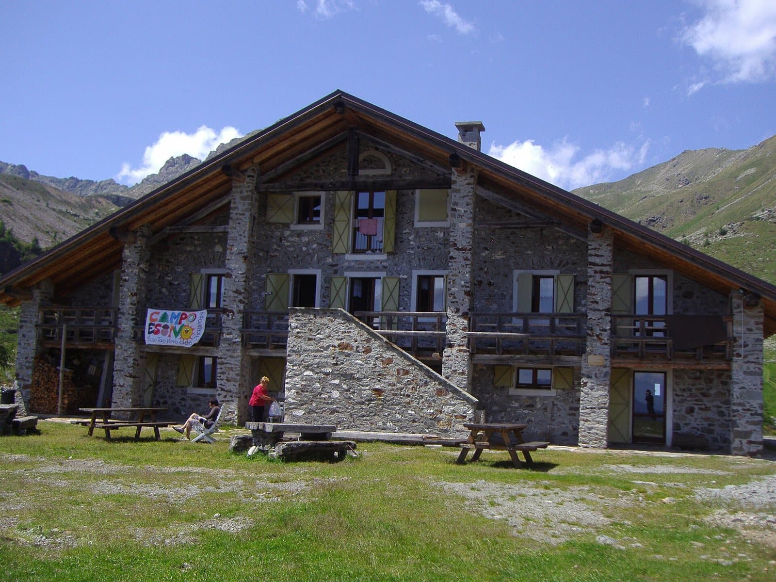
Go to the official website ↗At 2,079 metres, at the threshold of the Val Saiento, a former Guardia di Finanza border barracks turned into a volunteer-run hut, a few minutes from the car park.
- Type
- Mountain hut
- Municipality
- Vervio
- From Tirano
- Visit time
- Opening
- June 13 - September 30The website gives the opening from 13 June 2026 to September.Indicative dates, not official: check before you go.
- Official website
- rifugioschiazzera.eu
- Interests
- Nature and LandscapeHistory and CultureSport and AdventureValleys, Nature Reserves and Mountain Huts
- Activities
- TrekkingHikingMountain biking
A border barracks turned into a home
Above Tirano, among the hairpins of Vervio and Rogorbello, the road climbs to a large car park. Then a few minutes of steep mule track, and the Schiazzera hut appears at 2,079 metres, at the threshold of the Val Saiento, with the mountain behind and the landscape opening towards the Valtellina.
A border story
Until 1997 this building was a barracks of the Guardia di Finanza, whose officers watched for smugglers crossing into Switzerland through the nearby Passo del Portone. Today the same walls house a hut that puts hospitality first. It is run entirely by volunteers and supports Operazione Mato Grosso (OMG), a Catholic volunteer movement for education and aid to people in need in Latin America.
Nature and trails
A short distance away are the Schiazzera Lakes and the small lake of Pian Fusino, surrounded by rhododendrons. From the hut starts the First World War military mule track that leads, via Alpe Salina and Alpe Piana, to the Malghera hut. The hut is a support point on the Sentiero Italia and the Via Alpina. Above it, Monte Masuccio (2,816 m).
Hospitality
The hut has seven rooms for about 50 beds, bathrooms with hot showers and simple, genuine cooking. Special requests are always welcome.
From Tirano: distance, driving time and day trip
Schiazzera Mountain Hut from Tirano: about 50 minutes by car (26 km), to the nearest starting point; then you continue on foot. You follow the SS38, then the road to Tovo di Sant'Agata and climb via Rogorbello, on a regulated road with a daily ticket. To these times add the walk described on this page: plan your day accordingly. Stay in Tirano and set out each morning for a new destination: in the Valtellina it is the practical solution for those seeking hotels, services and connections a step from the station.
How to get there
From Tirano follow the state road to Tovo di Sant'Agata, then the paved road that climbs among the hamlets of Vervio, past the church of Rogorbello, to the large car park. From here a steep mule track leads to the hut in a few minutes.
What to do
A walk to the Schiazzera lakes and Pian Fusino, excursions along the military mule track, a stage of the Sentiero Italia towards Malghera and mountain biking.
Before you go
The website gives opening from 13 June 2026 to September. Always check the actual opening on the official website, rifugioschiazzera.eu, before setting out. Phone: +39 347 260 8250.
Gallery
Photo: Deriuale · CC BY 4.0, Balthazaar niva · Public domain, Deriuale · CC BY 4.0