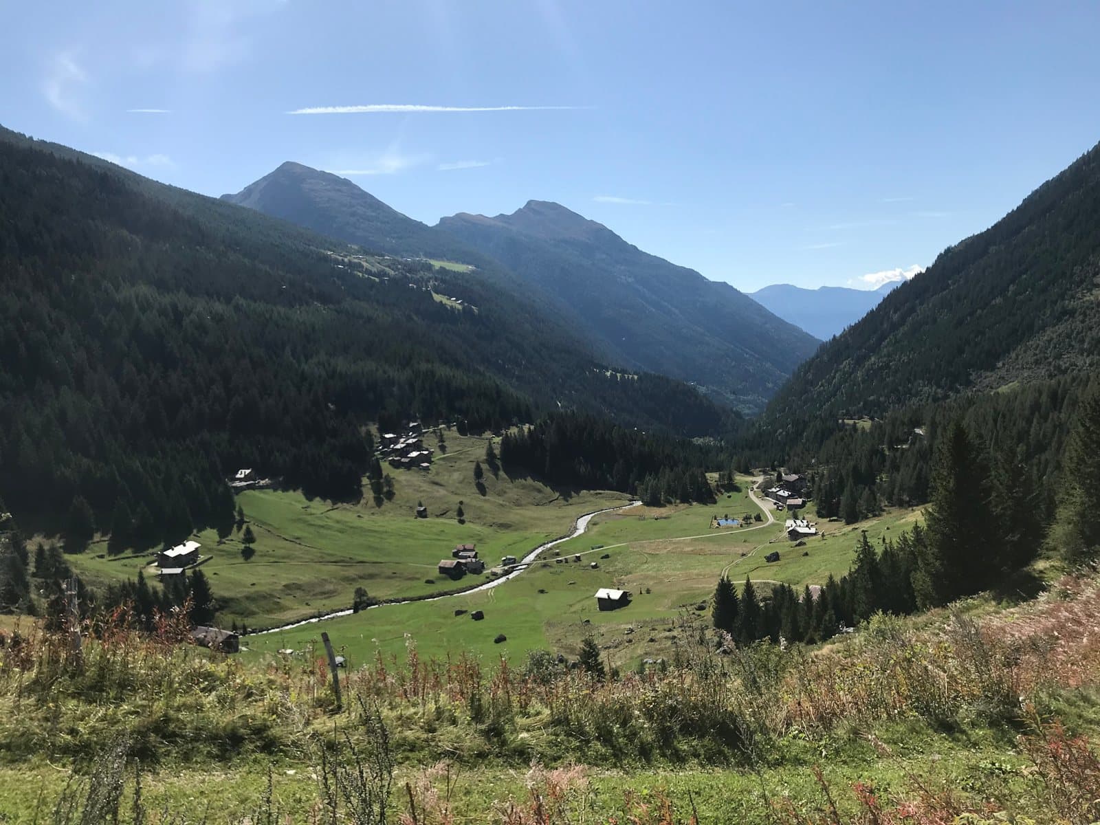
Photo: © Claudio Corcoglioniti
Easy to reach from Tirano · by car to the nearest point, then on foot
Distance and time from Tirano are calculated to the nearest point reachable by car to the place of interest: the rest of the route is on foot. Always check the route and distances carefully before setting out, also for possible seasonal or temporary closures of roads and passes.
Before you set out, check that the hut is actually open on its official website.
Go to the official website ↗At 1,964 metres, in a quiet alpine pasture dominated by the sanctuary's bell tower, a hut at the head of the western Val Grosina, at the start of the Valle di Sacco.
A pasture, a sanctuary and a hut, at the head of the Val Grosina
After Fusino the road narrows and the forest closes in. Then, at 1,964 metres, the landscape opens onto a green, silent alpine pasture: this is Malghera, at the beginning of the Valle di Sacco, in the western part of the Val Grosina. The sanctuary's bell tower dominates the huts and, next to it, the large Fabbriceria is now the mountain hut.
A story of mountain and community
The hut was born from the sanctuary's Fabbriceria: originally it had about thirteen places and stayed closed, with the key kept by the curate of Grosio. Over the years it has been enlarged and modernised several times. Today it has running water and showers, a winter room with three beds and a hospitality that has earned the "Ospitalità Italiana" recognition.
Nature and trails
Malghera is a place of passage. A stage of the Sentiero Italia arrives here, the one linking the Schiazzera hut to Malghera along the First World War military mule track, through pastures, woods and ridges. Around it, pastures and peaks of the western Val Grosina, suited to quiet excursions and more demanding climbs.
From Tirano: distance, driving time and day trip
Malghera Mountain Hut from Tirano: about 55 minutes by car (32 km), to the nearest starting point; then you continue on foot. You follow the SS38 and the SP27 to Grosio, then the Val Grosina road to Fusino, where you buy the ticket to continue. To these times add the walk described on this page: plan your day accordingly. Choose Tirano as your base for hikes in the Valtellina: from here roads, trains and buses lead to the loveliest valleys, lakes and passes.
How to get there
From Tirano follow the SS38 and then the SP27 to Grosio, then the Val Grosina road to Fusino (1,200 m), as for Eita. From Fusino continue on foot along the western Val Grosina: about 4 hours' walk for 11 km. A toll road lets you get closer to the hut: check conditions and permits with the municipality of Grosio.
What to do
Walks among the pastures, excursions towards the Valle di Sacco and the passes, a stage of the Sentiero Italia and mountain biking in the surroundings.
Before you go
The hut is generally open from early June to early October; the site also lists closure periods, so booking is advisable. Always check the actual opening on the official website, rifugiomalghera.it, before setting out. Book on +39 333 925 8966 or by email at info@rifugiomalghera.it.
Gallery
Photo: © Claudio Corcoglioniti