Photo: Gaggi Luca 76 · CC BY 3.0

A lovely day trip from Tirano · by car to the nearest point, then on foot
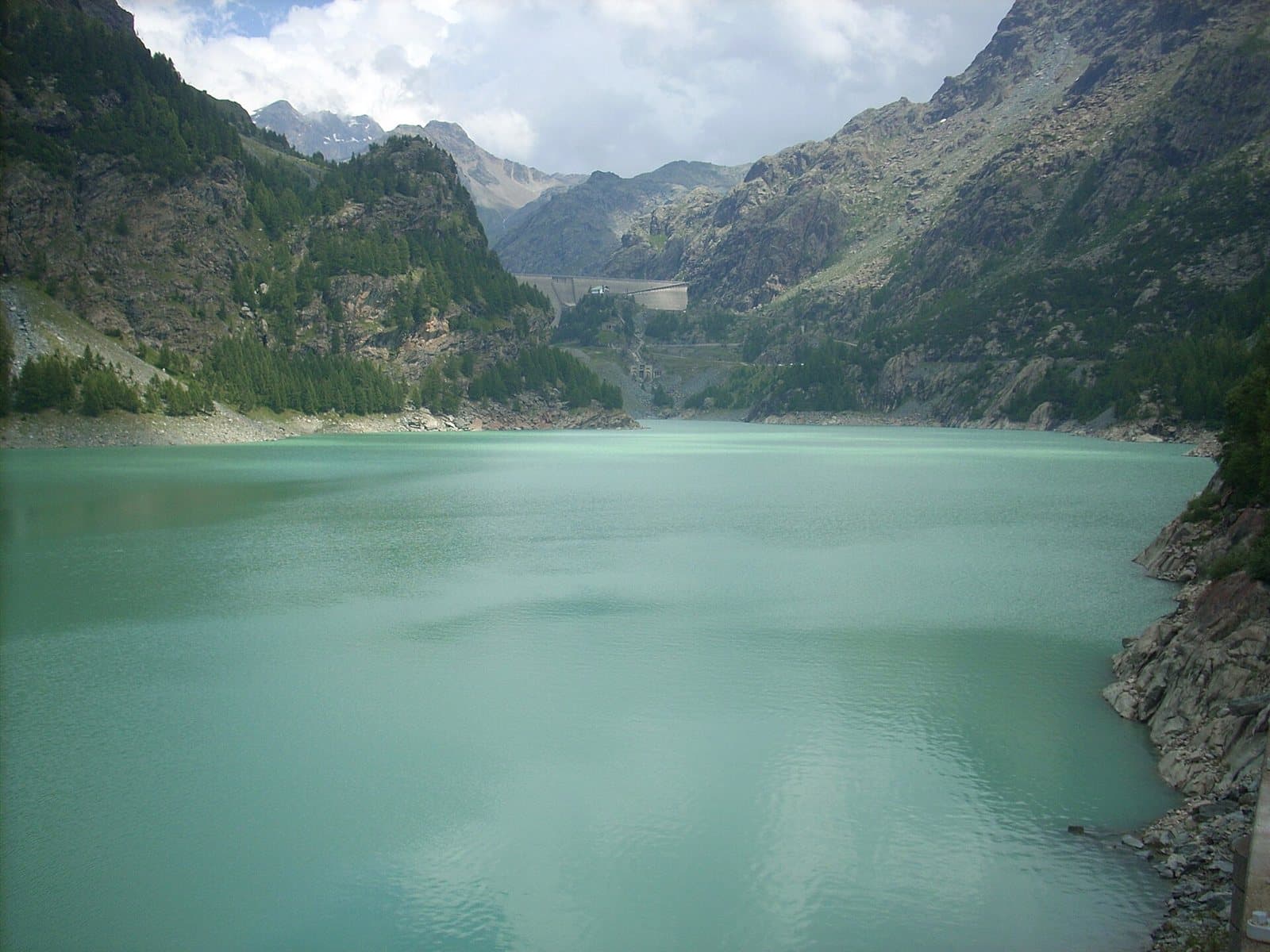
A green-turquoise reservoir at more than 1,900 metres, between two dams and the Bernina peaks, with the Zoia and Poschiavino huts a few steps away.
- Type
- Lake
- Municipality
- Lanzada
- From Tirano
- Visit time
- Opening
- June 15 - September 30An outdoor place, always reachable. At altitude snow can make roads and paths impassable: they generally clear from June-July to September. An estimate based on the altitude.Indicative dates, not official: check before you go.
- Interests
- Nature and LandscapeFamily
- Activities
- HikingMountain biking
The green mirror at the foot of the Bernina
At more than 1,900 metres, high above Lanzada, the Valmalenco opens onto a great mirror of green-turquoise water: the Campo Moro Reservoir. The barrier is formed by two gravity dams, separated by a spur of rock: the eastern one in concrete, 96 metres high and 180 long, and the western one in stone, 32 metres high and 150 long. They were built between 1956 and 1958 and hold about 11 million cubic metres of water.
Water that gives light
In 1965 an artificial cavern was dug in the rock, at about 2,000 metres, for the Campo Moro power station: a plant that, with the water of the reservoir and a drop of about 133 metres, produces every year energy for thousands of families. Today this corner of the mountain is a favourite for day trips, mountain biking and excursions towards the Marinelli Bombardieri hut and the Bernina peaks.
A place of huts
A few minutes from the car park is the Zoia hut, at 2,021 metres, with its famous crag; beside the dam the Poschiavino hut; higher up, above the nearby Alpe Gera lake, the Bignami hut.
The dam: history, capacity and the hydroelectric system
What you see at Campo Moro is not one dam but two, embraced by a spur of rock: the eastern concrete dam, 96 metres high and 180 long, and the western one in stone blocks, about thirty metres high and 150 long. They were built between 1956 and 1958, a few years before their bigger sister, Alpe Gera, and create a mirror of about 11 million cubic metres (some sources say 10) at about 1,996 metres. Besides the water coming down from Alpe Gera, the lake collects that of the Campagneda and Prabello streams and of the upper Val di Togno, and in summer its colour is a full, almost milky turquoise green.
It is the second step of the Valmalenco hydroelectric system, run by Enel Green Power. The water arrives from Alpe Gera at the Campo Moro cavern power station, a plant dug into the rock, linked to the outside by a tunnel of about 570 metres and completed in 1965; then it flows into the lake, and from the basin the long tunnel of about eight kilometres starts towards the Lanzada power station, with a drop of 900-1,000 metres. From there the water goes down to the Sondrio power station. Campo Moro is the lung that regulates the breathing between the high mountains and the valley floor: smaller than Alpe Gera, but indispensable, and for anyone looking at it from one of its shores, simply beautiful.
From Tirano: distance, driving time and day trip
Campo Moro Reservoir from Tirano: about 1 hour 40 minutes by car (58 km), to the nearest starting point; then you continue on foot. You drive down the SS38 towards Sondrio and up the Valmalenco to Chiesa and, for the higher destinations, to Lanzada and Chiareggio. To these times add the walk described on this page: plan your day accordingly. Tirano is the ideal base to visit the Valtellina: hotels and B&Bs, restaurants, shops, supermarkets, the Bernina Red Train station and buses to get around.
How to get there
From Lanzada follow the road to Campo Franscia and then the dirt road to the dam, in normal conditions. From Chiesa in Valmalenco there is also a bicycle route of about 16 kilometres.
Before you go
Always check the road conditions and the huts' opening.
Warning: road closed by a landslide
The municipal road from Lanzada to Franscia and Campo Moro is closed because of the landslide of November 2025 and, according to the Zoia hut, will stay closed for the whole winter 2026/27. A free shuttle bus ran in summer. Before setting out, check the state of the road and the alternative routes with the Municipality of Lanzada.
Gallery
Photo: LIUCLorenzo4 · CC0, Michele Mondora · CC BY-SA 4.0, Gaggi Luca 76 · CC BY 3.0