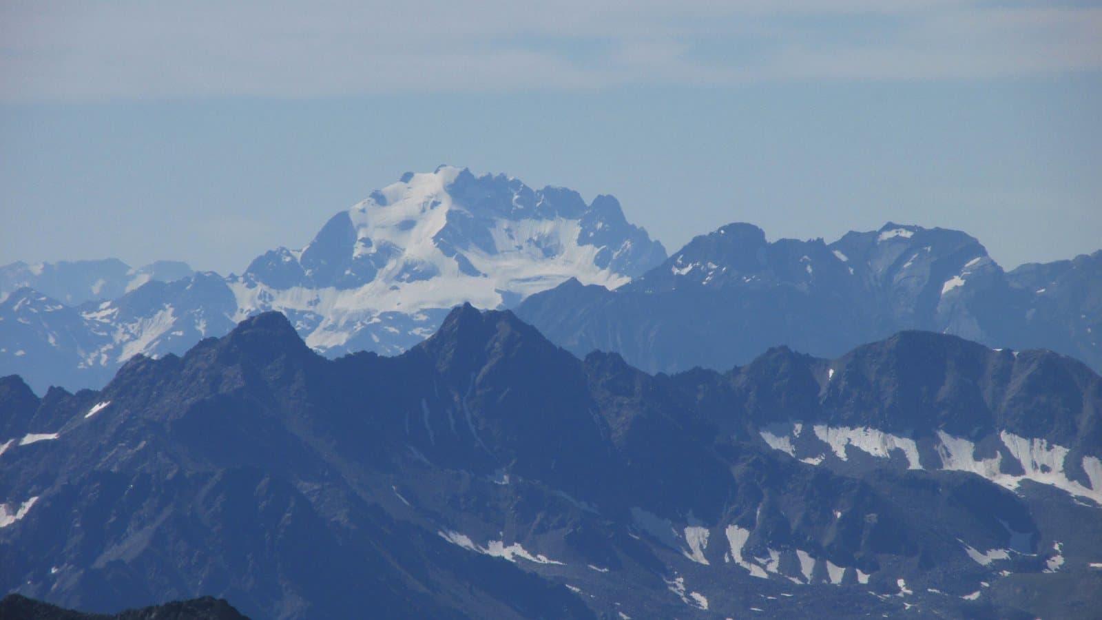
Photo: 32-Fuß-Freak · CC BY-SA 4.0

Easy to reach from Tirano · by car to the nearest point, then on foot
Distance and time from Tirano are calculated to the nearest point reachable by car to the place of interest: the rest of the route is on foot. Always check the route and distances carefully before setting out, also for possible seasonal or temporary closures of roads and passes.
3,439 metres above Valdidentro: the highest summit of the Livigno Alps, with a name that carries a family of herdsmen, a bivouac dedicated to a friend and an ice wall that lights up at sunset.
- Type
- Mountain
- Municipality
- Valdidentro
- From Tirano
- Opening
- June 15 - September 30An outdoor place, always reachable. At altitude snow can make roads and paths impassable: they generally clear from June-July to September. An estimate based on the altitude.Indicative dates, not official: check before you go.
- Activities
- MountaineeringSki mountaineering
The king of the Livigno Alps
The Cima Piazzi (or Cima de' Piazzi), 3,439 metres, is the highest summit of the Livigno Alps, in the western Rhaetian Alps, and dominates Valdidentro and the Val Viola. The name, it seems, recalls a Valtellina family that held grazing rights on the meadows at the foot of the mountain: a herdsmen's name for a mountain of ice. It is also the surname of the astronomer Giuseppe Piazzi, from the Valtellina, discoverer of Ceres in 1801: a link people here like to recall, even if it is not certain that the two names are related. In a parchment of 1547, kept in the municipal archive of Grosio, the summit appears under another name, «Corno di Pozi».
A mountain with a story
From Isolaccia, in Valdidentro, you climb through the Val Cardonè and the Val Lia to the Maurilio Cantoni Bivouac (2,625 m), built in 1980 by the CAI of Bormio in memory of the climber Maurilio Cantoni, who died in 1978 in an avalanche while descending from the Cima Piazzi. It is one of the most comfortable bivouacs in the Alps, they say: a fundamental point of support for the climb, also for ski mountaineering. Lower down, in the Val Cardonè, is the Paolo Ferrario Bivouac (2,340 m), built in 1956 by the CAI of Dervio: the second oldest in the area.
The neighbouring peaks
The group is a much-coveted goal for climbers and ski mountaineers: the Corno San Colombano (3,022 m), the Monte Rinalpi (3,009 m), the Pizzo Dosdè (3,280 m), the Cima Lago Spalmo (3,292 m) and the Cima di Saoseo (3,265 m) are just some of the summits you can climb starting from Isolaccia or Arnoga. The ascent of the Cima Piazzi, from Isolaccia by the Baite di Pezzel, the Madonna di Presedont, the Val Lia and the Malga Boron to the Cantoni Bivouac, then over the Vedretta della Piazzi and the north ridge, takes about 6 hours and 2,000 metres of ascent.
From Tirano: distance, driving time and day trip
Cima Piazzi from Tirano: about 50 minutes by car (42 km) to Isolaccia, in Valdidentro; then you continue on foot. You follow the SS38 dello Stelvio to Bormio and then the SS301 towards Livigno to Isolaccia. To admire it, the Val Viola is a few minutes from Isolaccia: a lovely day in the Upper Valtellina. Climbs at altitude take a full day and often a night in a hut, but Tirano, the Alpine Hub of the Valtellina, remains the ideal base for preparing and for returning: hotels, restaurants, shops and the Red Train station a step away.
How to get there
From Tirano follow the SS38 dello Stelvio to Bormio, then the SS301 towards Livigno and the Foscagno Pass as far as Isolaccia, in Valdidentro. From here start the paths to the Val Cardonè and Val Lia and to the Cantoni Bivouac. For the Val Viola you turn off at Arnoga.
What to do
To enjoy it without climbing, the Val Viola is enough, the «great mountain garden» above Arnoga, with its lake and the Viola hut; the Cima Piazzi dominates the valley, and the glacier that descends from its face can be seen from the Lago Viola. From the Val Cardonè and the Val Lia start the climbs, for the more experienced.
Before you go
The climb of the Cima Piazzi is a mountaineering route (glacier, crampons, ice axe, rope) and requires a long day and good fitness; in winter the bivouac can be reached only with stable snow cover. The accounts of the origin of the name are not unanimous: they are reported here as hypotheses. Check the conditions before setting out.
Gallery
Photo: Elisa Rossi 96 · CC BY-SA 4.0, MatthewGhera · CC BY 3.0