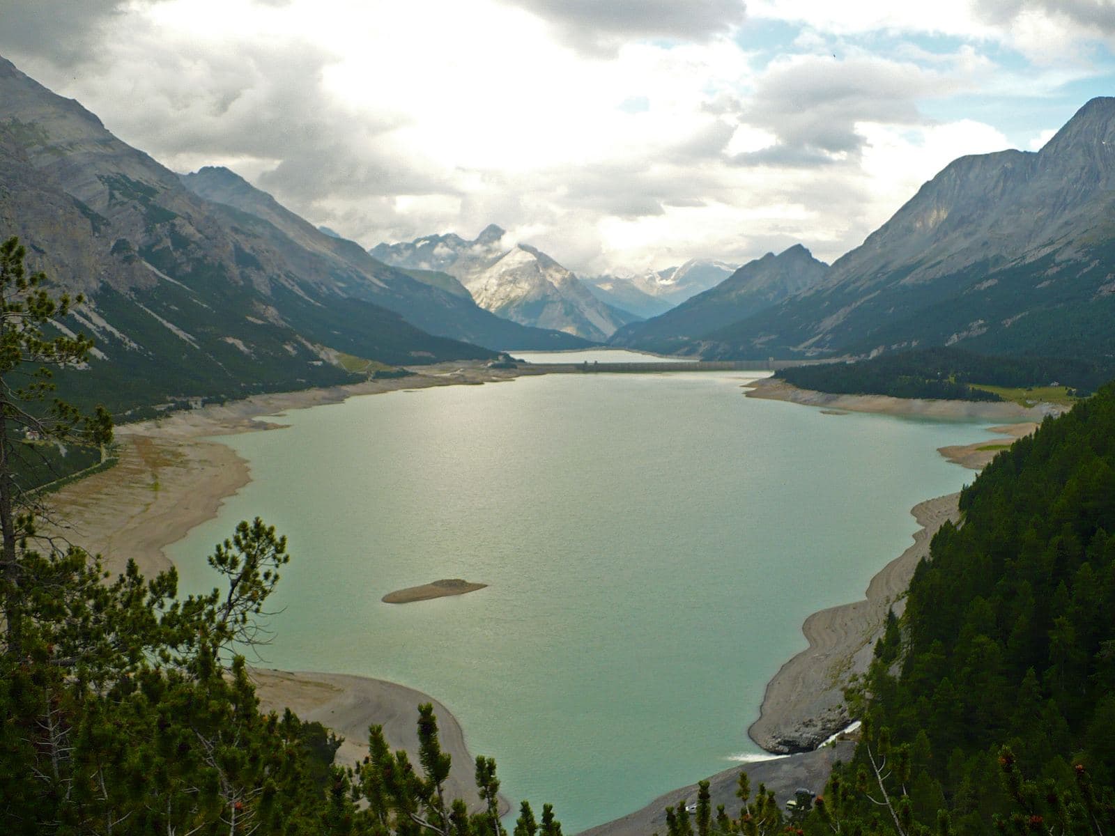
Photo: MatthewGhera · CC BY 3.0

A lovely day trip from Tirano · by car to the nearest point, then on foot
A road of hairpins, two medieval towers and two emerald lakes born where a village once stood: the perfect day in the Upper Valtellina, and the gateway to the Adda springs and Livigno.
- Type
- Lake
- Municipality
- Valdidentro
- From Tirano
- Visit time
- Opening
- June 1 - October 31The season runs from June to October: in winter the road is closed because of avalanche risk. In summer car access may be limited.Checked on October 29, 2026.
- Interests
- Nature and Landscape
- Activities
- HikingTrekkingMountain biking
The day begins at Premadio, in Valdidentro, some fifteen kilometres from Bormio. From Fior d'Alpe a road leaves the valley floor and climbs the mountainside in a long sequence of panoramic hairpins: about half an hour by car (the fittest do it by bike), and at every bend the valley opens a little more below you. It is a road you travel with your nose in the air and a light heart, because it already knows where it is going.
At 1,930 metres the Fraele Towers appear, two twin square towers that seem to rest on the edge of the world. They were built between 1391 and 1392 to control one of the most important passages of the age, the Imperial Road of Alemagna, along which caravans carried Valtellina wine to central Europe in exchange for salt. In 1481 they were reinforced by order of the Duke of Milan; in 1513 the Grisons, invading the county of Bormio, destroyed them. What remains is today the finest terrace over Valdidentro.
Beyond the towers, the Fraele Valley is a haven of quiet, but for centuries it was a place of work and passage. As early as the 12th century a mine was active here; there were blast furnaces and foundries, an inn, a customs post, a wide muleteers' track and the little village of San Giacomo, with its medieval church and hospice for travellers. In Napoleonic times the village was largely razed and its people took refuge in Premadio and Pedenosso, but in the first half of the 20th century it still had a carabinieri barracks, a post office, an inn and the church.
Then came the dams. In 1933 a first, small barrage created Lake Cancano. In 1940 work began on the San Giacomo dam, commissioned by the Azienda Elettrica Milano and designed by the engineer Luigi Gallioli: it stopped during the war and was completed in 1950, with a reservoir of 64 million cubic metres. The water rose and drowned the village; in 1953 the last trace, the top of the bell tower, vanished. In the same year the second great work began, the Cancano II dam, a 136-metre arch-gravity dam that in 1956 closed the valley at 1,900 metres above sea level. Together, the two lakes hold about 187 million cubic metres of water and feed the Premadio power station.
Every so often, history resurfaces. In June 2022, when A2A had to release large quantities of water to support irrigation in the Po Valley, the submerged village partly showed itself again for the first time in eighty years.
Today all this makes a perfect day out. From the Towers car park starts the lake circuit: about twenty kilometres of well-kept dirt road, almost flat, to be done in four or five hours on foot or by bike, and shortened as you like. With children it is a dream: space to run, equipped picnic areas, refreshment stops and mountain huts along the way, such as the Rifugio Val Fraele. If you don't have a bike you can rent one, electric too and with a child seat, and in July and August shuttles help those who prefer not to walk. With some care it can even be done with a pushchair. The colour of the water, turquoise and emerald, does the rest.
For those who want more, Cancano is an extraordinary starting point. From the Passo di Fraele car park, trail 138 climbs into Val Alpisella, with a long diagonal across the mid-slope, to the sources of the Adda, where icy water wells from the ground. Along the way you meet Lake Alpisella and, higher up, the Alpisella Pass, at 2,285 metres, which opens the door to Livigno.
Livigno can be reached on foot from right here, through Val Alpisella: about eight kilometres and four hours of walking, with the Stelvio National Park all around. Another little valley, Val Trela, climbs instead to the Bocchetta di Trela, at 2,349 metres, from which a short descent leads to the Alpe Trela, a mountain farm with refreshments and cowbells. From there the longer routes, often by mountain bike, link to the Trela and Eira passes and to Livigno. Those who love adventure can even make a two-day loop of it.
A few tips. The season runs from June to October, because in winter the road is closed due to avalanche risk. On summer weekends it is best to arrive early: parking is paid (about 5 euros a day) and in July and August traffic may have time restrictions. Bring a jacket: at almost 2,000 metres the weather changes fast. That is Cancano: an easy day for everyone, and for those who want it, an open door towards Livigno, the Adda and the silence of two little valleys.
The dam: history, capacity and the hydroelectric system
Before you set off along the shore, it is worth pausing to think about what lies beneath the water: because the lakes of Cancano, so calm and so turquoise, are the beating heart of the whole Upper Valtellina. They were built by the Azienda Elettrica Municipale di Milano, and today they are run by A2A, the group that inherited its history. There are three barriers, one after the other, each born to replace or enlarge the one before, like chapters of the same story.
The first, Cancano I, was born in the 1920s: a work of about 43 metres, with a reservoir of some twenty million cubic metres (sources give 1928 or 1933 as the year of completion), which fed the Fraele power station at Rasin, in service from 1928 and decommissioned in 2004: today it is a chapter of industrial archaeology. Then came San Giacomo, begun in 1940, interrupted by the war and finished in 1950: a straight buttress dam, 91.5 metres high and 965 long, its crest at 1,951.5 metres, holding 64 million cubic metres. Finally Cancano II, between 1953 and 1956: an arch-gravity dam of 136 metres, which closes the valley with an elegant curve and a reservoir of 123 million cubic metres. When it filled, it covered the old barrier and the ancient power station: now and then, when the level falls, they show themselves again like ghosts beneath the surface.
Together, the two lakes keep about 187 million cubic metres of water and entrust it to the underground Premadio power station, in Valdidentro: 226 megawatts, in service since 1956. From there the water continues its journey down the valley, through other A2A plants such as Grosio (431 megawatts) and Lovero, to Stazzona, a few kilometres from Tirano, the lowest point of the chain, where a barrage on the Adda gathers the last drops. For the Upper Valtellina A2A speaks of four large dams and eleven power stations, for about 784 megawatts: an orchestra of water playing from the top of the valley to the bottom. And it is only part of the picture: according to popular estimates the Valtellina has more than fifty dams, large and small, and gives about a twelfth of Italy's hydroelectric power and about half of Lombardy's. Dates and capacities vary slightly from source to source: read them as orders of magnitude.
From Tirano: distance, driving time and day trip
Cancano Lakes from Tirano: about 1 hour 25 minutes by car (55 km), to the nearest starting point; then you continue on foot. You drive up the SS38 to Bormio and continue towards Livigno (SS301) through Valdidentro, the heart of Alta Valtellina and gateway to the Val Viola and the Fraele valley. To these times add the walk described on this page: plan your day accordingly. Stay in Tirano and set out each morning for a new destination: in the Valtellina it is the practical solution for those seeking hotels, services and connections a step from the station.
Refreshment stops
Before you set out, always check that the hut is actually open on its official website.
Gallery
Photo: © Claudio Corcoglioniti, Giuseppe Angelo · CC BY 3.0, Touring Club Italiano (autore non indicato) · CC BY-SA 4.0, qwesy qwesy · CC BY 3.0, qwesy qwesy · CC BY 3.0