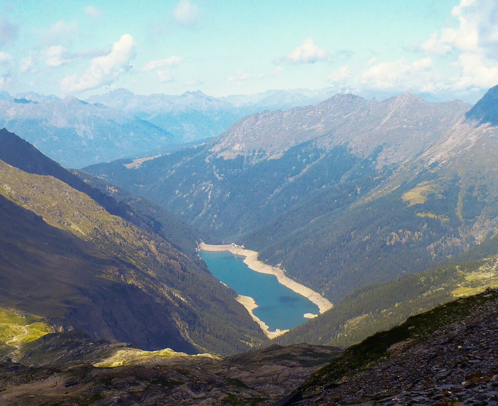
Photo: MatthewGhera · CC BY 3.0

Easy to reach from Tirano · by car to the nearest point, then on foot
The largest lake in the Orobic Alps: a six-kilometre turquoise ribbon in the heart of the Val Belviso, with an easy walk for everyone along the gnomes' path.
- Type
- Lake
- Municipality
- Aprica
- From Tirano
- Visit time
- Opening
- May 15 - October 31An outdoor place, always reachable. At altitude snow can make roads and paths impassable: they generally clear from June-July to September. An estimate based on the altitude.Indicative dates, not official: check before you go.
- Activities
- HikingTrekkingMountain biking
The great blue mirror of the Orobie
After the hairpins of the Val Belviso, among firs and silence, the valley suddenly opens and there it is: Lake Belviso, a ribbon of turquoise water about six kilometres long, set between rocky mountains and woods. With more than a square kilometre of surface and up to 120 metres of depth, it is the largest lake in the Orobic Alps. And yet it has an almost intimate calm: the water is so clear and the shores so quiet that it seems to have always been there.
A work of man that nature has made its own
The lake was created by the Frera dam, built between 1956 and 1959. It holds about 50 million cubic metres of water and is now run by Edison. Looking at it, though, no one would say it is artificial: the colours change with the seasons, from the deep green of summer to the golds of autumn, and to snow in winter. The whole valley is part of the Orobie Valtellinesi Park, a place where you breathe more slowly.
A walk for everyone
From the Ponte Frera car park, at 1,373 metres, starts the "gnomes' path", marked by wooden figurines, leading to the dam: suitable for trekking prams and bicycles, it is a perfect destination for families. On the lakeshore there is a path to stop and watch the water and, near the Cristina hut, a picnic area for lunch.
For those who want to climb
From the lake a track runs along the shore for about six kilometres, then the path climbs into the Val di Pila as far as the Malga di Pila and the Nani Tagliaferri hut, at 2,328 metres, on the Bergamo side. Higher up, the alpine lakes of Torena and Monte Torena, which comes close to 3,000 metres. For mountain bikers there is a long high-altitude loop from Aprica that touches the Belviso dam.
The dam: history, capacity and the hydroelectric system
A lake so calm and so blue seems to have been there forever, and yet it has a birth date: the Frera dam, which closes the Val Belviso, was built between 1956 and 1959, and an archive photograph of 1957 still tells the story of its construction site. It creates a reservoir of about 50 million cubic metres: a mirror of 1.1 square kilometres at 1,485 metres, up to 120 metres deep, the largest basin in the Orobie Alps, which collects the waters of a catchment of about 27 square kilometres. Today it belongs to Edison.
Edison has been present in the Valtellina for over a century and runs an integrated hub of seven power stations (Venina, Ganda, Belviso, Armisa, Publino, Zappello and Vedello) and seven dams and reservoirs. Frera belongs to the Belviso chain: the lake's water feeds the Belviso power station, at Teglio, and continues to the Ganda one, in the lower part of the valley, before returning to the river. Compared with the giants of the Adda, Frera is a hillside reservoir: a granary of water that keeps its reserve high up and gives it back downstream when needed. Measurements and management of the plant are given according to public sources of Edison and local popular writing: for definitive technical data the documentation of the operator is authoritative.
From Tirano: distance, driving time and day trip
Lake Belviso from Tirano: about 45 minutes by car (23 km), to the nearest starting point; then you continue on foot. You drive down the SS38 to Tresenda, follow the road towards Aprica and enter the Val Belviso, a quiet, little-trodden Orobie valley. To these times add the walk described on this page: plan your day accordingly. From Tirano, the Alpine Hub of the Valtellina, you can easily organise day trips and itineraries: in the evening you return to restaurants, shops and a good dinner.
How to get there
From Tresenda follow the road towards Aprica and go down to the Ganda bridge, at 915 metres, at the mouth of the valley. A narrow road, passable by an ordinary car, climbs through San Paolo and the Cristina hut to the Ponte Frera car park. Before setting out it is wise to check the state of the road.
Before you go
The lake is reachable mainly from spring to autumn; in winter the road may be closed. Wear comfortable shoes and bring a jacket: at 1,500 metres the air is cool even in summer.
Gallery
Photo: Gianluca Cogoli · CC BY 3.0, Orobicon at Italian Wikipedia · CC BY-SA 3.0, Fabiano Stangoni · CC BY-SA 4.0, MatthewGhera · CC BY 3.0, Ago76 · CC BY-SA 3.0, MatthewGhera · CC BY 3.0