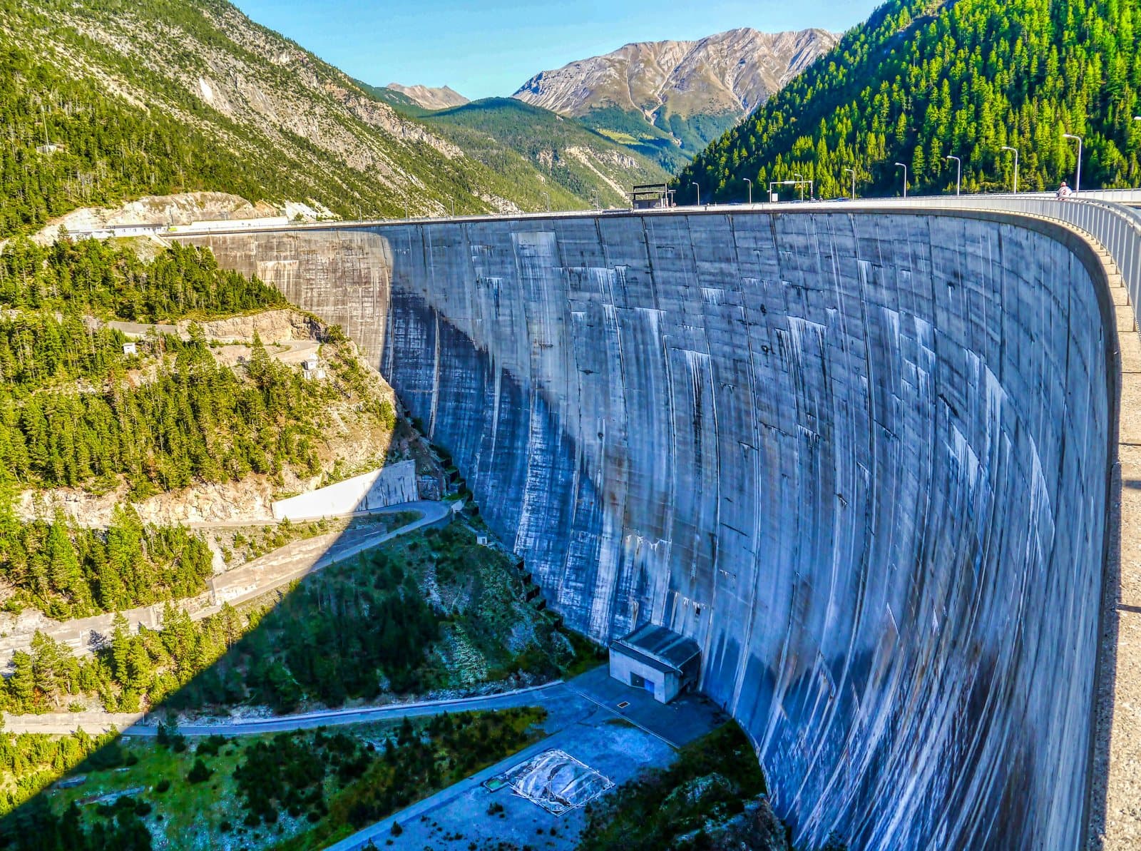
Photo: Zairon · CC BY-SA 4.0

A lovely day trip from Tirano · by car to the nearest point, then on foot
An arch dam 130 metres high, built by the Swiss astride the border, and an emerald lake of 164 million cubic metres that carries the name of «Little Tibet».
- Type
- Lake
- Municipality
- Livigno
- From Tirano
- Visit time
- Opening
- June 15 - September 30An outdoor place, always reachable. At altitude snow can make roads and paths impassable: they generally clear from June-July to September. An estimate based on the altitude.Indicative dates, not official: check before you go.
A lake that belongs to two countries
North of Livigno, at 1,805 metres, stretches Lake Livigno, also called Lago del Gallo: 4.7 square kilometres of water, up to 119 metres deep. The village stands at its southern end; the other half looks towards Switzerland. When the level is high it is an emerald-green ribbon; when it falls, the bottom becomes visible again and the landscape changes face.
The dam: history, capacity and the hydroelectric system
From the crest the view is one that stays with you: an arch of concrete about 130 metres high and about 540 long rests against the sides of the valley, and on one side the emerald-green water stretches as far as Livigno, on the other the gorge drops towards the Engadine. The Punt dal Gall dam is a Swiss work, built between 1965 and 1968 by the company Engadiner Kraftwerke: it stands on Swiss territory, at Zernez, in the Grisons, but creates a lake that belongs, for the most part, to Livigno. The reservoir holds about 164 million cubic metres of water, a little less than the two Cancano lakes put together.
The story begins in 1942, when the Azienda Elettrica Milanese proposed digging a tunnel to divert part of the water of the Spöl towards the Adda. After about ten years of negotiations, Italy and Switzerland signed the Bern Convention in 1957, ratified by Italy in 1958, and the Swiss built the dam to exploit the waters of the Inn. The water of the lake in fact leaves towards the Engadine: it does not enter the Adda system of the A2A and Enel power stations, but that of the Engadiner Kraftwerke, that is, the Inn. A lake half Italian that works for Switzerland: a small, fascinating border story.
To build the work the Munt la Schera tunnel was dug, about 3.5 kilometres long and single-lane, open to traffic since 1969: it links Livigno and the Upper Valtellina with Zernez and the Lower Engadine, is open in winter too when the Forcola closes, and a toll is charged. Sometimes the lake is full and reflects the larches like a mirror; at other times it drops and leaves the bottom uncovered, revealing an almost unrecognisable landscape: either way it is worth the stop.
From Tirano: distance, driving time and day trip
Lake Livigno and the Punt dal Gall dam from Tirano: about 1 hour 15 minutes by car (60 km), over the Forcola di Livigno or via Bormio and the Foscagno, to Livigno and then towards the Passo del Gallo. A day is enough to admire it: from Tirano, the Alpine Hub of the Valtellina, you set out in the morning and return in the evening to restaurants, shops and a good dinner.
How to get there
From Tirano you reach Livigno over the Forcola di Livigno (passing through Swiss territory: carry a valid document) or via Bormio and the Foscagno Pass. From Livigno follow the road towards the Passo del Gallo; the Munt la Schera tunnel, which continues towards the Engadine, is subject to a toll. Always check road conditions, especially in winter.
What to do
From the centre of Livigno you reach the dam towards the Passo del Gallo, where the road crosses the crest; to enjoy lake and valley it is worth giving it at least a few hours, perhaps placing the stop in a wider tour among the larch woods and the viewpoints above the shore.
Before you go
The view changes with the season and with the level of the lake, which sometimes drops a great deal. Bring a jacket even in summer: at 1,800 metres and above the weather changes quickly. Livigno is a reduced-duty zone: find out about the rules for purchase and transport.