Photo: Noperation · CC BY-SA 4.0

Easy to reach from Tirano · by car to the nearest point, then on foot
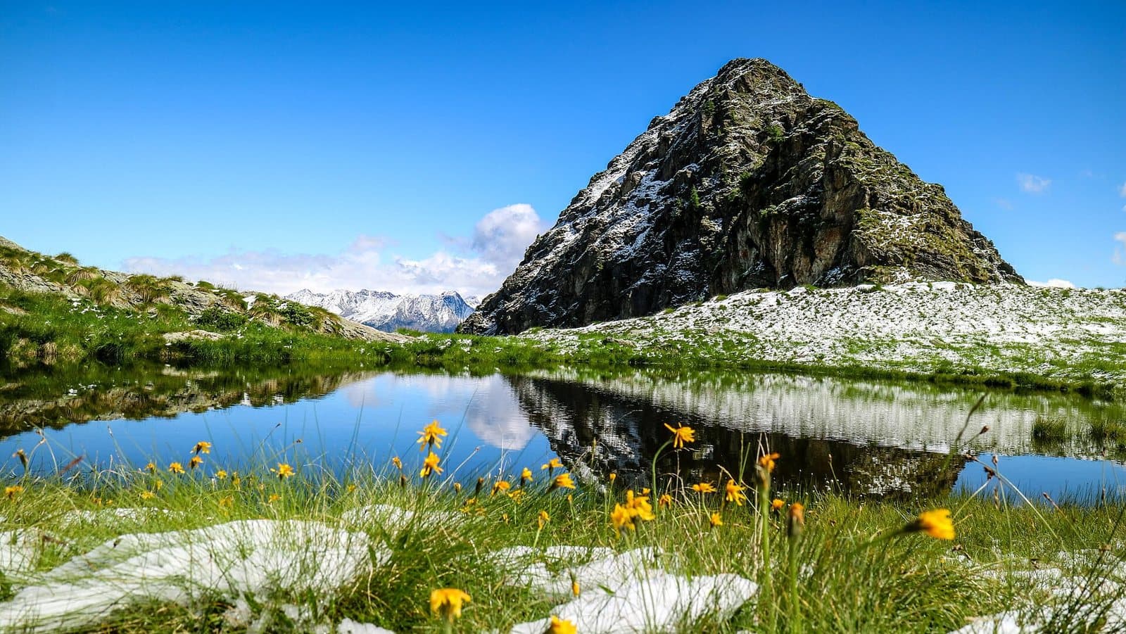
Two small lakes at about 2,100 metres above Aprica, with the cross of Monte Filone and a 360-degree view of the Orobie, the Rhaetian Alps and the Adamello.
- Type
- Lake
- Municipality
- Aprica
- From Tirano
- Visit time
- Opening
- June 15 - September 30An outdoor place, always reachable. At altitude snow can make roads and paths impassable: they generally clear from June-July to September. An estimate based on the altitude.Indicative dates, not official: check before you go.
- Activities
- HikingMountain biking
Two lakes and a cross above Aprica
Above Aprica, where the woods open onto the slopes and the pastures, the mountain offers a small treasure of water: Lake Palabione. At about 2,100 metres, among rocks and meadows, it mirrors the pointed peak that towers over it and, in summer, is ringed with yellow flowers. It is reached by a lovely walk, on foot or with the lifts, and gives the feeling of having come very high with very little effort.
A natural lake and an artificial one
There are in fact two lakes, linked by a stream. The lower one, at about 2,040 metres, is an artificial reservoir that in winter supplies the water for snowmaking in the Aprica-Corteno ski area. The upper one, at about 2,109 metres, is the real Lake Palabione: a natural lake in a moraine basin, slightly raised by a small barrier. Among the stones around, if you are patient, you can see marmots playing on the rocks.
As far as the cross of Monte Filone
From the Magnolta gondola the path climbs gently to the arrival of the Palabione chairlift, at 2,050 metres, and from there to the lake. Those who want to climb further can continue to the cross of Monte Filone: the view is a 360-degree panorama of the Orobic Alps, the Rhaetian Alps and the Adamello massif. The route is about 3.5 kilometres, one hour forty, easy as far as the lake and of medium difficulty up to the cross (paths 341, 327, 329).
For walkers and cyclists
Among the destinations in the area is the Dosso Pasò (2,575 m), reached on foot or by cable car and a splendid viewpoint, and the Magnolta–Pasò–Palabione loop, demanding, of about 15 kilometres and 990 metres of ascent, also enjoyed by cyclists.
From Tirano: distance, driving time and day trip
Lake Palabione from Tirano: about 40 minutes by car (20 km), to the nearest starting point; then you continue on foot. You drive down the SS38 to Tresenda and climb on the SS39 to the Aprica Pass, the gateway between the Valtellina and the Val Camonica. To these times add the walk described on this page: plan your day accordingly. Stay in Tirano and set out each morning for a new destination: in the Valtellina it is the practical solution for those seeking hotels, services and connections a step from the station.
How to get there
From Aprica take the Magnolta gondola, or walk up along the paths. You can also start from the Valtellina hut (1,920 m).
Before you go
The lake can be reached in summer and autumn. The lifts have seasonal hours: check them before setting out. Bring trekking shoes and a jacket.
Photo: Gianluca Cogoli · CC BY 3.0, Gianluca Cogoli · CC BY 3.0, Noperation · CC BY-SA 4.0