Photo: Gaggi Luca 76 · CC BY 3.0

A lovely day trip from Tirano · by car to the nearest point, then on foot
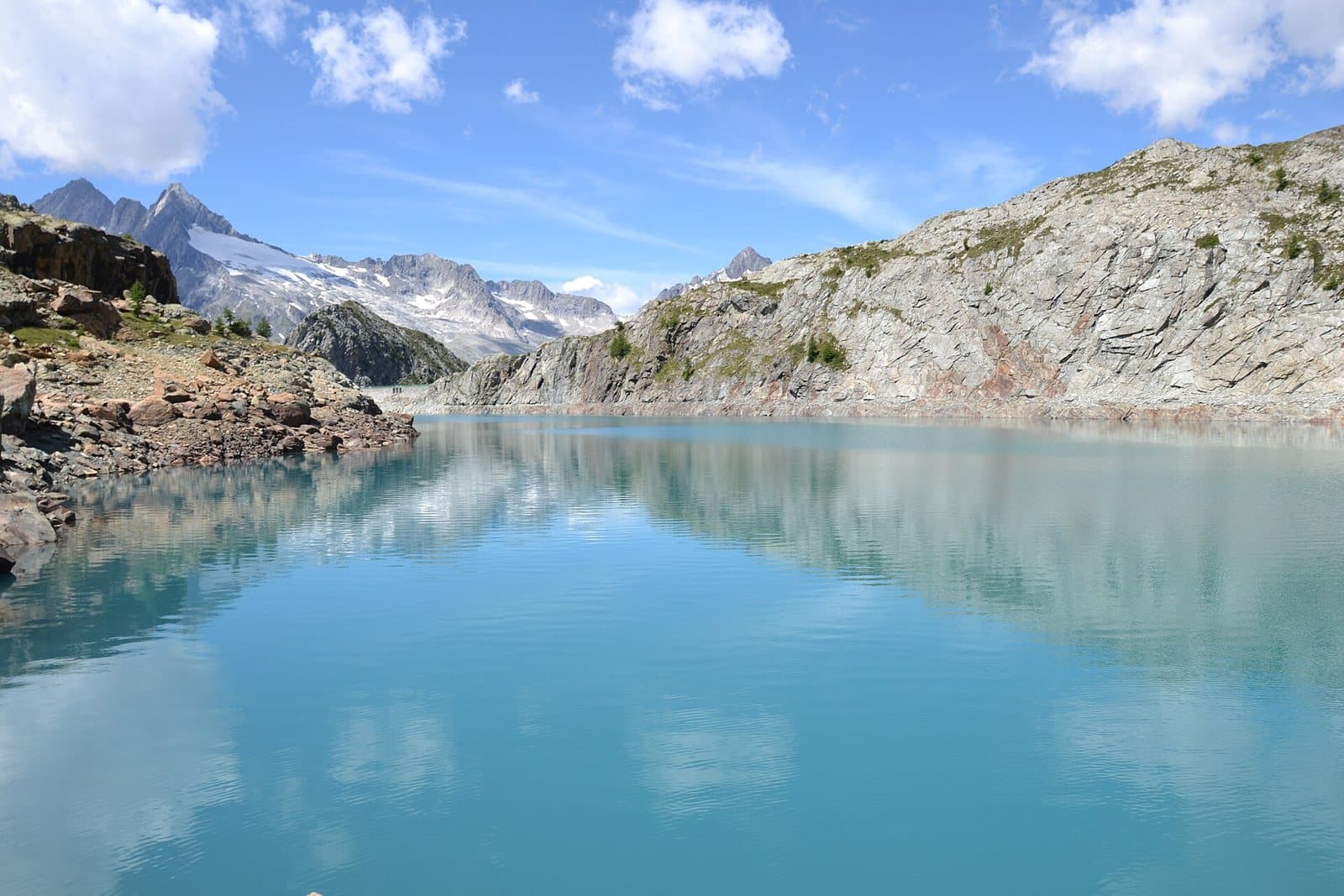
A lake of deep blue water at about 2,290 metres, above the Val Ventina, among red serpentine and larches, with a view of the Passo del Muretto.
- Type
- Lake
- Municipality
- Chiesa in Valmalenco
- From Tirano
- Visit time
- Opening
- June 15 - September 30An outdoor place, always reachable. At altitude snow can make roads and paths impassable: they generally clear from June-July to September. An estimate based on the altitude.Indicative dates, not official: check before you go.
- Activities
- HikingTrekking
The deep blue above the Val Ventina
Above the Val Ventina, in an isolated setting of scree and small cliffs of red serpentine, at about 2,290 metres, lies Lake Pirola: about 650 metres long and a hundred wide, stretched east to west like a small fjord between the rocks. The water is a deep blue, contrasting with the red rocks. Around it rise the Torrione Porro (2,357 m) to the south-west and the Monte Senevedo (2,561 m) to the north-east.
A man-made lake that nature has reclaimed
The basin was enlarged by a dam, but when the water level is low the lake looks natural again. Near the shore you can see the ruins of the Alpe Pirola, the custodian's house and the dam.
From Tirano: distance, driving time and day trip
Lake Pirola from Tirano: about 1 hour 15 minutes by car (55 km), to the nearest starting point; then you continue on foot. You drive down the SS38 towards Sondrio and up the Valmalenco to Chiesa and, for the higher destinations, to Lanzada and Chiareggio. To these times add the walk described on this page: plan your day accordingly. Choose Tirano as your base for hikes in the Valtellina: from here roads, trains and buses lead to the loveliest valleys, lakes and passes.
How to get there
From Chiareggio (1,612 m) cross the Mallero on a bridge and follow the dirt track in the forest, beyond the junction for the Alpe Ventina; at about 1,925 metres take the "LP" path on the left. In all it takes about two hours, with 785 metres of ascent. From the Alpe Pirola (2,102 m) the signs give half an hour to the lake. Along the path you meet larches, rhododendrons and, in season, raspberries and blueberries.
Before you go
It is a hiking route, not difficult but long. Bring water and suitable clothing.
Gallery
Photo: Gaggi Luca 76 · CC BY 3.0, Gaggi Luca 76 · CC BY 3.0, Gaggi Luca 76 · CC BY 3.0, Gaggi Luca 76 · CC BY 3.0