Photo: Walter Micheletti · CC BY 3.0

Easy to reach from Tirano · by car to the nearest point, then on foot
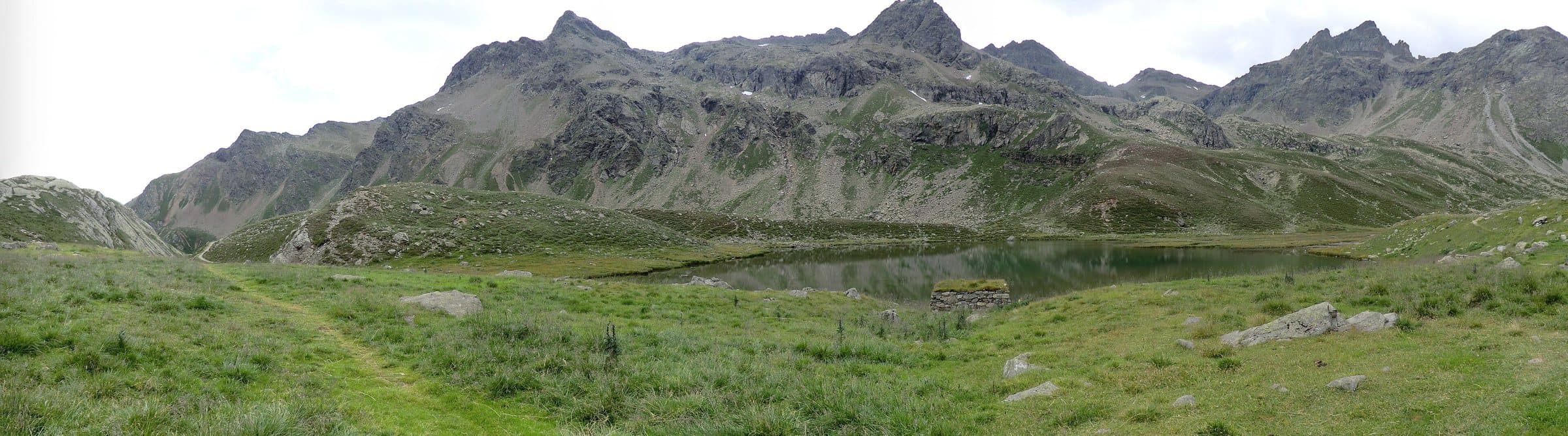
A "splendid" lake at about 2,410 metres, on a terrace below the Passo di Vermolera, among red stones and small turquoise lakes, facing the Piazzi group.
The splendid lake below the pass
Those who climb from Malghera towards the Passo di Vermolera first cross a landscape of dairies and huts scattered among the pastures, then an environment of red stones and small turquoise lakes. At about 2,410 metres, on a terrace below the pass, appears Lake Venere (Lac Vener in dialect), which the Valgrosina Trail course describes as "splendid". In the background, the Piazzi group and the peaks of Lago Spalmo.
From Tirano: distance, driving time and day trip
Lake Venere (Lac Vener) from Tirano: about 45 minutes by car (31 km), to the nearest starting point; then you continue on foot. You follow the SS38 and the SP27 to Grosio, then the Val Grosina road to Fusino, where you buy the ticket to continue. To these times add the walk described on this page: plan your day accordingly. From Tirano, the Alpine Hub of the Valtellina, you can easily organise day trips and itineraries: in the evening you return to restaurants, shops and a good dinner.
How to get there
From Malghera (1,937 m) the path climbs past Casera Sacco (2,008 m) and Baita Mandre Vecchie (2,063 m), then to the Pian del Lago, where there is an always-open bivouac, at 2,417 metres. The total ascent to the pass is about 800 metres (difficulty T3). You can also arrive from the Val d'Eita, passing the Tres lakes (2,194 m).
For those who want to continue
The Passo di Vermolera (2,732 m) opens at the foot of the Pizzo Matto (2,993 m) and the Sasso Campana (2,913 m).
Before you go
Above 2,000 metres snow can last until late summer. You need good shoes, water and an up-to-date map.