Photo: Istvan182 · CC BY-SA 4.0

A lovely day trip from Tirano · by car to the nearest point, then on foot
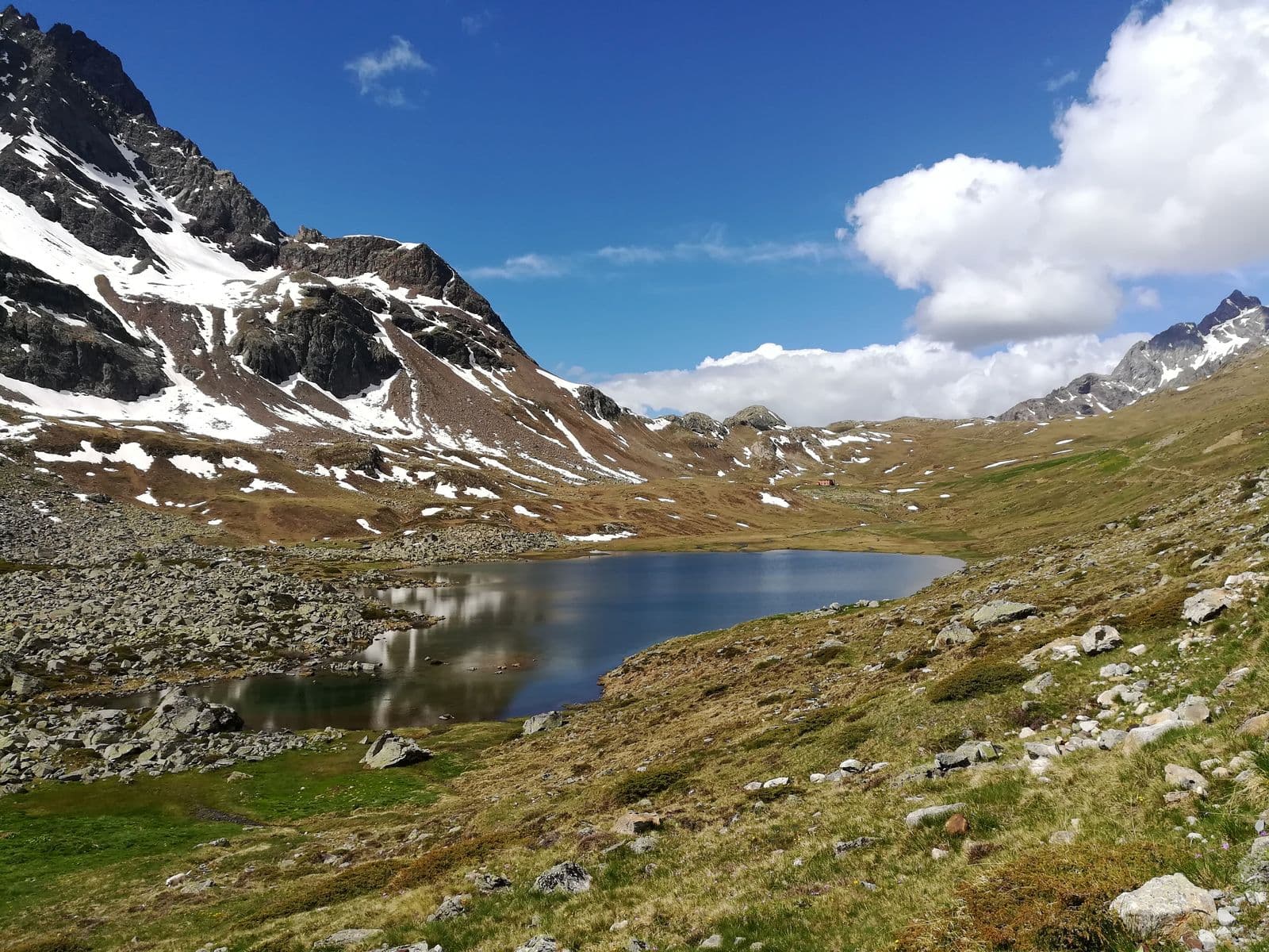
A glacial lake at about 2,300 metres, dammed by a moraine, at the foot of the Val Viola Pass: an almost flat walk from Altumeira, with the Piazzi glaciers in front.
- Type
- Lake
- Municipality
- Valdidentro
- From Tirano
- Visit time
- Opening
- June 15 - September 30An outdoor place, always reachable. At altitude snow can make roads and paths impassable: they generally clear from June-July to September. An estimate based on the altitude.Indicative dates, not official: check before you go.
- Interests
- Nature and LandscapeFamily
- Activities
- HikingMountain biking
The glacial lake at the foot of the Val Viola Pass
After five kilometres of paved road to Altumeira, the Val Viola path is almost entirely flat, with short gentle climbs, and leads straight to Lake Viola: a lake of glacial origin, dammed by a moraine, rich in trout, at about 2,300 metres, beside the Viola hut. From here your gaze runs over the glacier that comes down from the Cima dei Piazzi. It is a destination for everyone: families, walkers and cyclists.
The route
The route from the valley is about eight and a half kilometres, with about 440 metres of ascent: two hours forty on foot, an hour and a half by bicycle. A little higher you reach the Swiss border, at the Val Viola Pass, from which you descend towards the Val di Campo and the lake of the same name, on the Swiss side.
From Tirano: distance, driving time and day trip
Lake Viola (Lago di Val Viola) from Tirano: about 1 hour 20 minutes by car (61 km), to the nearest starting point; then you continue on foot. You drive up the SS38 to Bormio and continue towards Livigno (SS301) through Valdidentro, the heart of Alta Valtellina and gateway to the Val Viola and the Fraele valley. To these times add the walk described on this page: plan your day accordingly. Tirano is the ideal base to visit the Valtellina: hotels and B&Bs, restaurants, shops, supermarkets, the Bernina Red Train station and buses to get around.
How to get there
From Bormio follow the road for Livigno through Valdidentro, Isolaccia and Semogo to Arnoga. From here you travel five kilometres of paved road to Altumeira (in July and August there is also a shuttle), then an almost flat path leads to the lake.
Before you go
Above 2,000 metres snow can last until late summer. The lake is inside the Stelvio National Park: respect the rules.
Photo: Drakaris84 · CC BY-SA 4.0, Jiří Bubeníček · CC BY-SA 4.0