Photo: Fulvio.Schiano · CC0

Easy to reach from Tirano · by car to the nearest point, then on foot
Distance and time from Tirano are calculated to the nearest point reachable by car to the place of interest: the rest of the route is on foot. Always check the route and distances carefully before setting out, also for possible seasonal or temporary closures of roads and passes.
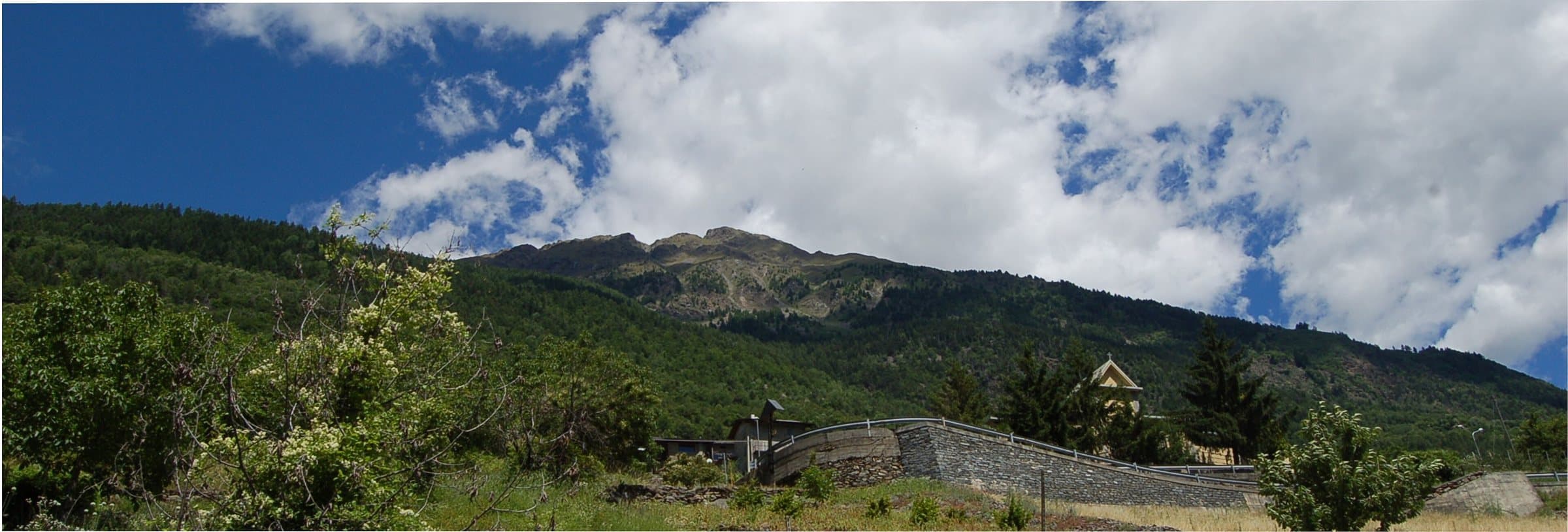
Tirano's home mountain: 2,816 metres above Baruffini and Roncaiola, with the Schiazzera hut, a military mule track, the Sentiero Italia and the Swiss border a step from the summit.
- Type
- Mountain
- Municipality
- Vervio
- From Tirano
- Opening
- June 15 - September 30An outdoor place, always reachable. At altitude snow can make roads and paths impassable: they generally clear from June-July to September. An estimate based on the altitude.Indicative dates, not official: check before you go.
- Activities
- HikingTrekkingSki mountaineering
The home mountain
Raising your eyes from Tirano, above Baruffini and Roncaiola, you see a great green mountain rising that turns to rock in the last stretch: it is the Monte Masuccio, 2,816 metres. It is part of the Livigno Alps and stands where the Valtellina meets Switzerland: the nearest point of the border is about 900 metres south-west of the summit, at 2,647 metres. From its south-eastern side the hamlets of Baruffini and Roncaiola look down (about three and four kilometres as the crow flies) and the municipality of Vervio; to the west, beyond the border, opens the Swiss village of Campocologno. In Tirano a street is named after it, via Monte Masuccio; and in the Valtellina «Masuccio» is also a surname.
A mountain of smugglers and soldiers
From the Schiazzera hut, at about 2,080 metres, above the basin of the Alpe Schiazzera, starts the military mule track of the Great War that climbs to the ridge: it is the normal route to the summit. This is border land, and the Schiazzera hut was until 1997 a barracks of the Guardia di Finanza, where the finance guards watched over the passage of smugglers towards Switzerland through the nearby Passo del Portone. Today the hut is run by volunteers and supports the Operazione Mato Grosso. About one kilometre as the crow flies north-west of the summit lies the Lago Schiazzera (2,391 m).
The Sentiero Italia
The stretch from Tirano to the Val Grosina is part of the Sentiero Italia, with white-red waymarks, and the Schiazzera hut is one of its points of support: from here you go towards Malghera, in the western Val Grosina. There is also a loop that goes around the Masuccio.
From Tirano: distance, driving time and day trip
Monte Masuccio from Tirano: about 50 minutes by car (26 km) to Susen, above Vervio; then you continue on foot to the Schiazzera hut. You follow the road to Tovo di Sant'Agata and then the one that climbs among the hamlets of Vervio. It is the home mountain: a real day trip, with the city always just below and the return for dinner. To these times add the walk described on this page: plan your day accordingly. From Tirano, the Alpine Hub of the Valtellina, you can easily organise day trips: in the evening you return to restaurants, shops and a good dinner.
How to get there
From Tirano follow the road to Tovo di Sant'Agata and then the one that climbs among the hamlets of Vervio, passing the church of Rogorbello. From the car park you can start from Susen (1,508 m): about an hour and a half on foot, for about 580 metres of ascent, to the Schiazzera hut; or from Pra Baruzzo (1,389 m), above Baruffini, for a longer route. From the hut the military mule track leads to the ridge and the summit. On foot from Tirano it takes about 3 hours and 830 metres of ascent to the hut.
What to do
From the summit the view runs over the Valtellina, Tirano and the border mountains. It is not a technical climb, but the descent from the top is made among unstable debris. Simpler, and suited to everyone, is the walk to the Schiazzera lakes and the Lago di Pian Fusino, with its rhododendrons.
Before you go
The hut is run by volunteers and opens in summer: check the official website (rifugioschiazzera.eu) before setting out. The summit is climbed on unstable ground: take care above all on the descent. The altitude of the summit (2,816 m) is confirmed by several sources, but walking times vary.
Photo: Fulvio.Schiano · Public domain, Teomonce91 · Public domain