Photo: Riccardo Ronchetti · CC BY-SA 4.0

Very easy to reach
The Valtellina of shade and silence: fourteen glacial valleys, turquoise lakes and a 130-kilometre Gran Via for those who want to walk where almost no one goes.
- Type
- Nature reserve
- Municipality
- Sondrio
- From Tirano
- Opening
- June 15 - September 30An outdoor place, always reachable. At altitude snow can make roads and paths impassable: they generally clear from June-July to September. An estimate based on the altitude.Indicative dates, not official: check before you go.
- Activities
- HikingTrekkingMountain bikingMountaineering
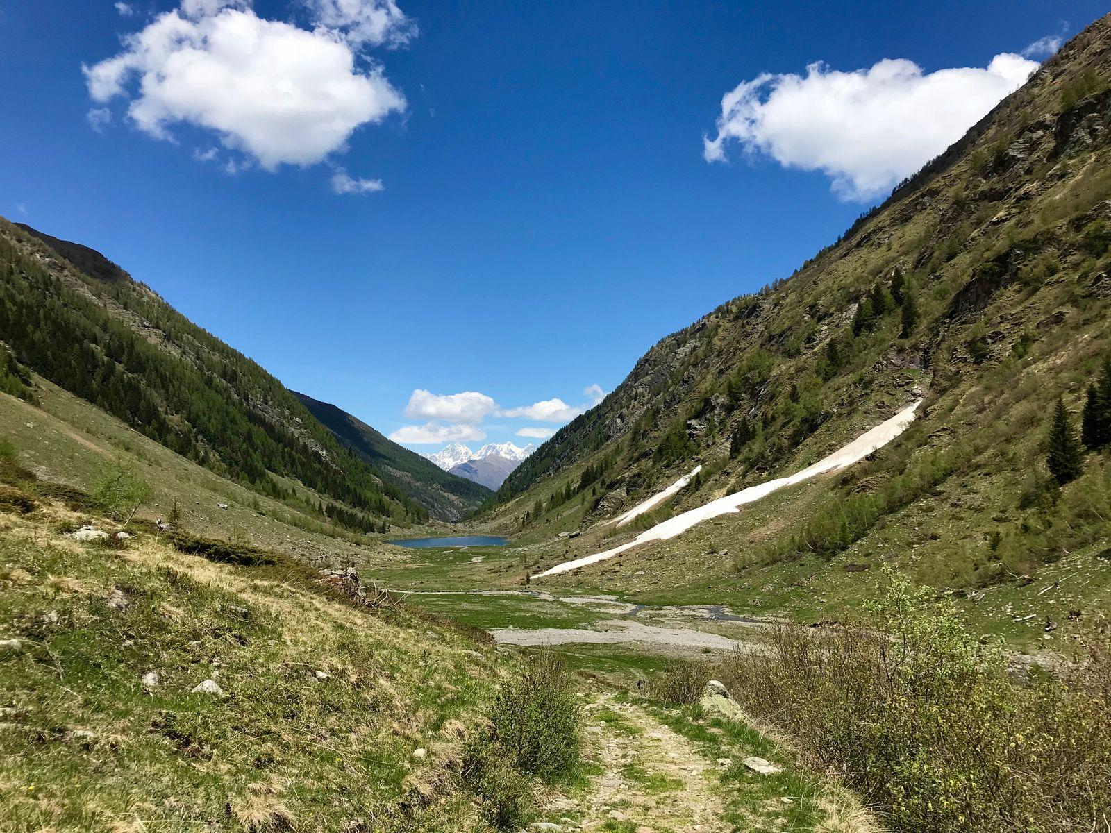
If the Rhaetian side of Valtellina is the side of vineyards and sunny villages, the Orobic side is its silent opposite: shadier, wilder, more secluded. The Orobie Valtellinesi Park, established in 1989, protects a vast mountain area on the southern side of the valley, from about 850 to over 3,000 metres, with Pizzo Coca, at 3,052 metres, as its roof.
Fourteen valleys of glacial origin descend towards Valtellina, each with its own character: Val Gerola, Val Tartano, Val Venina, Val Livrio, Val Belviso, and others lesser known that ask to be discovered at leisure. They are narrow, deep valleys, often with no road beyond the last village, where time is measured in steps.
And then there are the lakes, natural and artificial. In Val Gerola Lake Inferno, Trona and Pescegallo; in Val Livrio the Publino; in Val Venina Lake Scais, with its characteristic turquoise colour, and the Venina; in Val Belviso the great Lake Belviso. Among the natural lakes are those of Porcile, in Val Lunga, Zappello, in Val Venina, and those of Torena, in Val Belviso.
Nature is generous and discreet. In the park live chamois, ibex, mouflon and marmots, and among the woods you meet squirrels, weasels and other small mammals; among predators the wolf has been reported. In the sky fly eagles (especially towards Val Venina) and ravens; in the woods you hear woodpeckers and owls, and the rare capercaillie lives.
For those who want to walk far there is the Gran Via delle Orobie, a high-level route of about 130 kilometres from Delebio to Aprica, which crosses in sequence, from west to east, all the valleys of the park. It is usually done in eight to ten days, divided into eleven stages, with over 12,000 metres of total ascent and the highest point at the Biorco Pass, at 2,641 metres. It is a route for expert hikers (EE), often served only by unmanned bivouacs and huts, so without the possibility of resupply. It was born in the 1980s, on the initiative of the Sondrio section of the CAI and the Luigi Bombardieri Foundation, reusing ancient paths that had fallen into disuse; it was called Alta Via Bruno Credaro, and took its present name when, in 1989, it passed to the park's management.
In the park there are thirty-two huts and bivouacs, such as the Rifugio Luigi Mambretti, at 2,004 metres, built in 1924 in memory of a mountaineer who fell in 1923 on Punta Scais, aged 27. It is unmanned, but stands on a grassy ridge with a grand view of the north faces of Pizzo Porola, Punta Scais, Pizzo Redorta and Pizzo Brunone, with their small glaciers.
But you do not need to walk for days. The park also has easy gateways, such as Val Belviso, with its great lake and the “gnome trail” suitable for families, or the little lakes a few steps from the roads. What matters is to stop: in the quietest places of Valtellina the real luxury is to hear the wind.
It is the least frequented Valtellina, the one that lets itself be discovered by those with time and will to pause, and for that very reason the most precious.
From Tirano: distance, driving time and day trip
Orobie Valtellinesi Park from Tirano: about 30 minutes by car (26 km). You drive down the SS38 beyond Sondrio towards the Orobie valleys: it is one of the farthest destinations from Tirano, but rewards you with a quiet, little-trodden corner of the Valtellina. It is a distant destination: to enjoy it without haste it is best to leave early in the morning, or to combine the visit with other stops in the area, and return in the evening to sleep in Tirano. From Tirano, the Alpine Hub of the Valtellina, you can easily organise day trips and itineraries: in the evening you return to restaurants, shops and a good dinner.
Photo: DanielaMarina · CC BY-SA 4.0, MatthewGhera · CC BY 2.0, MatthewGhera · CC BY 3.0, MatthewGhera · CC BY 2.0, Rncrcr64 · CC BY-SA 4.0