Photo: Teomonce91 at Italian Wikipedia · Public domain

Easy to reach from Tirano
Distance and time from Tirano are calculated to the nearest point reachable by car to the place of interest: the rest of the route is on foot. Always check the route and distances carefully before setting out, also for possible seasonal or temporary closures of roads and passes.
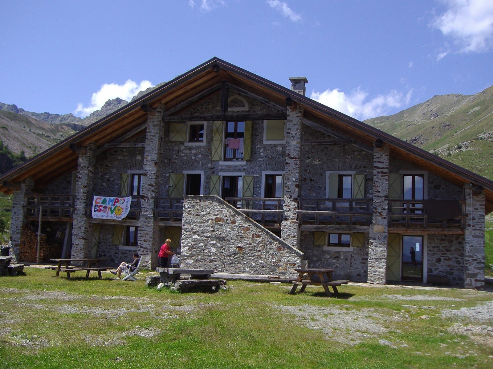
The smugglers' pass above Tirano: about 2,630 metres, a boundary stone, the Val Saiento and the Schiazzera Lakes beneath your feet. From the Guardia di Finanza barracks turned into a hut.
- Type
- Mountain passes and springs
- Municipality
- Vervio
- From Tirano
- Opening
- June 15 - September 30An outdoor place, always reachable. At altitude snow can make roads and paths impassable: they generally clear from June-July to September. An estimate based on the altitude.Indicative dates, not official: check before you go.
- Activities
- HikingTrekking
The smugglers' pass
The Portone Pass, also called Passo Banderola, at about 2,633 metres, is the crossing on the border between Italy and Switzerland that closes the Val Saiento, above Tirano. For generations it was the smugglers' passage: the upper Val Saiento allows a relatively easy crossing to the Val Poschiavo, and that is why many of today's paths follow the smugglers' routes, often chased by the Guardia di Finanza. Today the pass is visited by few hikers, and on the crossing stands a boundary stone, number 18.
The barracks that became a hut
The hut from which you set out, the Schiazzera hut, was built on a barracks of the Guardia di Finanza, used until 1997: the same walls from which the finance guards watched over the passage of those coming and going from Switzerland with the «bricolla» on their shoulders. Today the hut is run by volunteers and supports the Operazione Mato Grosso.
A path that starts in Tirano
From Tirano also starts the Smugglers' Path, a loop of about 16 kilometres, 5 and a half hours' walk, that passes through Baruffini and the Sasso del Gallo: a way to live history on foot.
From Tirano: distance, driving time and day trip
Portone Pass from Tirano: about 50 minutes by car (26 km) to the car park of the Schiazzera hut, above Vervio; then you continue on foot. You follow the road to Tovo di Sant'Agata and then the one that climbs among the hamlets of Vervio, passing the church of Rogorbello. To these times add the walk described on this page: plan your day accordingly. From Tirano, the Alpine Hub of the Valtellina, you can easily organise day trips: in the evening you return to restaurants, shops and a good dinner.
How to get there
From Tirano follow the road to Tovo di Sant'Agata and then the paved road that climbs among the hamlets of Vervio, to the large car park below the Schiazzera hut (2,080 m); the steep mule track leads to the hut in a few minutes. From the hut you climb to the Schiazzera lakes and from there to the pass, by path no. 230.
What to do
From the Schiazzera Lakes, at about 2,390 metres, you climb to the pass in about forty minutes following path no. 230 (going down, from the pass to the lakes takes about 25 minutes). A solitary walk, in a silent high valley, with Switzerland on the other side of the boundary stone.
Before you go
The pass is on the border with Switzerland: carry ID. Information on the altitude (2,633 m) and times varies from one source to another. The hut is run by volunteers and opens in summer: check rifugioschiazzera.eu.
Gallery
Photo: Balthazaar niva · Public domain, Deriuale · CC BY 4.0