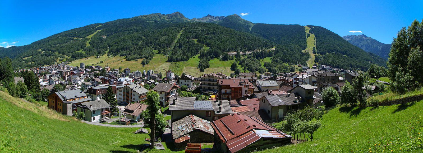
Photo: Noperation · CC BY-SA 4.0

Very easy to reach
Distance and time from Tirano are calculated to the nearest point reachable by car to the place of interest: the rest of the route is on foot. Always check the route and distances carefully before setting out, also for possible seasonal or temporary closures of roads and passes.
The gentlest pass between Valtellina and Val Camonica: an ancient crossing turned holiday resort, gateway to the Pian di Gembro peat bog and the Trivigno pastures, on the Giro's roads and on skis.
- Type
- Mountain passes and springs
- Municipality
- Aprica
- From Tirano
- Visit time
- Opening
- Always accessibleRoad open all year; in winter winter equipment may be needed.Checked on October 29, 2026.
- Activities
- Road cyclingMountain bikingHikingTrekkingAlpine skiingNordic skiing
Between the Orobie Alps and the southern Rhaetian Alps lies a pass that frightens no one. The Aprica Pass, at just over 1,100 metres, is the gentlest of the crossings between Valtellina and Val Camonica, and for that very reason has been the busiest for centuries. Here the mountain does not climb: it opens out, into meadows, fir and larch woods, and a sunny basin where, over time, a village was born.
Its history begins long before tourism. Since the Middle Ages, and probably already in Roman times, the pass was an important link between the two valleys, and in the San Pietro district stood a xenodochium, a hospice for pilgrims and soldiers. When the higher passes, such as the Mortirolo and the Gavia, were impassable for months, the Aprica remained the most comfortable and safe crossing. That is why, from 1848, the Austrian government of the Lombardo-Venetian Kingdom built the modern road here, today State Road 39, to link Edolo and Val Camonica with Tresenda and Valtellina.
For centuries Aprica was only a hamlet of Teglio, and gained municipal autonomy in the 1920s. But already in the late 19th century tourism had begun to replace pastoral life: the first real hotel, the Hotel Aprica dei Negri, existed before 1870, and among its guests were the violinist Teresina Tua and the Nobel laureate in medicine Camillo Golgi, who according to the sources stayed from 1880 to 1913. A vocation for hospitality, born from being an obligatory passage.
Sport too has left its mark here. Since 1962 the Giro d'Italia has made Aprica a stage finish ten times, the last in May 2022, often after the legendary climbs of the Mortirolo, Santa Cristina or the Gavia; and from 1975 to 1981 the village's slopes hosted Alpine skiing World Cup races. Today its roads are the meeting point of amateur cyclists preparing for mythical climbs, such as those of the Gran Fondo Gavia e Mortirolo.
But Aprica is above all nature, a step from the park. It lies at the foot of the Orobie Valtellinesi Park, among fir, larch and rhododendron woods, with chamois, golden eagles and ibex nearby, and a network of over two hundred kilometres of trails for trekking and mountain biking.
To begin, a walk to the Pian di Gembro Nature Reserve, at 1,350 metres, a few minutes from the village, is enough. It is a thousand-year-old peat bog of glacial origin, with wooden walkways leading to its heart, carnivorous plants, amphibians to observe in the educational classroom and a Visitor Centre with a bar-restaurant. An easy walk suitable for everyone, children included.
Those who want to climb higher can continue to the Alpe di Trivigno. From Pian di Gembro the paved road climbs to 1,560 metres, then turns to dirt and crosses the Alpe Strencia, at the foot of Monte Giovello, up to the pastures of Trivigno, at about 1,800 metres, above Tirano. It is a plateau of meadows and huts in panoramic position, with cows grazing freely in summer and great quiet; the view opens out as far as the Adamello group. By e-bike the loop from Aprica is about 31 kilometres, with 736 metres of ascent and gradients rarely over 10%: a medium, pleasant route, with refreshment stops such as the Albergo Paradiso. On foot, the area offers the Monte Giovello circuit.
For sport and adventure, Aprica has something for every pair of legs. In summer, mountain biking with a five-kilometre trail at about 1,700 metres from the Palabione area to Corteno Golgi and a centre to learn technique; trekking, sport climbing and the Gran Via delle Orobie, 130 kilometres along the Orobie Valtellinesi that end right here. The Palabione cable car rises to 1,700 metres, and from Malga Magnolta you climb in under two hours to Lake Palabione, at 2,109 metres; the fittest can climb Monte Palabione, at 2,358 metres.
And in winter Aprica transforms. Over fifty kilometres of Alpine ski runs, including the longest floodlit piste in Europe, six kilometres in the Baradello area, completed in 2021, and at Trivigno cross-country loops. A village born from a pass, which has stayed welcoming in every season.
From Tirano: distance, driving time and day trip
Aprica Pass from Tirano: about 25 minutes by car (17 km). You drive down the SS38 to Tresenda and climb on the SS39 to the Aprica Pass, the gateway between the Valtellina and the Val Camonica. It is so close that it can be combined with a stroll in Tirano: the morning here, the afternoon among the city's squares and cafés. Stay in Tirano and set out each morning for a new destination: in the Valtellina it is the practical solution for those seeking hotels, services and connections a step from the station.
How to get there
From Tirano follow the SS38 towards Sondrio to Tresenda and from there the SS39 climbs to the pass and the village of Aprica: about 20 minutes. From the other side you arrive from Edolo, in the Val Camonica.
Before you go
The road is open all year, but in winter you may need winter equipment (tyres or chains). Paths and lifts have their own seasons and timetables: check them on the Aprica websites.
Photo: Noperation · CC BY-SA 4.0, Adrian Michael · CC BY-SA 3.0, Giorsch · CC BY-SA 4.0, Noperation · CC BY-SA 4.0