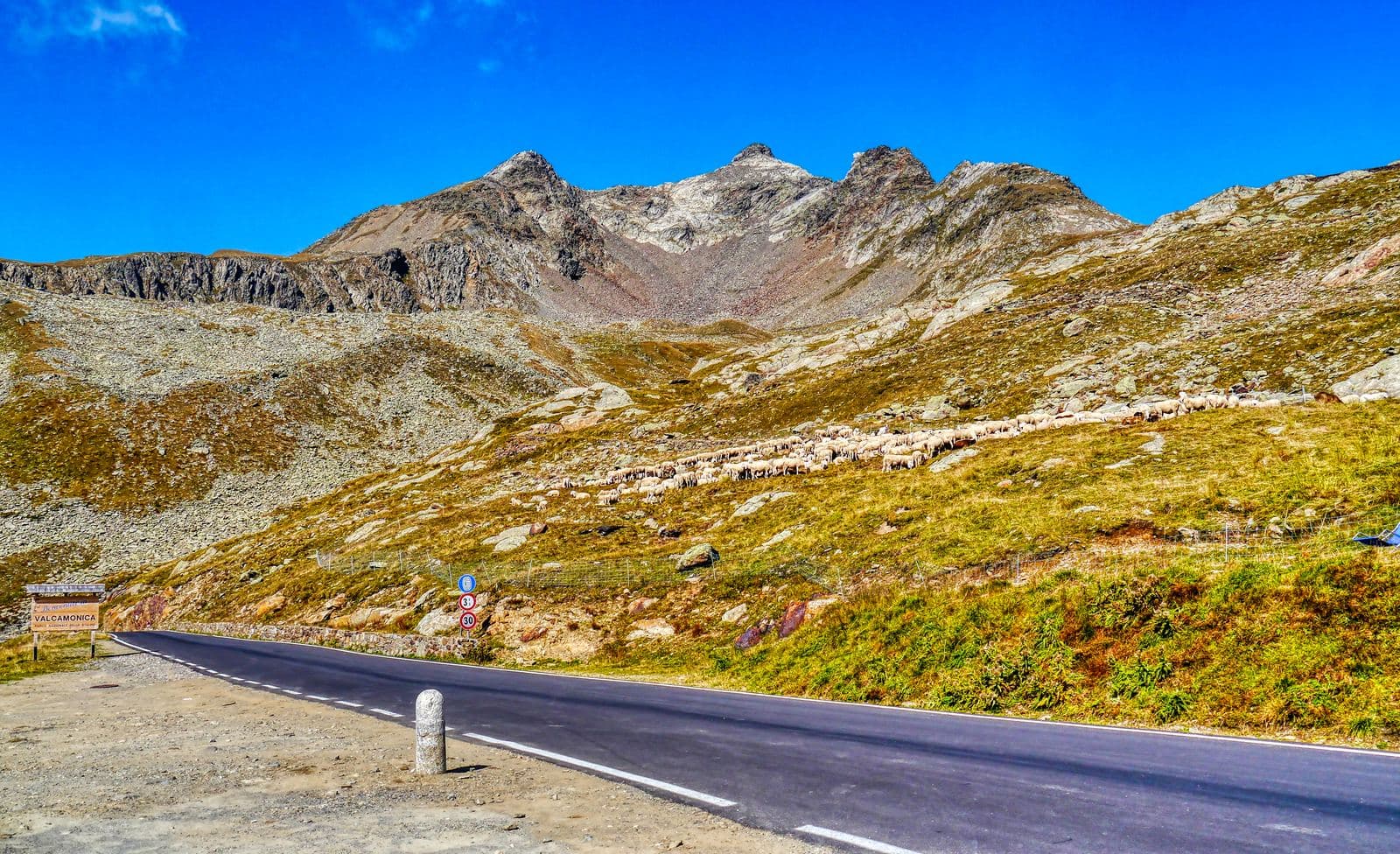
Photo: Zairon · CC BY-SA 4.0

A lovely day trip from Tirano
Distance and time from Tirano are calculated to the nearest point reachable by car to the place of interest: the rest of the route is on foot. Always check the route and distances carefully before setting out, also for possible seasonal or temporary closures of roads and passes.
2,621 metres between Santa Caterina Valfurva and Val Camonica: an old mule track, the Great War front, the snowstorm that made the 1988 Giro and a heart of glaciers and lakes in the Stelvio Park.
- Type
- Mountain passes and springs
- Municipality
- Valfurva
- From Tirano
- Visit time
- Opening
- May 25 - October 31Normally from late May to October; closed with snow.Indicative dates, not official: check before you go.
- Activities
- Road cyclingHikingTrekking
Some roads you do once as a challenge and repeat for pleasure. The Gavia Pass, at 2,621 metres, is one of them. It links Santa Caterina Valfurva, in Valtellina, to Ponte di Legno, in Val Camonica, crossing one of the most unspoiled landscapes of the Stelvio National Park. It is the second-highest paved pass in Italy after the Stelvio, and on the Brescia side the carriageway is at times only wide enough for a single car.
Its history is ancient and carries a sinister name. In the Middle Ages it was a path linking the two valleys, and the stories remember it as the “Pass of the Dead Man's Head”, for the dangers faced by those who crossed it. It was the Great War that transformed it: in 1916 the military engineers widened and rebuilt the route, because the front ran a few kilometres away, and by 1918 the road was ready. From those years there remain trenches, positions and mountain works still visible: the “Cento Scalini” of Monte Gavia, a long stone staircase built by the engineers, and the First World War Trail leading to Vallumbrina.
Then came the modern age. From the 1950s the road was improved, with a tunnel and finally asphalt, and in the 1960s, at the will of Vincenzo Torriani, the Giro's patron, the Gavia entered the pink race's route, where its prestige was instant. The Giro has climbed it fourteen times and in eight editions it has been the Cima Coppi, the highest point of the race.
But no edition is like that of 1988. On 5 June the stage crossed the Gavia in a full snowstorm, with sub-zero temperatures and shivering riders, some in cotton jerseys, like the Dutchman Johan Van der Velde, who crossed the summit first. The stage was won by another Dutchman, Erik Breukink, but it was the American Andrew Hampsten, second, who took the pink jersey and went on to win the Giro, the first American to do so. It is the stage that defines heroic cycling, and the Gavia is its stage set.
Today the climb from Santa Caterina measures about 17-18 kilometres, with a maximum gradient of 16%, and is a goal for amateur cyclists from all over the world; with the Mortirolo and the Stelvio it forms the trio of the Giro's great passes. By bike or motorbike, the Gavia teaches you to remember every hairpin.
But the beauty of the Gavia goes well beyond the asphalt. We are in the heart of the Stelvio Park, at the foot of the Ortles-Cevedale group, with peaks such as Pizzo Tresero (3,594 m) and Punta Pendranzini (3,599). Around the pass stretch alpine lakes: Lago Bianco, one of the emblematic places, and, on the Brescia side, Lago Nero, of glacial origin, with dark waters. On the Pian delle Marmotte plateau, at 2,360 metres, a large colony of marmots lives, and the gaze is lost in a rich alpine flora and snowy peaks.
Once out of the car, the walks suit every taste. For the gentlest, the path from the pass to the Rifugio Berni, in 45 minutes, skirts Lago Bianco through high meadows and suits all ages. From the Rifugio Berni starts the nature trail of the Sforzellina Glacier, about an hour with panels on geology, flora and the glacier's evolution. Those who want summits can climb Monte Gaviola, over 3,000 metres, in about an hour and twenty from the pass, with views of the Ortles-Cevedale, or the Belvedere, an hour and a quarter, on an old military path. The longest route descends from the Rifugio Berni to Santa Caterina Valfurva in about three hours, 8.5 kilometres among larches and the Dosso Tresero viewpoint; the historical adventure is the First World War Trail, about five hours to see trenches and fortifications.
To stop there are the huts, such as the Rifugio Bonetta, at 2,600 metres right on the pass, and the Rifugio Berni, near the monument: traditional stops for cyclists and bases for hikes. On the other side, Santa Caterina Valfurva is the village at the foot of the climb, a good starting point for any adventure.
One tip: the pass is normally closed from October to May because of snow, and even in midsummer the weather changes quickly. Start early, bring a jacket and go slowly: the road is narrow and the landscape deserves every minute.
From Tirano: distance, driving time and day trip
Gavia Pass from Tirano: about 1 hour 5 minutes by car (65 km). You drive up the SS38 dello Stelvio to Bormio and then up to altitude: the roads over the great passes are open only in summer, so in winter always check for closures. It is the ideal distance for a whole day: leave Tirano in the morning, take the place in unhurriedly and have dinner in town on your return. Tirano is the ideal base to visit the Valtellina: hotels and B&Bs, restaurants, shops, supermarkets, the Bernina Red Train station and buses to get around.
How to get there
From Tirano follow the SS38 dello Stelvio to Bormio and go up to Santa Caterina Valfurva; from here the SP29 leads to the pass in about 25 minutes. From the opposite side you arrive from Ponte di Legno, in the Val Camonica.
Before you go
The road is open only in summer (normally from late May to October) and is narrow: on the Brescia side, in places, only one car fits. Check closures and the opening of the Berni and Bonetta huts before setting out.
Refreshment stops
Before you set out, always check that the hut is actually open on its official website.
Mountain hut & refreshments
Rifugio Berni
Mountain hut & refreshments
Rifugio Bonetta
Gallery
Photo: © Claudio Corcoglioniti