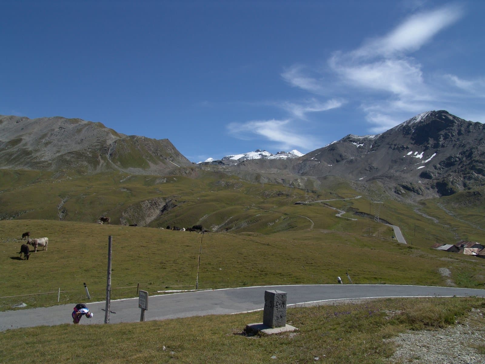
Photo: Dr. Volkmar Rudolf/Tilman2007 · CC BY-SA 4.0

Easy to reach from Tirano
Distance and time from Tirano are calculated to the nearest point reachable by car to the place of interest: the rest of the route is on foot. Always check the route and distances carefully before setting out, also for possible seasonal or temporary closures of roads and passes.
2,501 metres: the highest road pass in Switzerland, a step from the Stelvio, entered from the Fourth Cantoniera and descending thirteen kilometres to the Val Müstair. The third side of the Stelvio.
- Type
- Mountain passes and springs
- Municipality
- Val Müstair
- From Tirano
- Opening
- June 1 - September 30Closed from October to May.Indicative dates, not official: check before you go.
- Activities
- Road cycling
The pass that is not the Stelvio (but almost)
The Giogo di Santa Maria, or Umbrail Pass (in Romansh Pass dal Umbrail, in German Umbrailpass or Wormserjoch), 2,501 metres according to Swiss maps (other sources say 2,503), is a pass of the western Rhaetian Alps close to the Italian-Swiss border and the Stelvio Pass, which connects the Canton of the Grisons with the Upper Valtellina. It is the highest road pass in Switzerland, opened to traffic in 1901. The German name «Wormserjoch» recalls the old German name of Bormio, «Worms»: the pass that leads to Bormio.
The third side of the Stelvio
From Italy it is reached from the Fourth Cantoniera, on the Lombard side of the Stelvio, and indeed it is often considered the third access side of the pass, in Swiss territory. Whoever descends to Santa Maria, in the Val Müstair, has before them a narrow, steep road: 13 kilometres and 1,126 metres of descent. Since 2015 it has been completely asphalted (the last 2.5 kilometres down in the valley were asphalted in 2016). From the pass the view opens over the Val Müstair, the Valle di Fraele and the Valtellina.
A tourist vocation
Because of its altitude, the border, the long winter closure (October to May) and the almost unspoilt landscape, the Umbrail is not a traffic road but a holiday road: it is a coveted goal for cyclists and motorcyclists, in summer. In the Giro d'Italia it first appeared in 2017; in 2024 it was inserted in the route after the Stelvio was cancelled for avalanche risk, and became Cima Coppi, but bad weather cancelled this passage too.
From Tirano: distance, driving time and day trip
Umbrail Pass from Tirano: about 1 hour by car (58 km), along the SS38 dello Stelvio to Bormio and then to the Fourth Cantoniera, where you take the road to the Umbrail. Another good reason to do the Stelvio: two passes in a day. From Tirano, the Alpine Hub of the Valtellina, it is an ideal day: you set out in the morning, stop at the hairpins and at the pass and in the evening return to restaurants, shops and a good dinner.
How to get there
From Tirano follow the SS38 dello Stelvio to Bormio and then the pass road to the Fourth Cantoniera (about 2,490 m); here you take the road that climbs to the Umbrail and then descends into the Val Müstair. Valid documents are needed to go into Switzerland.
What to do
From the pass you can continue into Switzerland to Santa Maria Val Müstair and leave Italy behind, or stop: on the pass there are the sign with the altitude and a belvedere over the valley. For walkers, the paths towards the Piz Umbrail start from here.
Before you go
The road is open only in summer (normally from late May to October) and is narrow and steep on the Swiss side. Check closures and weather before setting out. Some information on the 2024 Giro stage is reported by different sources: check it.
Photo: Wladyslaw · CC BY-SA 3.0, Zairon · CC BY-SA 4.0, Tilman2007 · CC BY-SA 3.0