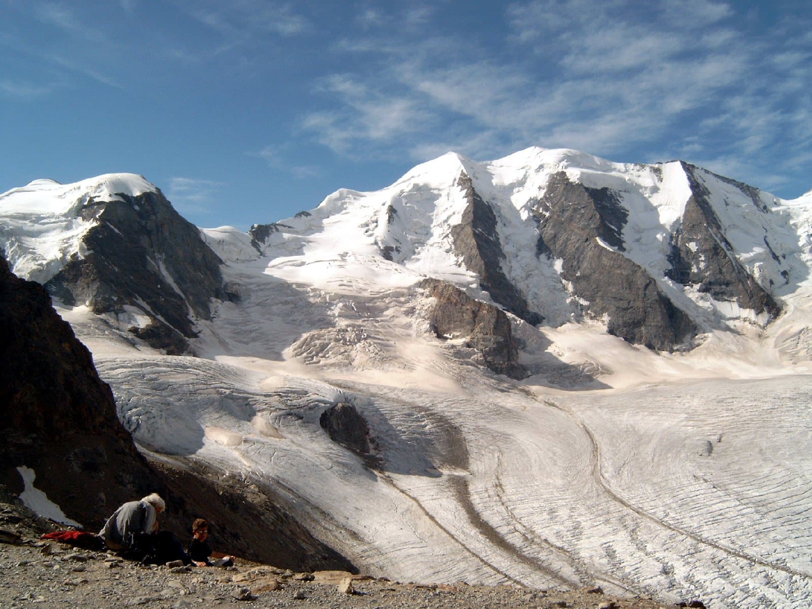
Photo: Tinelot Wittermans · CC BY-SA 3.0

A lovely day trip from Tirano · by car to the nearest point, then on foot
Distance and time from Tirano are calculated to the nearest point reachable by car to the place of interest: the rest of the route is on foot. Always check the route and distances carefully before setting out, also for possible seasonal or temporary closures of roads and passes.
Three sister summits and four hanging glaciers on the border between the Valmalenco and the Engadine: one of the most beautiful mountains of the Central Alps, star of a 1929 film and a few minutes from the Red Train.
- Type
- Mountain
- Municipality
- Lanzada
- From Tirano
- Opening
- June 15 - September 30An outdoor place, always reachable. At altitude snow can make roads and paths impassable: they generally clear from June-July to September. An estimate based on the altitude.Indicative dates, not official: check before you go.
- Activities
- MountaineeringSki mountaineering
Three peaks, one beauty
Piz Palü is one of those mountains that look drawn by someone who loved symmetry. Three clearly distinct summits: the main or central one, the Muot dal Palü, about 3,900 metres (Swiss maps have fixed it at 3,901 m since 2001, while before it was 3,905); the eastern summit, 3,882 m; and the western one, Piz Spinas, 3,823 m. Three great ribs and four hanging glaciers make it one of the best-loved summits of the Central Alps. Its name comes from the Latin palus, «marsh», and recalls the Alpe Palü, on the edge of a marshy area east of the peak.
The border between Italy and Switzerland runs over the central summit and then south towards the Fellaria plateau, above the upper Valmalenco; at its foot, on the Swiss side, Lake Palü is mirrored.
A film, a legend
Piz Palü also has a cinematic past. In 1929 the mountain-film pioneer Arnold Fanck and Georg Wilhelm Pabst shot «The White Hell of Piz Palü» here, with a young Leni Riefenstahl: one of the works that made the history of high-altitude cinema.
The first ascents
The first ascents are a small story of rivalry between guides: an expedition in 1835, led by Johann Madutz and the «King of the Bernina» Gian Marchet Colani, probably reached only the eastern summit; the first documented ascent of the central and eastern summits is by the Englishman K. E. Digby, in 1866, with the guide Peter Jenny and a porter. The north face, with its three spurs, is one of the most famous in the Alps: the Kuffner spur (1899) is the easiest, the Bumiller (1887) the hardest.
From Tirano: distance, driving time and day trip
Piz Palü from Tirano: about 1 hour 45 minutes by car (58 km) to the Diavolezza, through Switzerland: to admire it, by Red Train or by car, a single day is enough. You follow the Bernina road from Tirano to Poschiavo and then the pass; from there the Diavolezza cable car takes you to about 3,000 metres. For the Italian side you go instead up the Valmalenco, to Campo Moro. Climbs at altitude take a full day and often a night in a hut, but Tirano, the Alpine Hub of the Valtellina, remains the ideal base for preparing and for returning: hotels, restaurants, shops and the Red Train station a step away.
How to get there
From Tirano take the Bernina road, across the Swiss border, to Poschiavo and the Bernina Pass; a little beyond the pass, towards Pontresina, is the base of the Diavolezza cable car. Alternatively, from Tirano station the Red Train goes to Bernina Diavolezza and Alp Grüm, from where you admire the Palü glacier. On the Italian side you drive up the Valmalenco to the Campo Moro dam.
What to do
If you do not climb to the summit, Palü can still be savoured: from the Red Train, at Alp Grüm station, the glacier opens in a single glance and Lake Palü reflects the face. If you want to climb, you can start from the Diavolezza, at about 3,000 metres: the normal route from the north takes about 4 hours to the central summit, with rope, crampons and ice axe. On the Italian side you rely on the huts of the Valmalenco, such as the Marco e Rosa, which also serves the Bernina.
Before you go
The climb to the summit requires glacier skills, rope, crampons and ice axe, ideally with a mountain guide, because the Pers glacier has many crevasses. The summit is on the border: carry a valid ID. Cable cars, railway and huts have opening times that change: always check the official websites before setting out.
Photo: Pimlico27 · CC BY-SA 4.0, Hansueli Krapf · CC BY-SA 3.0