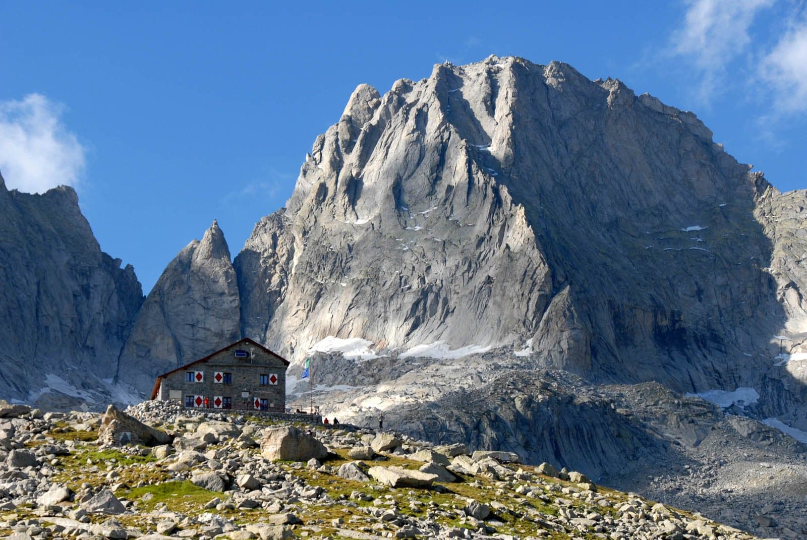
Photo: Ggambaro · CC BY-SA 3.0

A lovely day trip from Tirano · by car to the nearest point, then on foot
Distance and time from Tirano are calculated to the nearest point reachable by car to the place of interest: the rest of the route is on foot. Always check the route and distances carefully before setting out, also for possible seasonal or temporary closures of roads and passes.
The granite cathedral of the Val Masino: 3,308 metres of golden rock, the most famous north face of the Central Alps, the Cassin route of 1937 and a story of courage and tragedy.
- Type
- Mountain
- Municipality
- Val Masino
- From Tirano
- Opening
- June 15 - September 30An outdoor place, always reachable. At altitude snow can make roads and paths impassable: they generally clear from June-July to September. An estimate based on the altitude.Indicative dates, not official: check before you go.
- Activities
- MountaineeringClimbing
The cathedral of the Val Masino
Raise your eyes from the bottom of the Val Masino and there is a mountain that seems made to be looked at: the Pizzo Badile, about 3,308 metres (some maps say 3,305), a trapezoidal pyramid of granite that has attracted climbers for centuries. It stands on the border with Switzerland, between the Val Masino and the Val Bondasca, and its north face, rising above the glacier, climbs for more than 700 metres: it is one of the great classic north faces of the Alps. The rock is a «serizzo ghiandone», a granite very rich in feldspar, and its name comes from the trapezoidal shape of the mountain.
A story of roped parties
The first ascent was on 27 July 1867: the Briton William Auguste Coolidge, with François and Henri Dévouassoud, climbed from the south side, along what is still the normal route. But the Badile is above all the mountain of the Cassin route: on 14-16 July 1937 Riccardo Cassin, Gino Esposito, Vittorio Ratti, Mario Molteni and Giuseppe Valsecchi opened their route on the north-east face, after three days of struggle against bad weather. Molteni and Valsecchi died of exhaustion on the descent. In 1952 Hermann Buhl climbed it solo in 4 and a half hours, having set out by bicycle from Landeck and returned home, again by bicycle, the same weekend.
Granite, sun and silence
In summer the Val Masino is a great theatre of rock, and the Badile is its main character. From the Gianetti hut (2,534 m), on the south side, the mountain shows itself at a single glance; from there starts the normal route, about 400 metres, grade PD with passages of upper third grade. If you do not climb, you can walk in the Val Porcellizzo and look at the walls from below: even so, it is enough.
From Tirano: distance, driving time and day trip
Pizzo Badile from Tirano: about 1 hour 20 minutes by car (63 km) to Bagni di Masino, in the Val Masino; then you continue on foot to the Gianetti hut. You follow the SS38 towards Sondrio and, past Morbegno, drive up the Val Masino to the last car park. A long drive between two different landscapes, the eastern Valtellina and the Val Masino: well worth it. Climbs at altitude take a full day and often a night in a hut, but Tirano, the Alpine Hub of the Valtellina, remains the ideal base for preparing and for returning: hotels, restaurants, shops and the Red Train station a step away.
How to get there
From Tirano follow the SS38 to Ardenno, then drive up the Val Masino to San Martino and Bagni di Masino. From Bagni di Masino a path climbs into the Val Porcellizzo and to the Gianetti hut (2,534 m): allow a few hours on foot. From the hut, by the normal route, the summit is about 400 metres of climbing away.
What to do
From the Gianetti hut the whole amphitheatre of the Badile and the Cengalo opens up, with glaciers and peaks chasing each other along the border. For hikers it is a high-altitude goal but without technical problems as far as the hut; for climbers the Badile is a granite classic, from the normal route to the Cassin. On the Swiss side too, from the Val Bondasca, you can admire the north face from below.
Before you go
The normal route is a mountaineering route (grade PD, with passages of upper third grade) and the descent is considered complex and dangerous: there are fixed abseils (you need two 65-metre ropes). It is not a climb to improvise: helmet, rope, experience or a mountain guide. The summit is on the border with Switzerland: carry a valid ID. Always check the hut opening and the conditions of the mountain.
Photo: Zacharie Grossen · CC BY-SA 4.0, Maria Piccinini · CC BY-SA 4.0