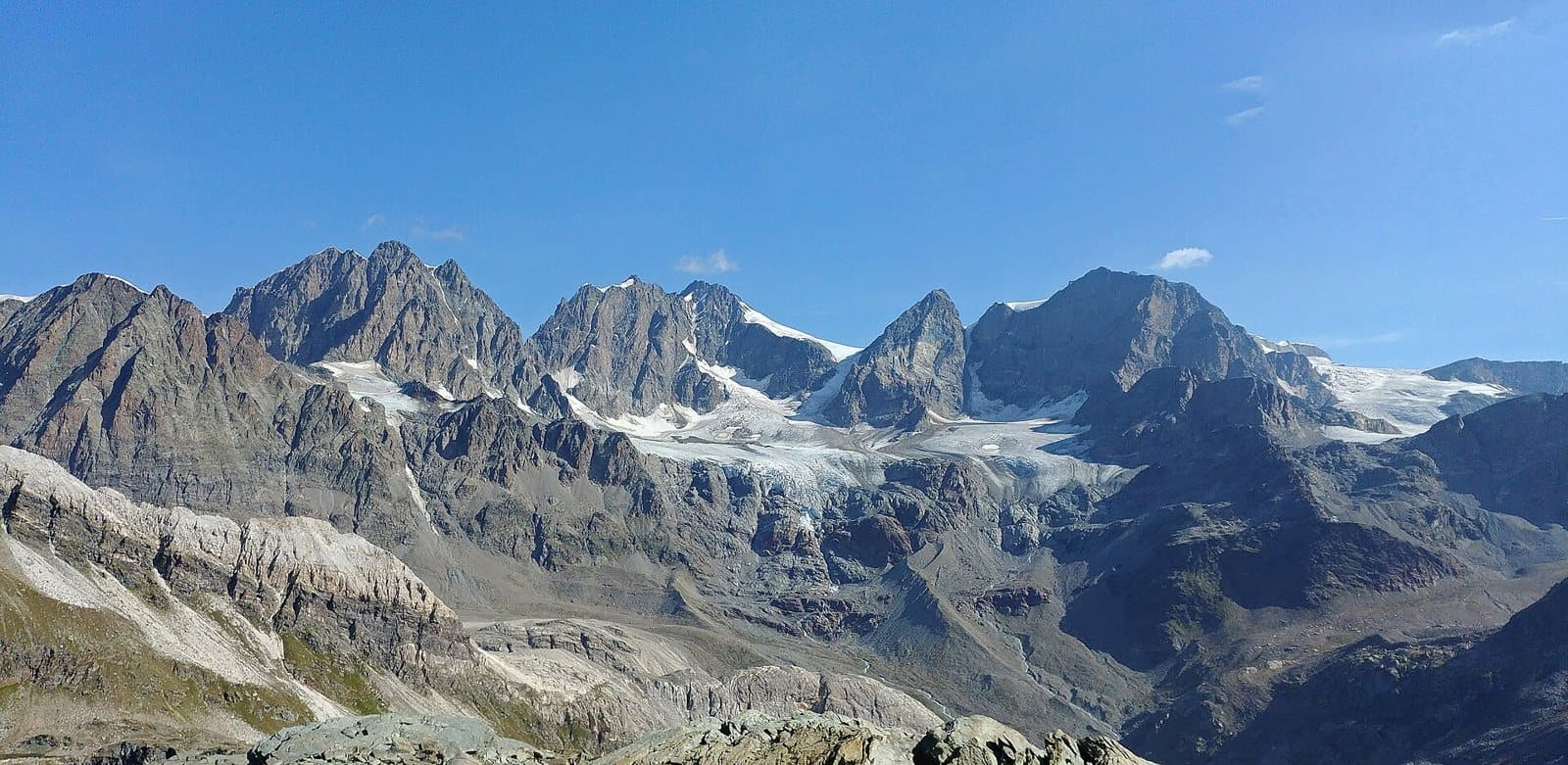
Photo: MatthewGhera · CC BY 3.0

Easy to reach from Tirano · by car to the nearest point, then on foot
Distance and time from Tirano are calculated to the nearest point reachable by car to the place of interest: the rest of the route is on foot. Always check the route and distances carefully before setting out, also for possible seasonal or temporary closures of roads and passes.
4,049 metres of ice: the king of the Bernina group, the easternmost four-thousander of the Alps, with an Italian summit, the Perrucchetti, that is the highest point in Lombardy. And the Red Train that leaves from Tirano runs right at its feet.
- Type
- Mountain
- Municipality
- Lanzada
- From Tirano
- Opening
- June 15 - September 30An outdoor place, always reachable. At altitude snow can make roads and paths impassable: they generally clear from June-July to September. An estimate based on the altitude.Indicative dates, not official: check before you go.
- Activities
- MountaineeringSki mountaineeringTrekking
The king of the Rhaetian Alps
Some mountains you look at, and some you wait for. Piz Bernina, 4,049 metres (4,050 on some maps), is one you wait for: and when the clouds finally part, its pyramid of ice seems to belong to another world. It is the highest summit of the Rhaetian Alps, the easternmost four-thousander of the Alps and the crown of a group of giants lined up along the border between Italy and Switzerland: Piz Roseg, Piz Scerscen, Piz Zupò, Piz Palü.
The summit lies in Swiss territory, but the mountain is ours too. From its ridge the Punta Perrucchetti, about 4,020 metres, branches off to the south: it is the Italian summit of the Bernina and the highest point in all of Lombardy.
A giant with a train at its feet
The Bernina has something no other four-thousander can boast: a train passes at its feet. The Bernina Railway, the Red Train that starts right from Tirano, climbs to the 2,253 metres of the Ospizio Bernina and carries on towards Pontresina and St. Moritz among perennial glaciers. From the window, on clear days, the massif shows itself in all its grandeur, with tongues of ice flowing down towards the valley floor.
A story of roped parties
The first ascent is attributed to 1850, by the Swiss forester and topographer Johann Coaz with two companions from the valley. From the Italian side the normal route starts at the Marinelli-Bombardieri hut (2,813 m), crosses the Passo Marinelli Occidentale and traverses the upper Scerscen glacier to the Marco e Rosa hut (3,610 m), the highest in the area; from there a ridge of snow and ice leads to the Punta Perrucchetti and, over the last rocks, to the summit. The great classic, though, is the Biancograt, the north ridge on the Swiss side, one of the finest climbs in the Alps.
From Tirano: distance, driving time and day trip
Piz Bernina from Tirano: about 45 minutes by car (38 km) to the Campo Moro dam, in the Valmalenco; then you continue on foot towards the huts. You follow the SS38 towards Sondrio and drive up the Valmalenco to Lanzada. Or, to admire it without effort, the Red Train leaves from Tirano station and brings it before your eyes. Climbs at altitude take a full day and often a night in a hut, but Tirano, the Alpine Hub of the Valtellina, remains the ideal base for preparing and for returning: hotels, restaurants, shops and the Red Train station a step away.
How to get there
From Tirano follow the SS38 to Sondrio, then drive up the Valmalenco to Lanzada and Campo Franscia; from there the road continues, unpaved, to the Campo Moro dam at about 2,000 metres. From the dam the Marinelli-Bombardieri hut is about 3 and a half hours on foot. Alternatively, the Red Train from Tirano station takes you to the foot of the Swiss side of the massif.
What to do
You do not need to reach the summit to fall in love with the Bernina. From the Campo Moro dam an easy walk leads to the Bignami hut (2,401 m), with the group towering over the lake; higher up, the Marinelli-Bombardieri hut puts the massif and the Scerscen glacier right before your eyes. If you prefer the train, you can get off at stations of the Bernina line such as Ospizio Bernina, Alp Grüm or Morteratsch, and walk with the mountain in front of you.
Before you go
Climbing Piz Bernina requires glacier experience, crampons, ice axe, rope and, ideally, a mountain guide: it is not something to improvise. The summit is in Switzerland, so carry a valid ID. Hut opening dates change from year to year: always check the official websites before setting out. At altitude the weather can change within a few hours.
Gallery
Photo: Maxinmilan · CC BY-SA 4.0, Hansueli Krapf · CC BY-SA 3.0, Pimlico27 · CC BY-SA 4.0, Kurt Ritschard · CC BY-SA 2.0, Samedan · Public domain