Photo: Anidaat · CC BY-SA 4.0

A lovely day trip from Tirano · by car to the nearest point, then on foot
Distance and time from Tirano are calculated to the nearest point reachable by car to the place of interest: the rest of the route is on foot. Always check the route and distances carefully before setting out, also for possible seasonal or temporary closures of roads and passes.
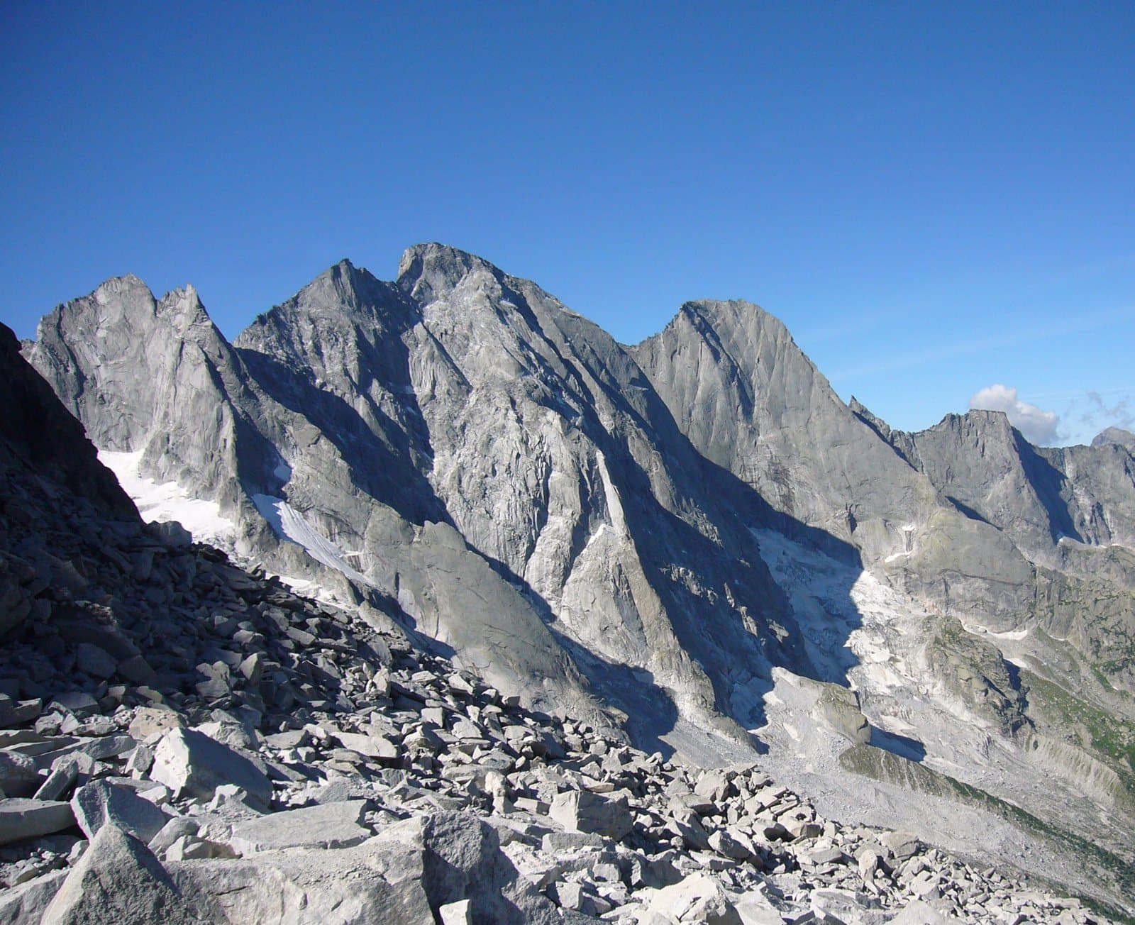
A truncated pyramid of granite and ice of 3,369 metres, the highest of the Badile group: the summit that in 2017 reminded everyone how alive a mountain is, and that today you admire from the Gianetti hut.
- Type
- Mountain
- Municipality
- Val Masino
- From Tirano
- Opening
- June 15 - September 30An outdoor place, always reachable. At altitude snow can make roads and paths impassable: they generally clear from June-July to September. An estimate based on the altitude.Indicative dates, not official: check before you go.
- Activities
- MountaineeringClimbing
The taller sister of the Badile
Next to the Badile, 66 metres higher, stands the Pizzo Cengalo: 3,369 metres, one of the highest and grandest mountains of the group. It lies on the border between Italy (Val Masino) and Switzerland (Val Bondasca): an imposing massif shaped like a truncated pyramid, with a summit formed by a broad snowy dome. Three ridges descend from it: the south, snowy and rounded at the top, then steep and sharp; and the west and the east, descending to the Cengalo (3,057 m) and Gemelli (3,106 m) cols, from which steep icy gullies drop to the north.
The name, it is said, comes from «chénghel», a word of the Val Bregaglia that means a wooded or grassy slope near rock steps.
Freshfield's climb
The first known ascent was on 25 July 1866, when the Englishmen Douglas William Freshfield and Charles Comyns Tucker, with the guide François Dévouassoud of Chamonix, climbed from the south: it is still the normal route today. It starts from the Gianetti hut (2,534 m), passes the Cengalo col and goes up the broad west ridge, over scree, broken rock and snow (difficulty F+).
A mountain that moves
The Cengalo is also the mountain of the 2017 landslide. At the end of December 2011 a part of the north face had already collapsed; on 23 August 2017, around 9.30 am, an enormous landslide detached from the north-east face, at about 3,000 metres, creating a debris flow that devastated the Val Bondasca and partly reached the village of Bondo, in Switzerland. A lesson on the vitality of the Alps, which is also studied for its causes in a changing climate.
From Tirano: distance, driving time and day trip
Pizzo Cengalo from Tirano: about 1 hour 20 minutes by car (63 km) to Bagni di Masino, in the Val Masino; then you continue on foot to the Gianetti hut. You follow the SS38 towards Sondrio and, past Morbegno, drive up the Val Masino to the last car park. Climbs at altitude take a full day and often a night in a hut, but Tirano, the Alpine Hub of the Valtellina, remains the ideal base for preparing and for returning: hotels, restaurants, shops and the Red Train station a step away.
How to get there
From Tirano follow the SS38 to Ardenno, then drive up the Val Masino to San Martino and Bagni di Masino. From there the path climbs into the Val Porcellizzo to the Gianetti hut (2,534 m); from the hut starts the normal route to the Cengalo. The Swiss side, the Val Bondasca, was hit by the 2017 landslide.
What to do
The loveliest way to see the Cengalo is from the Gianetti hut, with the Badile beside it and the great granite amphitheatre above your head. For those who climb, the Cengalo is a mountaineering rather than hiking goal: the Vinci ridge and the Gaiser-Lehmann route are among the most repeated. Those who prefer to stay on the path still have the Val Porcellizzo, where you walk beneath the walls.
Before you go
The mountain is on the border with Switzerland: carry a valid ID. After the 2017 landslide the Val Bondasca changed a great deal: find out about the condition of the paths and any restrictions before setting out. The climb requires mountaineering experience, crampons and ice axe even in summer.