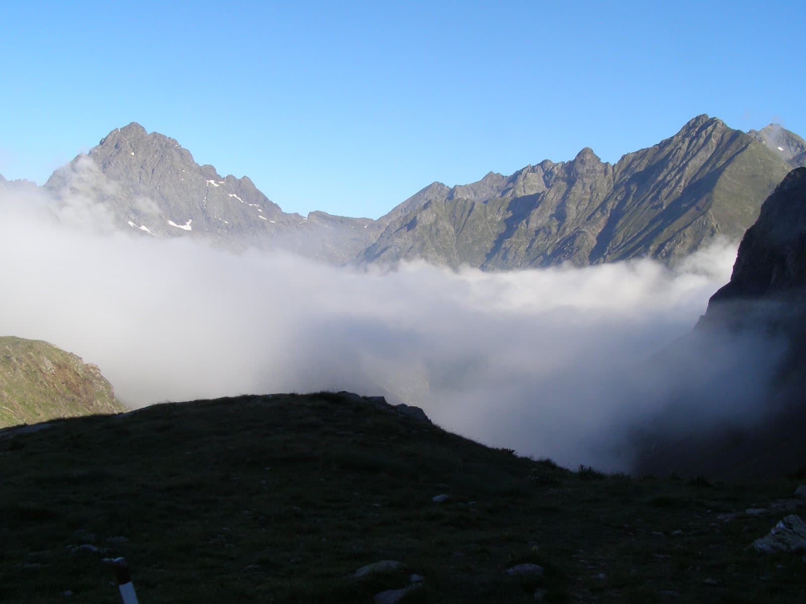
Photo: Nicola Fotonico · CC BY-SA 4.0

Easy to reach from Tirano · by car to the nearest point, then on foot
Distance and time from Tirano are calculated to the nearest point reachable by car to the place of interest: the rest of the route is on foot. Always check the route and distances carefully before setting out, also for possible seasonal or temporary closures of roads and passes.
The King of the Orobie: 3,050 metres above the Conca dei Giganti, the highest summit of the Alps that divide the Valtellina from the Bergamo area, with a story of wrong measurements and a CAI president who wanted to know the truth.
- Type
- Mountain
- Municipality
- Valbondione
- From Tirano
- Opening
- June 15 - September 30An outdoor place, always reachable. At altitude snow can make roads and paths impassable: they generally clear from June-July to September. An estimate based on the altitude.Indicative dates, not official: check before you go.
- Activities
- Mountaineering
The King of the Orobie
On the line that divides the Valtellina from the Val Seriana, in the province of Bergamo, rises the Pizzo Coca: about 3,050 metres (3,052 on some maps), the highest mountain of the Orobie Alps, hence called the «King of the Orobie». It rises for more than two thousand metres above the floor of the Seriana valley and divides the Valle di Coca, the Valmorta and the Val d'Arigna. The Valtellina side is the most austere, with steep slopes at whose base lie small glaciers, the Vedretta del Marovin and the Vedretta del Lupo; the south and east sides, in the Bergamo area, less wild but still rugged, are those of the busiest routes. It has two summits about fifty metres apart, and its name comes from «cocca», meaning «peak».
A matter of twenty metres
When it was first climbed, nobody yet knew for certain which of the Coca, the Redorta and the Scais was the highest of the Orobie. The first ascent was in July 1877, by Antonio Baroni, who from Valbondione went up the south side by the Bocchetta dei Camosci, along what is still the normal route. A few months later the president of the CAI of Bergamo, Antonio Curò, decided to settle the doubt: on 30 September 1877 he climbed the Redorta, which on the maps of the time was marked as the highest summit, and with his measurements established that the Coca was higher by about twenty metres, a figure close to the real one. The King of the Orobie was therefore the Coca.
First routes, first ice
On 11 September 1889 Baroni also opened a route on the Valtellina side: the north-west snow couloir from the Val d'Arigna, which inaugurated ice routes on the Orobie. From the top the panorama is 360 degrees: the Bernina and the Disgrazia to the north, the Adamello to the east, the Presolana and, on clear days, the Apennines to the south.
From Tirano: distance, driving time and day trip
Pizzo Coca from Tirano: about 45 minutes by car (30 km) to Arigna, in the Val d'Arigna, above Ponte in Valtellina; then you continue on foot. You follow the SS38 towards Sondrio and at Ponte in Valtellina go up into the Val d'Arigna. For the normal route, on the Bergamo side, you start instead from Valbondione: another day, in another world. Climbs at altitude take a full day and often a night in a hut, but Tirano, the Alpine Hub of the Valtellina, remains the ideal base for preparing and for returning: hotels, restaurants, shops and the Red Train station a step away.
How to get there
From the Valtellina side you go up the Val d'Arigna, above Ponte in Valtellina, towards the border ridge with the Bergamo area. The normal route, more frequented, starts from Valbondione, in the Val Seriana (Bergamo), by path no. 301 to the Coca hut.
What to do
The normal route starts from Valbondione (900 m) by path no. 301 and in about two and a half hours leads to the Coca hut (1,891 m), then to the Lago di Coca (2,108 m) and the Bocchetta dei Camosci (2,719 m), from where a steep and difficult stretch reaches the top. From the Valtellina you look at the Coca above the Val d'Arigna and, at the foot of its walls, the Conca dei Giganti with the Redorta and the Scais.
Before you go
The climbs are mountaineering routes and require experience, even in summer: friable rock, ice and snow. Sources give slightly different altitudes (3,050 or 3,052 m). Hut opening times change: check the official websites.
Photo: Marcobarci · CC BY-SA 4.0, Misakczech · CC BY 3.0, Ago76 · CC BY-SA 3.0