Photo: MatthewGhera · CC BY 3.0

Easy to reach from Tirano · by car to the nearest point, then on foot
Distance and time from Tirano are calculated to the nearest point reachable by car to the place of interest: the rest of the route is on foot. Always check the route and distances carefully before setting out, also for possible seasonal or temporary closures of roads and passes.
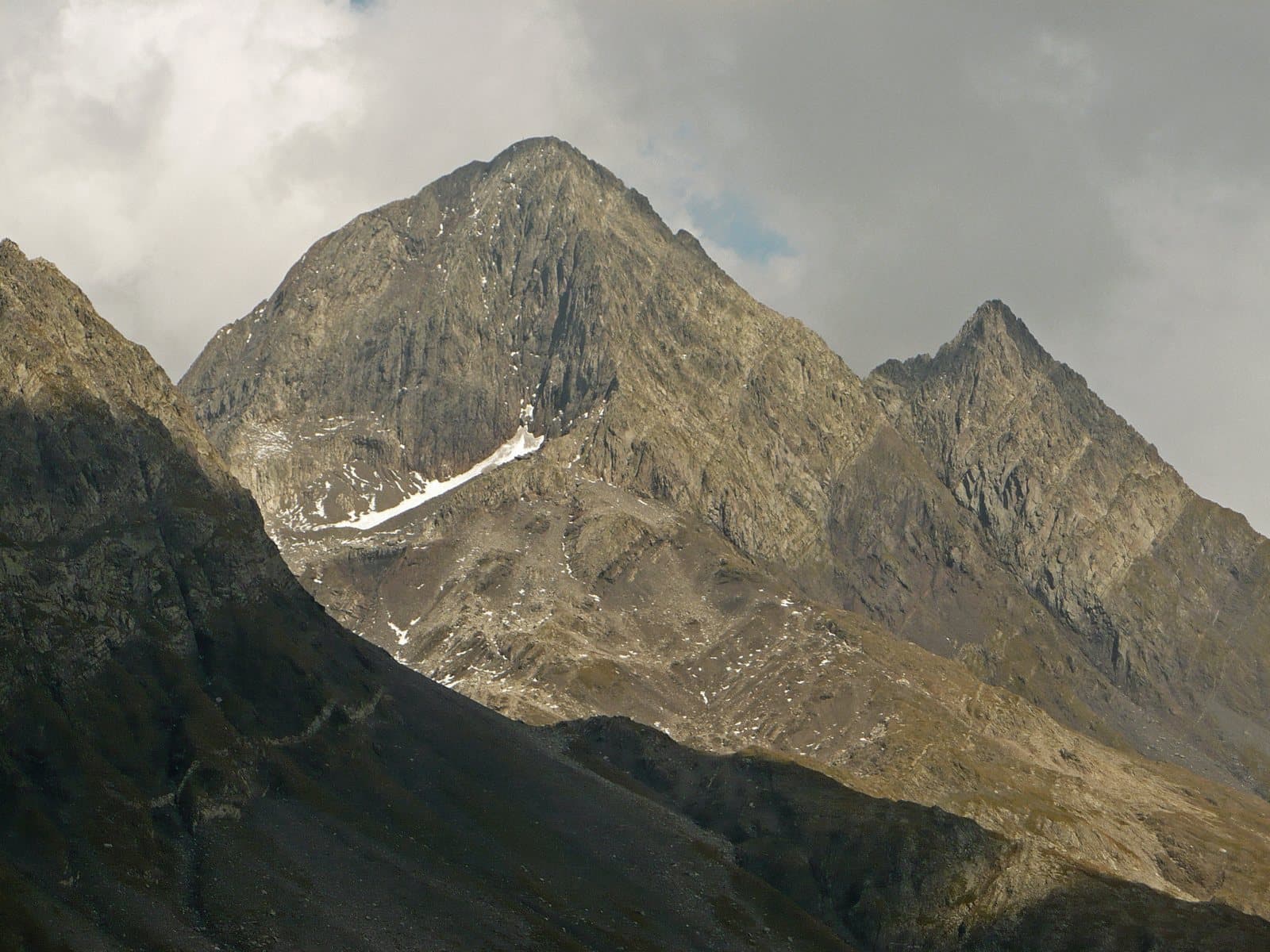
The «Matterhorn of the Orobie»: a slender pyramid of about 2,914 metres above the Val d'Ambria, with a twin, the Diavolino, and a story of guides, springs and a first female ascent in 1879.
- Type
- Mountain
- Municipality
- Carona
- From Tirano
- Opening
- June 15 - September 30An outdoor place, always reachable. At altitude snow can make roads and paths impassable: they generally clear from June-July to September. An estimate based on the altitude.Indicative dates, not official: check before you go.
- Activities
- MountaineeringTrekking
The Matterhorn of the Orobie
The Pizzo del Diavolo di Tenda, about 2,914 metres (2,916 according to some maps), is a mountain of the Orobie Alps on the watershed between the province of Bergamo and that of Sondrio. It marks the point where the Val Brembana to the south-west, the Val Seriana to the south-east and the Val d'Ambria, a tributary of the Valtellina, to the north separate. Its pyramidal shape, slender and regular, makes it instantly recognisable, also thanks to a second, almost mirror-like summit, the Diavolino (2,810 m). It is the highest summit of the Val Brembana and the ninth of the Orobie: it is often nicknamed the «Matterhorn of the Orobie» for its angular shapes, which from afar recall those of the Matterhorn, although much less vertical. At the base of the north side there are small glaciers and snowfields, in rapid retreat; on the south side rise the sources of the river Brembo.
A story of guides
The mountain has fascinated climbers since the dawn of mountaineering. In September 1870 the Valtellina doctor Alessandro Rossi went up the Val d'Ambria to the Bocchetta di Podavit and made the first ascent along what is today the normal route. The climber who left the greatest mark, however, was the Bergamo guide Antonio Baroni, who climbed the Pizzo many times and opened numerous routes: in 1876 the south-west ridge with Luigi Brioschi, then the descent of the north-east ridge with Emilio Torri. On 5 April 1879 he guided Signora Fadini by the normal route, in the first documented female ascent; in 1882 he made the first winter ascent; in 1889 he opened the Baroni route, along the south-east ridge, and linked the Diavolo and the Diavolino on the descent. In 1902, now seventy, he closed his guiding career by repeating his route, finding on it a final variation much harder than the original.
From Tirano: distance, driving time and day trip
Pizzo del Diavolo di Tenda from Tirano: about 45 minutes by car (33 km) to the Val d'Ambria, above Piateda; then you continue on foot. You follow the SS38 towards Sondrio and at Piateda go up the Val d'Ambria. Climbs at altitude take a full day and often a night in a hut, but Tirano, the Alpine Hub of the Valtellina, remains the ideal base for preparing and for returning: hotels, restaurants, shops and the Red Train station a step away.
How to get there
From Tirano follow the SS38 towards Sondrio to Piateda and go up the Val d'Ambria; from here you continue on foot to the Bocchetta di Podavit (2,624 m) and by the north-west ridge to the summit. On the Bergamo side the normal route starts from Carona, in the Val Brembana, by the Fratelli Calvi hut: about 5 hours and 1,800 metres of ascent.
What to do
From the Val d'Ambria, in the Valtellina, the Diavolo is seen from below as a pyramid closing the valley. To climb it you follow the valley to the Bocchetta di Podavit (2,624 m) and from there the north-west ridge with passages up to grade II, always well marked; other busy itineraries are the Diavolino-Diavolo traverse and the Baroni route.
Before you go
The climb is a mountaineering route, with passages up to grade II, always marked; for everyone else the Val d'Ambria is a lovely walk. The historical information should be checked on up-to-date sources. Check hut opening times and route conditions.
Photo: Orobicon · CC BY-SA 3.0, Orobicon · CC BY 2.5, MatthewGhera · CC BY 3.0