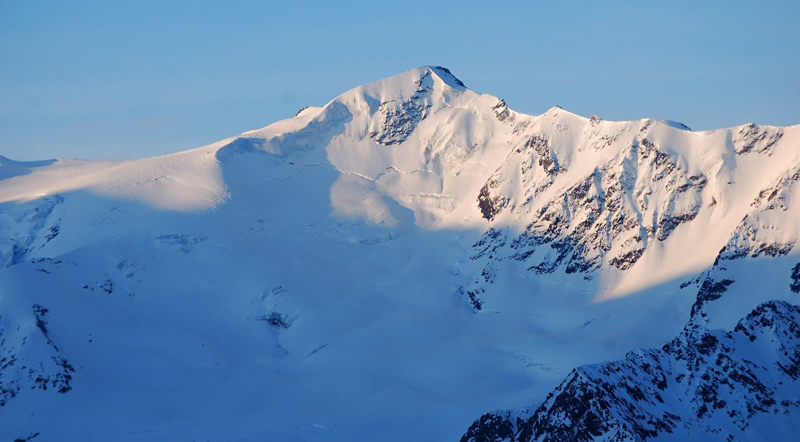
Photo: Svíčková · CC BY-SA 3.0

A lovely day trip from Tirano · by car to the nearest point, then on foot
Distance and time from Tirano are calculated to the nearest point reachable by car to the place of interest: the rest of the route is on foot. Always check the route and distances carefully before setting out, also for possible seasonal or temporary closures of roads and passes.
3,678 metres of snow and memory: the summit of the highest battle in history, on 13 August 1918. Today it is a snowy climb above the Forni Glacier, and the Berni hut, on the Gavia road, keeps its memory.
- Type
- Mountain
- Municipality
- Valfurva
- From Tirano
- Opening
- June 15 - September 30An outdoor place, always reachable. At altitude snow can make roads and paths impassable: they generally clear from June-July to September. An estimate based on the altitude.Indicative dates, not official: check before you go.
- Activities
- MountaineeringSki mountaineering
A mountain of snow
The Punta San Matteo, 3,678 metres (3,692 according to some sources), is an almost entirely snowy peak that overlooks the south of the Forni glacial basin and is one of the 13 peaks of the chain that runs from the Cevedale to the Pizzo Tresero. It lies on the border between Lombardy and Trentino-Alto Adige, south of the Monte Vioz. All its sides are covered in snow, with moderate slopes and easy access, except the north face, more interesting for climbers.
The highest battle in history
The first ascent was in 1865: J. H. Backhouse, D. W. Freshfield and F. F. Tuckett, with the guides François Dévouassoud and Peter Michel; the present name was given by Julius Payer the following year. But the Punta San Matteo is famous above all for war. In the Great War on this summit was fought what is considered the highest battle in history: on 13 August 1918 the Alpini took the peak, after months of preparation, with five columns marching on the glacier. The command of the «San Matteo Operations» was at the Gavia hut. The Berni hut is dedicated to Captain Arnaldo Berni, a protagonist of the battle, reported missing on 3 September 1918, and every year the Alpini of the valley climb in pilgrimage to the San Matteo military shrine.
The north face
In 1936 Kurt Richter, Rudolf Marzagg and Hans Sepp Pinggera climbed the north face, today the classic route; in 1982 Elio Pasquinoli and Luigi Zen also overcame the serac that dominates it.
From Tirano: distance, driving time and day trip
Punta San Matteo from Tirano: about 1 hour 5 minutes by car (57 km) to the Berni hut, on the Gavia Pass road; then you continue on foot. You follow the SS38 dello Stelvio to Bormio and go up to Santa Caterina Valfurva; from there the SP29 of the Gavia (about 25 minutes) takes you to the hut. Climbs at altitude take a full day and often a night in a hut, but Tirano, the Alpine Hub of the Valtellina, remains the ideal base for preparing and for returning: hotels, restaurants, shops and the Red Train station a step away.
How to get there
From Santa Caterina Valfurva follow the SP29 of the Gavia Pass to the Berni hut (about 25 minutes by car), or go up from Ponte di Legno. On foot you start from Santa Caterina (2 hours, 800 metres of ascent, paths 24-25), from Sant'Apollonia or from the Val di Rezzalo. From the hut the normal route follows the Dosegù glacier.
What to do
The normal route starts at the Berni hut (2,541 m), dedicated to Captain Arnaldo Berni, and follows roughly the path of the first climbers on the Dosegù glacier (difficulty PD/PD+). From the hut also starts the Friendship Trail, a walk of just over two hours to the glacier waterfalls and the Ortles Bivouac. On the Gavia road, in Valfurva, stands the monument to the victims of the battle.
Before you go
The climb is on glacier: crampons, ice axe, rope and preparation or a mountain guide. The story of the battle is told in several versions: dates should be checked against the sources. The Gavia road is open only in summer: check closures. Opening times of the Berni hut: on the official website.
Photo: Svíčková · CC BY-SA 3.0, Schlesinger · CC BY-SA 4.0, K.u.k. Kriegspressequartier (Vienna) · Public domain