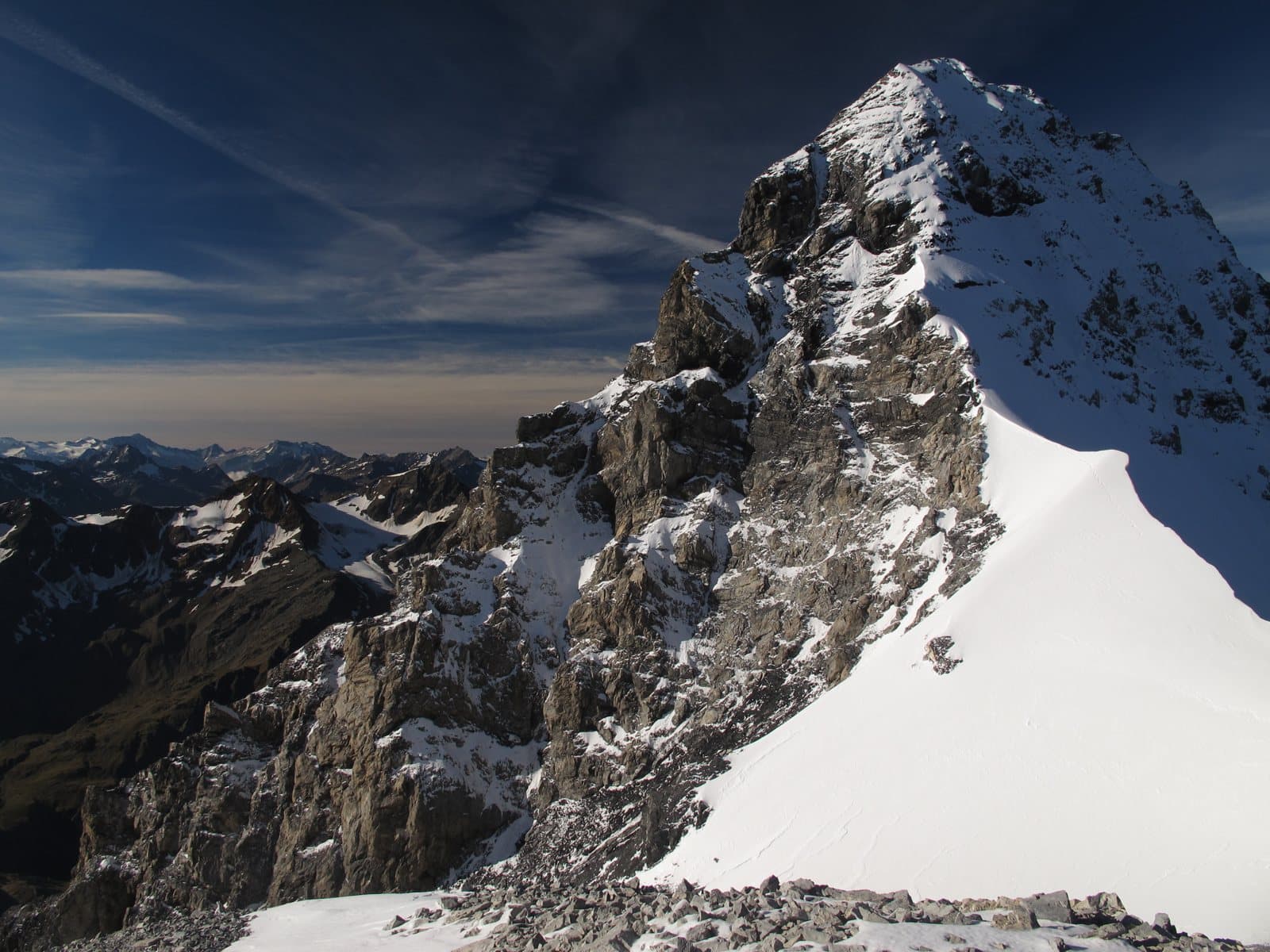
Photo: Tadeáš Gregor · CC BY-SA 4.0

Easy to reach from Tirano · by car to the nearest point, then on foot
Distance and time from Tirano are calculated to the nearest point reachable by car to the place of interest: the rest of the route is on foot. Always check the route and distances carefully before setting out, also for possible seasonal or temporary closures of roads and passes.
An elegant spire of about 3,650 metres, dedicated to an Austrian priest-mountaineer: beautiful to look at from the Quinto Alpini hut, hard to climb because of its crumbling rock, and the protagonist of a colossal rockslide in 2004.
- Type
- Mountain
- Municipality
- Valfurva
- From Tirano
- Opening
- June 15 - September 30An outdoor place, always reachable. At altitude snow can make roads and paths impassable: they generally clear from June-July to September. An estimate based on the altitude.Indicative dates, not official: check before you go.
- Activities
- Mountaineering
The summit of a priest
The Punta Thurwieser (in German Thurwieserspitze), 3,641 metres (3,652 on other maps), takes its name from Peter Karl Thurwieser, an Austrian meteorologist, mountaineer and priest. It is the highest summit of the small Trafoi-Thurwieser subgroup, between Lombardy and South Tyrol, and is considered one of the loveliest in the region: to the south it shows a high wall of friable rock polished by ice, it culminates in a rounded rocky cap and descends to the north with a steep wall of snow and rock.
The first ascents
The first ascent is by Theodor Harpprecht and Joseph Schnell in 1869, after many failed attempts: it is still the normal route today. The ascent of the south-west flank (1882) followed, by Georg Geyer, Julius Prohaska and the brothers Emil and Richard Zsigmondy, and the grand ridge traverse to the Cima Trafoi. In 1893 Guido Lammer climbed the north face solo, a route still arduous today.
The 2004 rockslide
On 18 September 2004 a huge rockslide detached from the summit: 2.7 million cubic metres of rock fell into the Val Zebrù. The access road to the Quinto Alpini hut and a cabin were destroyed, but there were no victims.
From Tirano: distance, driving time and day trip
Punta Thurwieser from Tirano: about 1 hour by car (57 km) to the Val Zebrù, at San Nicolò Valfurva; then you continue on foot to the Quinto Alpini hut. You follow the SS38 dello Stelvio to Bormio and go up into the Valfurva. Climbs at altitude take a full day and often a night in a hut, but Tirano, the Alpine Hub of the Valtellina, remains the ideal base for preparing and for returning: hotels, restaurants, shops and the Red Train station a step away.
How to get there
From Bormio drive up the Valfurva to San Nicolò and follow the Val Zebrù to the last car park; according to the hut, a jeep service runs to the Baita del Pastore, from where the path climbs to the Quinto Alpini hut (2,877 m), the starting base for the Thurwieser. On foot from San Nicolò allow about 4 hours.
What to do
The Thurwieser is best seen from the Quinto Alpini hut, which is its base, with the south wall above your head. Today it is climbed by only a few routes and with good snow cover, because the rock is very poor: the normal route starts from the Thurwieser Pass and requires a thin ridge, broken rock and cornices (difficulty AD).
Before you go
Mountaineering climb on poor rock: crampons, ice axe, rope, preparation or a mountain guide. Hut opening times change: check before setting out.
Photo: Svíčková · CC BY-SA 3.0, Schlesinger · CC BY-SA 4.0