Photo: Luca Casartelli · CC BY-SA 3.0

A lovely day trip from Tirano · by car to the nearest point, then on foot
Distance and time from Tirano are calculated to the nearest point reachable by car to the place of interest: the rest of the route is on foot. Always check the route and distances carefully before setting out, also for possible seasonal or temporary closures of roads and passes.
Before you set out, check that the hut is actually open on its official website.
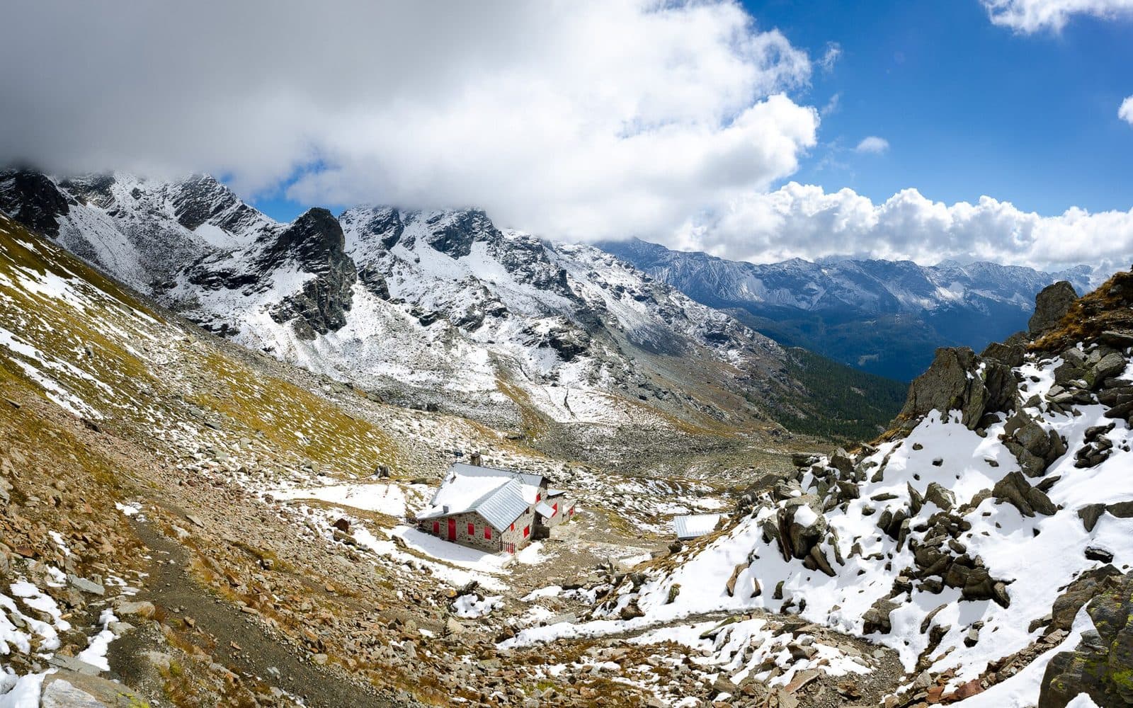
Go to the official website ↗An "eagle's nest" at 2,636 metres beneath the Bocchetta delle Forbici, born in 1927 from a ruin found by a group of hikers from Brianza.
- Type
- Mountain hut
- Municipality
- Lanzada
- From Tirano
- Visit time
- Opening
- June 1 - September 30Booking advisedIndicative dates, not official: check before you go.
- Official website
- caicaratebrianza.it
- Activities
- TrekkingHikingMountaineering
An eyrie at 2,636 metres
Rifugio Carate Brianza stands beneath the Bocchetta delle Forbici, at 2,636 metres, in the Bernina group, at a point from which the gaze runs over the glaciers and peaks of the upper Valmalenco. Inside, everything is made of wood, with a small library of books to leaf through, and the management is family-run: hot vegetable soup, polenta and the Valtellina bisciola are enough to tell you where you have arrived. Those who have been describe it as a comfortable eagle's nest.
The story of a ruin and a dream
The story begins on 8 March 1923, when Guglielmo Caglio, a mountain enthusiast trained in Como, founded the Unione Escursionisti Caratesi in Carate Brianza, to introduce his fellow townspeople to the mountains. During an expedition to the Bocchetta delle Forbici, in the upper Valmalenco, Caglio noticed a small abandoned building and imagined turning it into a hut. The Capanna Carate was inaugurated on 13-16 August 1927. The CAI section of Carate Brianza was born in 1934, and the hut is today the highest place bearing its name. In 2018-2019 it was enlarged (kitchen, dining room and terrace), with contributions from the CAI, the BCC of Carate Brianza and the municipality of Lanzada.
The hut
It has 24 beds, 35 dining seats inside and 30 on the terrace. Animals are welcome, there are vegetarian and intolerance-friendly menus, and mobile coverage. It can only be reached on foot.
From Tirano: distance, driving time and day trip
Carate Brianza Mountain Hut from Tirano: about 1 hour 40 minutes by car (57 km), to the nearest starting point; then you continue on foot. You drive down the SS38 towards Sondrio and up the Valmalenco to Chiesa and, for the higher destinations, to Lanzada and Chiareggio. To these times add the walk described on this page: plan your day accordingly. Stay in Tirano and set out each morning for a new destination: in the Valtellina it is the practical solution for those seeking hotels, services and connections a step from the station.
How to get there
The most used route starts from the Lago di Campo Moro car park (1,991 m) and follows path 342/1: about two hours, 5 km, 670-750 metres of ascent, easy or of medium difficulty, on a rocky slope and then in a lovely wood. The last stretch has a funny name, the "path of the seven sighs", because the goal seems never to arrive. Other routes: from the Gera dam, or from Rifugio Bignami and the Bocchetta di Fellaria, about 4 hours and 800 metres of ascent; from the Scerscen Valley, 5 hours, for experienced hikers. From the hut you can continue on path 305 towards the Forcella di Fellaria and Rifugio Bignami, the Fellaria glacier and the Bivacco Anghileri Rusconi, in a longer loop.
Before you go
The hut is open in summer, generally from June to September. Always check that it is actually open on the official website, caicaratebrianza.it, before you set out. Bookings by phone (+39 0342 452560) or email (rifugiocarate2636@gmail.com).
Photo: Gaggi Luca 76 · CC BY 3.0, Luca Casartelli · CC BY-SA 3.0