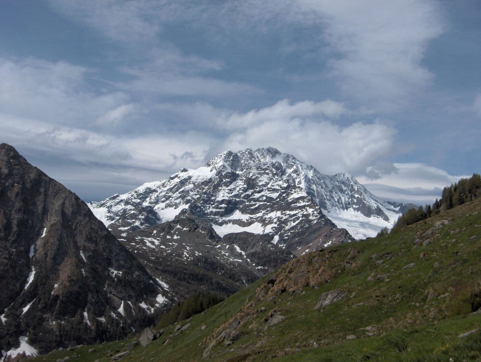
Photo: Roberto Galbiati · CC BY-SA 3.0

A lovely day trip from Tirano · by car to the nearest point, then on foot
Distance and time from Tirano are calculated to the nearest point reachable by car to the place of interest: the rest of the route is on foot. Always check the route and distances carefully before setting out, also for possible seasonal or temporary closures of roads and passes.
3,678 metres between Valmalenco and Val Masino: five glaciers, five ridges, a name that tells of misfortune or a thaw, and the 1862 first ascent that put it on the mountaineering map.
- Type
- Mountain
- Municipality
- Chiesa in Valmalenco
- From Tirano
- Opening
- June 15 - September 30An outdoor place, always reachable. At altitude snow can make roads and paths impassable: they generally clear from June-July to September. An estimate based on the altitude.Indicative dates, not official: check before you go.
- Interests
- Nature and Landscape
- Activities
- MountaineeringSki mountaineeringTrekking
You can recognise it from almost anywhere in central Valtellina. Monte Disgrazia, 3,678 metres, imposing and regular, is the emblem mountain of Valmalenco and the highest of the Masino group, south of the Bernina range. It lies between Valmalenco and Val Masino, entirely in Italian territory, and is one of the most fascinating and wild glacial environments of the central Alps.
Its name has two readings. In Italian “Disgrazia” recalls a misfortune, and according to some it was given in memory of a divine punishment; in Lombard the mountain is called “Mont Des'giascia”, which literally means “mountain of the thaw”. Whichever version is true, there remains the charm of a summit that bears so mysterious a name.
It is a granite mountain, with five glaciers and five wild ridges, and therefore a demanding climb. The first ascent dates to 23 August 1862 and was made by Leslie Stephen, E. S. Kennedy and Thomas Cox, with the Swiss guide Melchior Anderegg. The three Englishmen wanted to climb from Valmalenco, but after a quick reconnaissance chose Val Masino: their route, over the Preda Rossa glacier and along the north-west ridge, is still the normal route today, of grade II. In 1882 Charles Pilkington and his companions opened the north-east ridge route, without guides.
At its foot, in Valmalenco, are huts that are historic stages: the Rifugio Ponti, at 2,559 metres, in Val Masino; the Gerli-Porro and the Ventina, at Alpe Ventina, facing the glacier; the Bosio-Galli and the Cassandra lakes. The climb starts from here, but people also come up here for the sheer pleasure of looking at it.
Those who don't want to climb it can walk around it. The Giro del Monte Disgrazia is a four-day adventure on the southern side of the massif: from Preda Rossa, in Val Masino, you descend to the Rifugio Bosio over the Passo di Corna Rossa; on the second day a long traverse, over the Passo Cassandra or the Passo Ventina, leads to Chiareggio; on the third you climb Val Sissone and, over the Passo di Mello, reach the Bivacco Kima; on the fourth, from the Bocchetta Roma, you descend to Preda Rossa. It is a way of seeing the mountain from every side, with the eye of someone who climbs it.
And there is the dawn. When the sun rises on the Disgrazia, its walls glow pink, and from Valmalenco, from Chiareggio or Alpe Ventina, the spectacle alone is enough to justify an early start. For skiers it is also a ski-mountaineering destination, with a three-day loop from Chiareggio.
A few cautions. The climb requires glacier experience, crampons, ice axe and rope, or an alpine guide: it is best not to improvise. For everyone else, the Disgrazia is to be admired, and that is no small thing.
From Tirano: distance, driving time and day trip
Monte Disgrazia from Tirano: about 1 hour 45 minutes by car (53 km), to the nearest starting point; then you continue on foot. You drive down the SS38 towards Sondrio and up the Valmalenco to Chiesa and, for the higher destinations, to Lanzada and Chiareggio. To these times add the walk described on this page: plan your day accordingly. From Tirano, the Alpine Hub of the Valtellina, you can easily organise day trips and itineraries: in the evening you return to restaurants, shops and a good dinner.
Refreshment stops
Before you set out, always check that the hut is actually open on its official website.
Gallery
Photo: Inter556 · CC BY-SA 3.0, DanielaMari · CC BY-SA 4.0, Luca Casartelli · CC BY-SA 3.0, Luca Casartelli · CC BY-SA 3.0, Roberto Galbiati · CC BY-SA 3.0