Photo: Drakaris84 · CC BY-SA 4.0
Easy to reach from Tirano
A wide, bright valley on the Swiss border: alpine lakes, glaciers glittering on the peaks and a flat road leading on foot or by bike to Lake Viola.
- Type
- Valley
- Municipality
- Valdidentro
- From Tirano
- Visit time
- Opening
- June 15 - September 30An outdoor place, always reachable. At altitude snow can make roads and paths impassable: they generally clear from June-July to September. An estimate based on the altitude.Indicative dates, not official: check before you go.
- Activities
- HikingTrekkingMountain bikingSnowshoeing
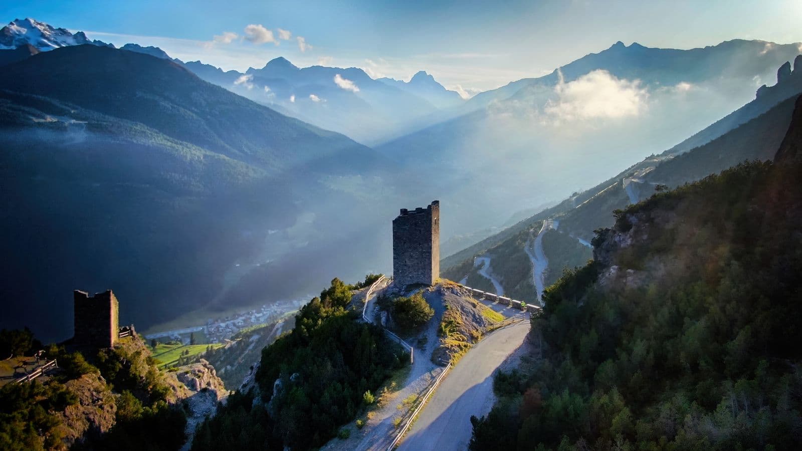
There is a valley above Valdidentro that is like a great mountain garden. Val Viola Bormina is wide and bright, made of conifer woods, high meadows, torrents and, high up, a great glacial basin where the lakes gleam. All around, the peaks rise above three thousand metres: Cima dei Piazzi, Corno Sinigaglia, Corno di Dosdè, with their white glaciers. It lies within the Stelvio National Park.
You reach it from Arnoga, in Valdidentro, and the first stretch is easy: five kilometres of paved road lead to the Altumeira car park, and in July and August there is also a shuttle. From there on it is a dirt road and a path that is almost entirely flat, with short gentle climbs, suitable for families, walkers and cyclists.
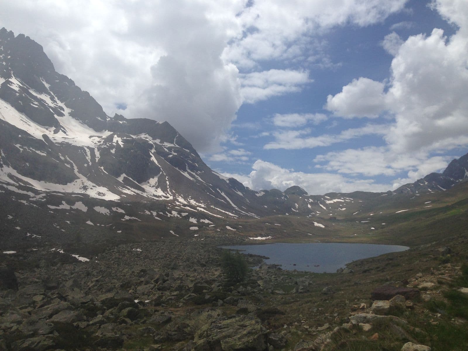
The classic destination is Lake Viola, at about 2,300 metres, beside the Rifugio Viola. The route from the valley is about eight and a half kilometres, with 439 metres of ascent: two hours forty on foot, an hour and a half by bike. The lake is of glacial origin, dammed by a moraine, rich in trout, and from here the gaze runs to the glacier descending from Cima dei Piazzi. A little higher you reach the Swiss border at the Val Viola Pass, from which you descend towards Val di Campo.
Those looking for something different have other roads. The Panoramica is about 10 kilometres, three to four hours and 567 metres of ascent. By mountain bike there is a loop of about 19 kilometres and 823 metres of ascent that starts from Arnoga, passes Altumeira, the Rifugio Viola and Val Dosdè and returns to Arnoga, with a singletrack descent: among the loveliest in the Bormio area, they say, and within everyone's reach. From here you can also reach Val Verva, Val Dosdè with the Rifugio Federico and, beyond the border, Val di Campo.
History passes through this valley too: along its slope runs the Decauville, the old route of a narrow-gauge railway that carried material from the Cancano dams to Arnoga, now an almost flat and panoramic path, on foot or by bike.
And then there are the seasons. In summer, the flowering meadows and the lakes, with stops at the Rifugio Viola, at 2,314 metres, and at the Agriturismo Baita Caricc, in the lower part of the valley, along the path to Val Dosdè. In winter the valley turns white and silent: you walk with snowshoes, and as far as the Baita Caricc you can also come by snowcat or fat bike, which the farm rents out. A valley for lovers of open spaces: space, air and a horizon that at last does not end.
From Tirano: distance, driving time and day trip
Val Viola from Tirano: about 55 minutes by car (54 km). You drive up the SS38 to Bormio and continue towards Livigno (SS301) through Valdidentro, the heart of Alta Valtellina and gateway to the Val Viola and the Fraele valley. From Tirano you get there without haste: a good breakfast in town, the day in the mountains and in the evening back at table in the centre. From Tirano, the Alpine Hub of the Valtellina, you can easily organise day trips and itineraries: in the evening you return to restaurants, shops and a good dinner.
Refreshment stops
Before you set out, always check that the hut is actually open on its official website.
Mountain hut & refreshments
Agriturismo Baita Caricc
Photo: Istvan182 · CC BY-SA 4.0, Dispe · CC0, Dispe · CC0, Dispe · CC0