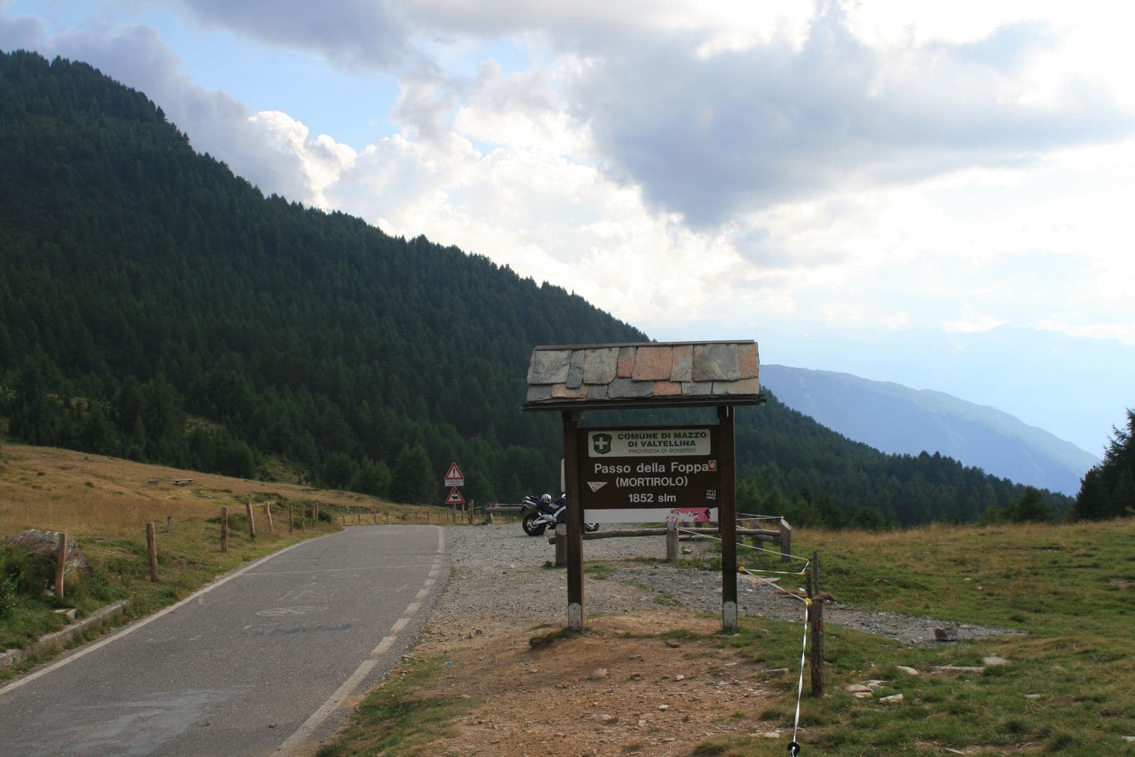
Photo: Gabri80 · CC BY-SA 3.0

The route
- Length
- 49.1 km
- Duration
- 3 h 15 min
- Ascent
- 1,468 m
- Descent
- 1,466 m
- Highest point
- 1,848 m
- Lowest point
- 427 m
- Difficulty
- Demanding · Very good fitness
- Surface
- Paved road
Route data and track are provided by Komoot and are indicative: ascents, elevations and times are estimates. Before setting out, always check the route, difficulty, conditions and any seasonal or temporary closures.
From Tirano to the Mortirolo Pass climbing from Tiolo, above Grosio, and descending to Mazzo di Valtellina: 49 kilometres and about 1,470 metres of ascent.
- Type
- Road route
- Municipality
- Tirano
- Opening
- May 15 - November 15Season estimated from the route's highest point (1848 m): check snow, ice and conditions before setting out.Indicative dates, not official: check before you go.
- Places of interest along the route
- Basilica of the Madonna di TiranoPalazzo SalisLago di LoveroMortirolo Antonioli Mountain HutMortirolo Pass
- Activities
- Road cycling
Tirano is the perfect starting point to tackle one of the most beautiful climbs in the world, the one that leads to the Mortirolo Pass. You start from Via Valorsa, in Tirano, straight from the saddle, and follow the Sentiero Valtellina as far as Grosio, on about fifteen kilometres of false flat that let you warm up while you enjoy the natural beauty of this first part of the Alta Valle. Once in Grosio the climb to the Mortirolo Pass begins, starting from Tiolo. The route is well signposted and, between one pedal stroke and the next, offers beautiful glimpses of the Valtellina. The climb, intense as it is, is gentler than the one from Mazzo di Valtellina. At the pass you can enjoy the panorama and take a short break at one of the huts at the foot of the pass. The return is by the other Valtellina access road to the pass, descending towards Mazzo di Valtellina: on the way down you pass the small monument to Marco Pantani, the Pirate who made so many cyclists fall in love with this climb. It is 49 kilometres and about 1,470 metres of ascent, at elevations between about 430 and 1,850 metres. On Komoot it is rated hard, with very good fitness required, for a stated time of about three hours and a quarter. The climb requires moderate technical preparation. The surface is asphalt and about thirty per cent of the route runs on a cycle path. An excellent workout too.
From Tirano: distance, driving time and day trip
The route starts from Via Valorsa, in Tirano, and you can set off straight from the saddle: no car needed. In the evening you return to restaurants, shops and a good dinner.
How to get there
The starting point is Via Valorsa, in Tirano, also reachable by train. The Komoot map can be followed straight from the page: save the route offline before setting out, as the mobile network may be missing.
How to ride it
Carry water, food and a jacket for the descent from the pass, and set out in stable weather: at the top it is much colder than in the valley. On the cycle path, in the first stretch, you meet pedestrians and families: slow down where it is crowded. Check conditions and orders before setting out: the passes may have seasonal or temporary closures.
Places of interest along the route
Along the route, or no more than 500 metres from it, you meet these places. The kilometres are approximate and counted from the Via Valorsa start.
At the start, about 180 metres from the route: Basilica of the Madonna di Tirano. The Renaissance sanctuary born from an apparition in 1504: stucco, wood carving and an extraordinarily rich 17th-century organ, to be admired at leisure.
Around kilometre 2: Palazzo Salis. A 17th-century noble residence in the heart of Tirano: Baroque portal, ten frescoed rooms, a chapel and one of the very few Italian gardens in the Alps, waiting to be discovered.
Around kilometre 5, about 180 metres from the route: Lago di Lovero. A quiet lake little more than an hour's walk from Tirano along the Sentiero Valtellina: born with the dam of 1948, in a valley where in 1807 a landslide from Monte Masuccio had already created a natural one.
Around kilometre 27: Mortirolo Antonioli Mountain Hut. A renovated old alpine dairy, a few steps from the Mortirolo Pass: home cooking, a family welcome and a grassy hollow with a small lake.
Around kilometre 28, about 160 metres from the route: Mortirolo Pass. A climb cyclists name in a low voice: the legend of the Pirate, the duels that decided Giros, three sides to conquer and a table with a view over half of Valtellina.
Before you go
Check the weather, the road conditions and any seasonal or temporary closures of the passes. Carry a helmet, water, food, a spare inner tube, a windproof jacket and a charged phone: the single emergency number is 112. Respect the Highway Code, use lights in tunnels and keep to the right.
Gallery
Photo: © Claudio Corcoglioniti