Valtellina in the First World War
The White War on the roof of Italy: stone forts, villages on glaciers and the battle fought at the highest altitude of the whole conflict.
12 min read
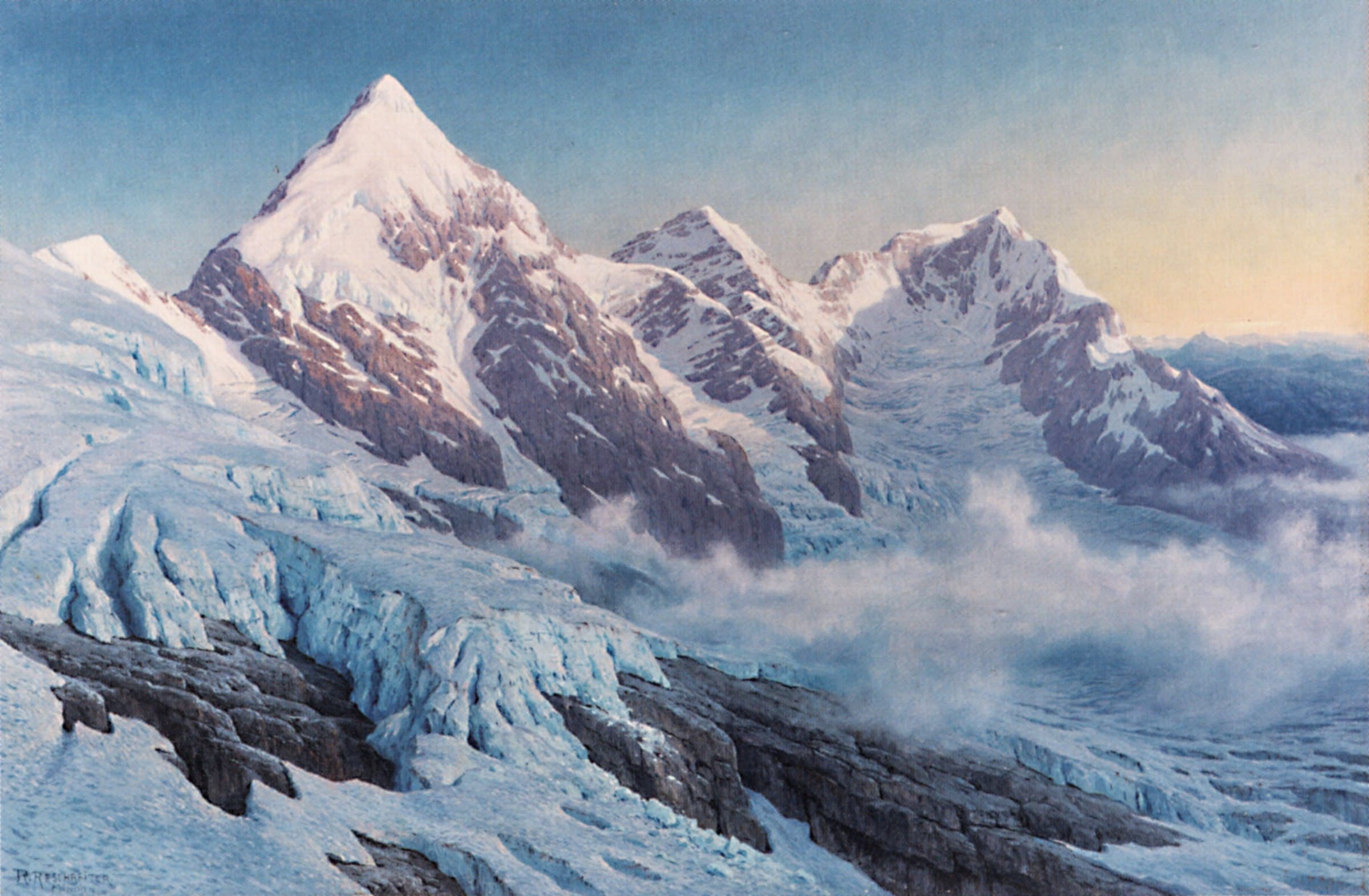
When Italy entered the war in May 1915, few people thought of Valtellina. The great clashes would take place on the Isonzo, on the Asiago Plateau, on the Piave. And yet, at over three thousand metres, among the glaciers of the Ortles-Cevedale, a war unlike any other was fought: a war without battlefields, in which the most dangerous enemies were frost, avalanches and wind; a war of sentries on the seracs, of mule tracks cut into the rock, of villages of huts on the ridges. It is the White War. And its story, here, concerns some of the most beautiful places that can be visited today.
A border above the clouds
To understand the war in Alta Valtellina you have to look at the map. From Plezzo, on the upper Isonzo, to the Stelvio Pass, on the Swiss border, there are over four hundred kilometres of front, almost all above two thousand metres. Halfway along lie the Dolomites; in the south-western part, between the Swiss border and Lake Garda, are the Ortles, Presanella and Adamello groups, which controlled the Stelvio and Tonale passes. The highest point, the Ortles, reaches 3,905 metres. In this sector, the Ortles-Cevedale, conditions were the most extreme of the whole White War: the average altitudes were about five hundred metres higher than in the other sectors, and the terrain was so rugged that, while on the one hand it prevented large-scale military action, on the other it pushed the living and fighting conditions of the men to the limit.
On the Italian side, the army had deployed the 1st Army of General Roberto Brusati; the III Corps occupied the entire western side of the Trentino salient, from the Stelvio to Garda, with a series of permanent works, mostly obsolete, which formed the Bormio and Tonale-Mortirolo barriers. On the Austro-Hungarian side, General Viktor Dankl von Krasnik took command of the defence of the Tyrol, headquartered in Innsbruck, and its western limit was precisely the Stelvio Pass; its units could count on the support of the fort of Gomagoi, on the Stelvio axis, and of the modern barrier defending the Tonale.
The valley, meanwhile, had an extra problem. Before and during the Great War Italy built a defensive line to prevent a possible breakthrough of the front through neutral Switzerland, the so-called Frontiera Nord; and even the documents of the Swiss army drawn up between 1870 and 1918 show advanced plans for invading Valtellina, to defend the flanks of Canton Ticino in the event of an Italo-Swiss conflict. Valtellina was, in other words, a place where one looked in several directions at once.
The fort that watched over the Stelvio
The defence of Alta Valtellina had been planned well before 1915. As early as 1899 the Supreme Commission for the Defence of the State had established that the Stelvio road required an artillery position at Motte di Oga. The project stayed in a drawer for some years, until in 1908 the defence of Valtellina became a priority again, and construction began on the road to reach the site. The command then chose the Dossaccio, at 1,740 metres, because it was better protected and harder to reach.
Thus was born Forte Venini, the Fort of Oga, completed shortly before the Great War and oriented east to west, so that the long-range guns, able to reach about thirteen kilometres, could traverse and cover the passes and gaps through which the Austrian threat might come. From its passages one could reach Trafoi, beyond the Stelvio. The garrison, which could house up to eighty men, was self-sufficient in everything. In war the little fortress worked like this: Italian observers on the ridges to the north radioed the targets; tracer shells checked the fire; the observers sent corrections and only then did the guns fire to hit. The purpose was defensive: to hinder enemy movements on the Stelvio road and to protect the Fraele pass and the approaches to Valdidentro and Valfurva. Local tradition says that the shots made the windows of Bormio's houses rattle.
After the war an infantry unit of thirty men garrisoned the fort, later replaced by mountain artillerymen until 1938, the year it was named after Captain Venini, a Valtellinese and gold medallist. From 1938 to 8 September 1943 a unit of the Guardia alla Frontiera was stationed there. During the Social Republic, Fascists and Germans took the weapons to Sondrio; the partisans entered it in the spring of 1945, without having to attack. The army abandoned it and in 1958 left it for good; doors and windows were walled up, the materials sold as scrap, the guns taken away. Since 1985 the Comunità Montana Alta Valtellina has restored it and reopened it to the public: today it is one of the best-preserved fortifications of the Great War in Europe, and it is visited with a mix of awe and wonder.
4 June 1915 and the village on the glacier
The war in Alta Valtellina began quietly. A few days after the declaration, on 4 June 1915, a small Austrian unit, reportedly of just twenty-nine men, seized Monte Scorluzzo, at about 3,094 metres, in an area that was the pivot of the defence of the Stelvio Pass. It was the beginning of a series of clashes between small units, in which military action often boiled down to a race to seize a summit or a ridge. There were no great battles of battalions, but a war of patrols, of surprises, of positions won and lost.
To hold the heights, shelters and links with the valley floor were needed. The soldier-labourers dug trenches and tunnels and built real villages on the ridges. One of them was the military village of Filon dei Mot, whose ruins can be reached from the Stelvio Pass: a settlement of huts and shelters that looks as if it came out of a Nordic fairy tale. In a cave just below the summit of Scorluzzo a perfectly preserved Austro-Hungarian shelter of the Great War has been discovered, protected by the ice that formed after the site was abandoned at the end of the conflict. For its beauty and its ruins, the site has been nicknamed, with a bit of rhetoric but much sincerity, the "Machu Picchu of the Alps".
Living at three thousand metres
What did it mean to live in those places? The mountains of the three groups are high (with average altitudes above two thousand metres, up to the 3,905 of the Ortles) and hard to traverse: the further one got from the valley floor, the more transport required pack animals and men's backs, even for the very heavy loads of the artillery. As the conflict went on a dense network of roads, mule tracks and paths was built reaching the outposts in the most inaccessible places, and in the last two years of the war the use of cableways was systematised. Building roads and cableways was perhaps the undertaking that demanded the most energy and sacrifice on this front.
To this toil was added the climate. The cold, the avalanches, the wind, the snow that buried the huts: the mountain was a more fearsome enemy than the adversary. To move on ice and snow, the Italian army created special units: the Battaglione Alpini Sciatori, led by Nino Calvi; and the patrol of the Guide Ardite della Val Zebrù, a special unit born towards the end of October 1916 under the command of Lieutenant Locatelli, who was followed by Sergeant Giuseppe Tuana. It was made up of Valtellinese, Brescians, Bergamasques and Aostans: expert mountaineers and hunters, excellent marksmen. Once the objective was set, they enjoyed complete freedom of action, and they were the protagonists of all the riskiest undertakings.
The landscape, for its part, still preserves the signs of those years. On the summit of the Gran Zebrù, in the heart of the group, there was a hut, the Baracca del Gran Zebrù, today documented by high-altitude archaeologists; and on the Gavia Pass, the refuge housed the command of the "San Matteo Operations". Since the end of the last conflict the receding ice has given back, year after year, objects, remains, mementos.
13 August 1918: the battle of San Matteo
The episode that made this front famous is that of Punta San Matteo, 3,678 metres high. In the late summer of 1918 what is considered the battle fought at the highest altitude of the entire First World War took place there. Since the spring of 1918 about thirty Austro-Hungarian gunners had occupied the summit with a small fortified position equipped with light artillery, from which they shelled the road towards the Gavia Pass and harassed Italian supply convoys. The Italian army had explored the summit as early as 1915 but had never established a permanent garrison there.
In the preceding months, several tonnes of artillery, ammunition and materials were carried up from the Rifugio Gavia, which housed the command of the "San Matteo Operations". On 13 August, after some days of storms, the day was clear. Five columns of Alpini, four setting out from below Bivacco Seveso and one from Vallumbrina, attacked and captured Punta San Matteo and Monte Mantello. The first column was made up of nine Alpini of the Guide Ardite della Val Zebrù, among them Benvenuto Urbani of Valfurva; the second was led by Lieutenant Gian Battista Compagnoni, a well-known Valfurva mountaineer, with thirty-one Alpini of the 308th company of the Monte Ortler skiers battalion. The 307th company, under Captain Arnaldo Berni, was at Vallumbrina with the task of organising the occupation and holding the position. Half the Austro-Hungarian defenders were captured; the others fled towards the lower positions. The loss was felt by Austria-Hungary as a humiliation.
From September to November: the last clash
The imperial forces did not stand by. On 3 September 1918 Operation "Gemse" (chamois) was launched to retake the summit: a heavy artillery bombardment, followed by the assault of at least a hundred and fifty Kaiserschützen, the Tyrolean imperial hunters. The position was retaken. The Italians responded with a counter-bombardment that hit soldiers on both sides; Captain Arnaldo Berni, wounded by the first Austrian bombardment and then killed by Italian fire, was never found. It was, according to some reconstructions, the last Austro-Hungarian victory of the war. On 3 November, after intense artillery preparation, the Alpini retook the summit for the second and last time, on the very day the armistice was signed at Villa Giusti, near Padua, which ended the war in the mountains on 4 November at 3 p.m.
The dead in that battle were few, according to the sources: ten Italians and seventeen Austro-Hungarians; but few other pages of the Great War tell so well what that war was. In 2004 the bodies of three Kaiserschützen were found, at about 3,400 metres, near the summit: a sign that the ice still keeps its memories today. After the victory of Vittorio Veneto, the 7th Army began the high-mountain campaign: the III Alpini group crossed the Stelvio Pass and went down to Trafoi, other units crossed the Gavia and the Tonale.
After the war: a changing frontier
When the conflict ended, both sides of the Stelvio became Italian: the pass lost much of its strategic meaning and its winter closure was decided. The stagecoach that had served the road for ninety years, and had remained in operation until 1915, was by now the memory of another world. But the war had left a deep mark on the valley and its communities: the fallen, the maimed, the villages in mourning, the families waiting for a son who never came back.
Even today, in Valfurva, on the road that climbs to the Gavia Pass, stands a monument to the victims of the battle of San Matteo; every year the Alpini of the valley go on pilgrimage to the San Matteo military shrine. And the memory of that war is not confined to books: you can walk it.
Walking inside history
The Stelvio National Park, with Regione Lombardia and ERSAF, in collaboration with the Museo della Guerra Bianca, has created six thematic experiential routes that follow stretches of the Italian-Austrian front and tell the events of 1915-1918 on the mountains of the park, with zero-impact technologies that allow visitors to explore the places interactively. One of these, the Stelvio Historical Trek, leads to Filon dei Mot and Monte Scorluzzo: about 7.96 kilometres, three and a half hours of walking, almost eight hundred metres of ascent. The mountain guides of Bormio offer it as guided excursions.
Those who prefer stone can visit Forte Venini at Oga, open to the public, with its battery, its passages, its tunnels. Those who love glaciers can climb towards the Rifugio Garibaldi, at the Stelvio. Those who want to understand the landscape can sit on the shores of Lago Bianco and Lago Nero, at the Gavia, and imagine those ridges full of huts. In any case, the lesson is the same: the mountain, which today seems to us a place of holiday, was also a place of pain. To remember this is a way, the most sincere one, of loving it.
One war, two points of view
In this account there are two armies: the Alpini and the Kaiserschützen, the Standschützen and the conscripts. In the valleys that today belong to two different states, the names are in Italian and German: the Königspitze is the Gran Zebrù. Behind each name, men who often spoke neighbouring dialects, who knew the same mountains and who found themselves on opposite fronts. The stories of the Valfurva Valtellinese, like Compagnoni, and of the Tyrolean soldiers who faced them are part of the same tale: that of a mountain divided by borders and united by hardship. That is why today, walking on the ridges of the Stelvio, one feels a sense of respect for all, regardless of flag.
From Tirano: distance, driving time and day trip
From Tirano the White War can be explored in a day: the Stelvio Pass is a little over an hour by car (when the road is open), Bormio and Forte Venini at Oga are closer, and the Forni valley, at Santa Caterina, is about 50 minutes away. A good base from which to walk into this history and return to the city in the evening.